Deer Creek Cabin (MT)
Custer Gallatin National Forest
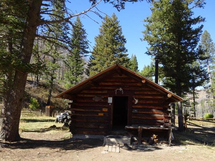
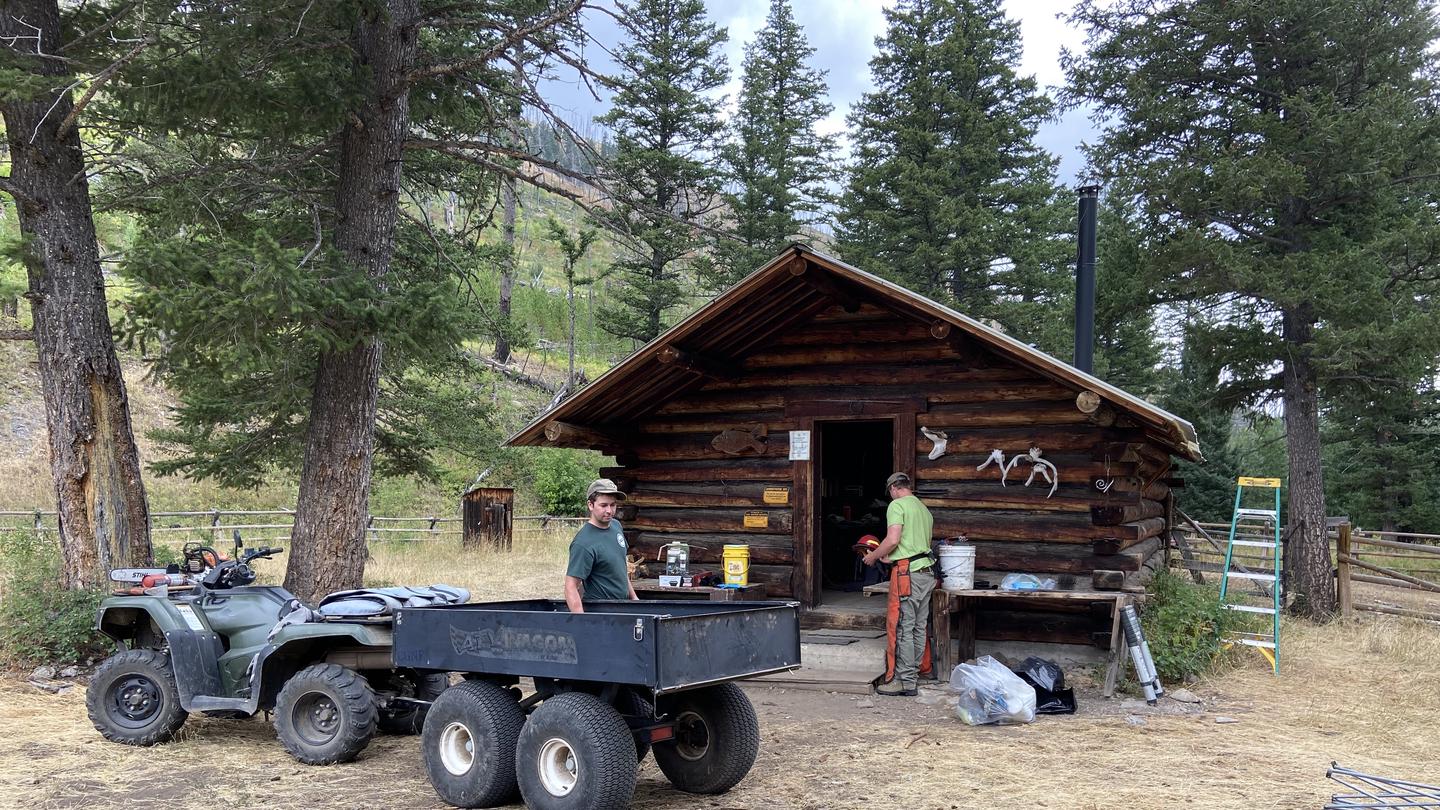
The Todd Family began building Deer Creek Cabin in 1953 and finished it in 1960. They used it as a retreat while they grazed cattle on federal lands in the summer and hunted in the fall. The cabin has survived two forest fires. Gallatin National Forest assumed ownership of the cabin in 1993.
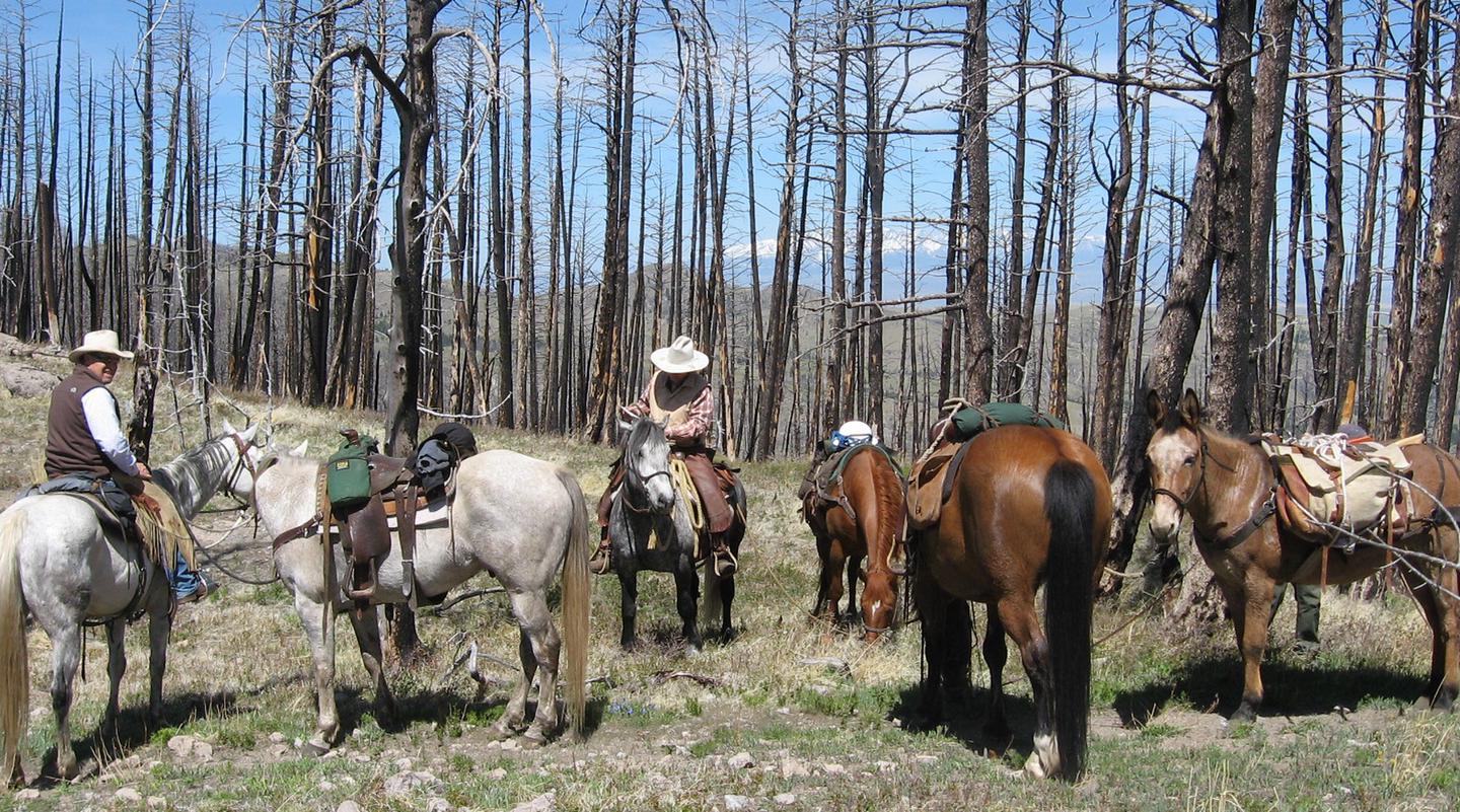
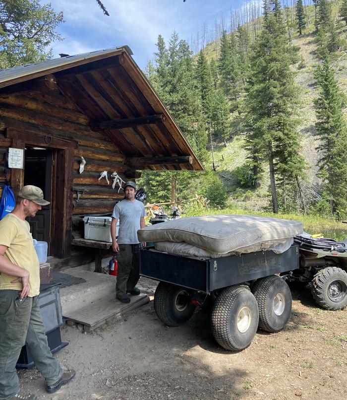
The cabin is open year-round, but access is challenging. There are three routes to the cabin that can be used by equestrians, hikers and ATVs in the summer. During the winter, by snowshoes, skis and snowmobiles. Snowmobilers will need to park their trailers down low on the Iron Mountain Road, keeping the road passable for others. These trails will be marked as to uses. These 4- to 5-mile routes may ford creeks, with creek depths varying from 6 inches to several feet, in the spring.
Some basic conveniences are provided, but guests will need to bring most of their own amenities to ensure a comfortable stay.
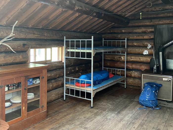
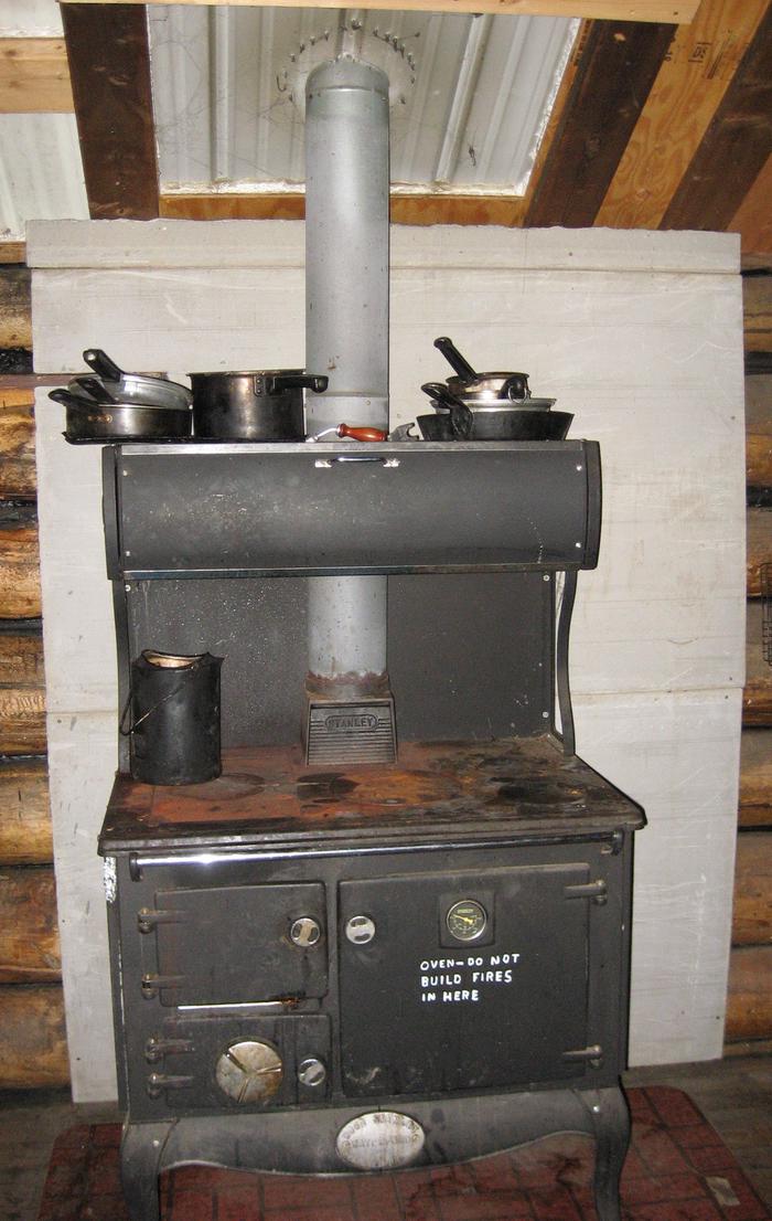
The single-room cabin has a wood cook stove and a wood heating stove. It can sleep up to four people on a provided double bed and set of bunk beds. There are no mattresses. Please bring your own sleeping pads. Other amenities include basic cooking supplies, a table with chairs, some cleaning gear, propane-fueled lantern,propane-fueled cookstove, axe, maul, bucket and shovel. Bring propane canisters for the lantern and stove.
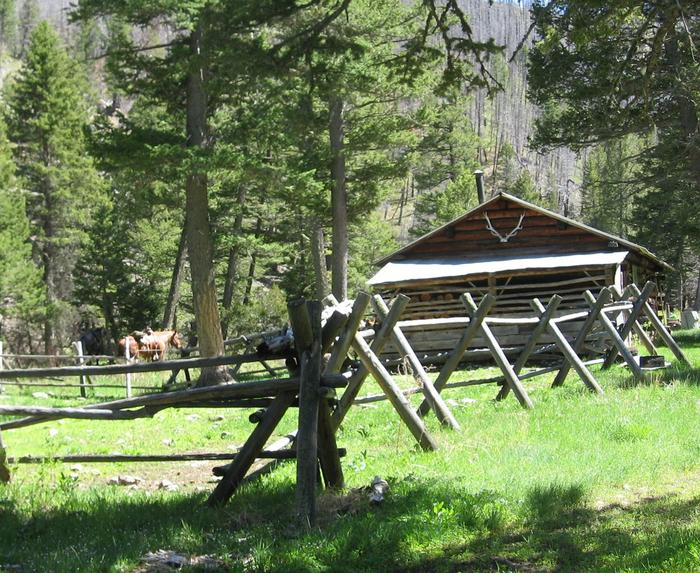
A campfire ring and outhouse with pit toilet are located outside the cabin. Livestock may be kept at the available adjacent corral and in partially fenced pasture.
No water or electricity is provided. Guests must bring their own drinking water or treat water taken from the creek.
Items such as battery-powered flashlights or lanterns, bedding, matches, extra toilet paper and dish soap are not provided.
Need to Know
- 5 night maximum stay limit
- The cabin remains locked; guests must CHECK their confirmation letter for the cabin combination.
- ARRIVAL ON 1st DAY OF RESERVATION 2:00 p.m. DEPARTURE ON THE LAST DAY OF YOUR RESERVATION 12:00 p.m.
The cabin is open year-round, but access is challenging; three routes to the cabin are available. Two routes by ATV and motorcycle and one route by equestrians and hikers in the summer or by snowshoers and skiers in the winter; these 4- to 5-mile routes may ford creeks, with creek depths varying from 6 inches to several feet in the spring
- Drinking water is not available; water obtained from nearby natural water sources should be treated prior to use to prevent Giardia
For a comfortable stay, please bring the following items: flashlight, propane canister for provided lantern, bedding, sleeping pad, cookware, dishes, utensils, newspaper, matches, toilet paper, first-aid kit, drinking water
No garbage service; please bring garbage bags and pack out all that you pack in, including empty propane canisters.
- Cell phone coverage is either limited or not available in this area
Guests should be aware that there is a risk of exposure to hantavirus when visiting remote cabins;
click here to learn more
- Guests must carefully follow the food storage order for Gallatin National Forest; click here for more information
- Maximum group size for using the facility and adjacent area is 15 people
- No liquid fueled (white gas) stoves or lanterns allowed in the cabin or on the porch
A stock corral is provided; please clean the stock corral before leaving. Hay and feed for stock must be certified weed-free. Out of state horses must have current Coggins test.
Within the Yellowstone Ranger District, refunds for weather or accessibility issues on the day of arrival or later will not be considered. Refunds will not be considered for conditions resulting from poor housekeeping by previous visitors.
- Please collect your own firewood for campfires
- Firing a gun or using any other weapon is not allowed within 150 yards of the cabin
- Primary occupant is responsible to ensure all members of their party abide by US Forest Service regulations
- Click here for more information about Gallatin National Forest
- Please call the Livingston office of the Yellowstone Ranger District at (406) 222-1892, during business hours: 8 a.m. to noon and 1 p.m. to 4:30 p.m. MST, Monday through Friday, for current weather conditions/alerts, information and questions about the cabin.
- Don't Move Firewood: Prevent the spread of tree-killing pests by obtaining firewood near your destination and burning it on-site. For more information visit dontmovefirewood.org.
Natural Features
This remote location provides habitat for a variety of wildlife, including bear, moose, antelope, elk and deer. Many species of birds also inhabit the area.
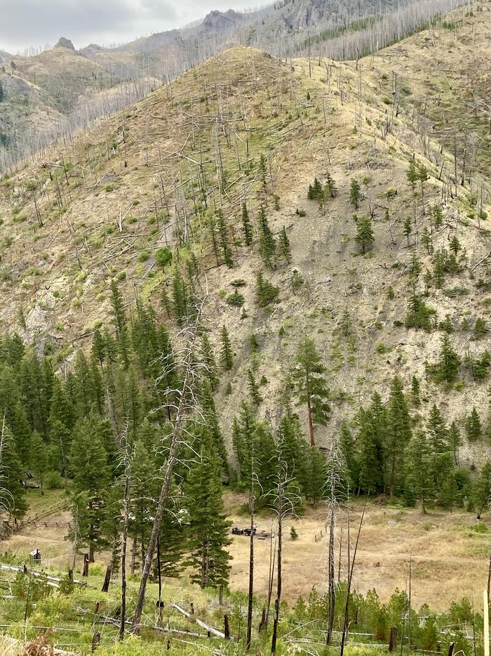
Blackened trees from a 2006 forest fire still line the nearby hillsides.
Recreation
There are numerous trails around the cabin that provide opportunities for exploration. Experienced cross-country skiers and snowshoers will find a challenging winter landscape.
Anglers can fish for trout in the nearby creek. The area offers good big game and bird hunting opportunities in the fall.
Contact Information
Default
5242 HWY 89 SOUTH LIVINGSTON MT 59047
Phone Number
For campground inquiries, please call: 406-222-1892
Rental Options
Learn more about gear rental options for your trip
Driving Directions
Deer Creek Cabin is located approximately 30 miles south of Big Timber, Montana. It can be accessed by 3 different routes. It is recommended that renters carry topographic maps, GPS and compasses for navigation since the route may be difficult to find. One route to follow is the Placer Gulch Trailhead access by foot, horse, or OHV (50 inches or less): From Exit 370 on Interstate 90 just east of Big Timber, take Frontage Road (south side of the interstate) 8 miles east. Turn right (south) onto Lower Deer Creek Road (Forest Service Road #482) and proceed 16.2 miles to the Placer Gulch Trailhead sign located on the left side of the road. Park at the trailhead and travel Placer Gulch Trail 256 by foot, horse or off-road vehicles a distance of 5.2 miles, to the Deer Creek Cabin. Jim's Gulch Trailhead access by foot or horse: From Big Timber, travel 14 miles east on Interstate Highway 90 to Exit 384, Bridger Creek. At the stop sign, turn right and travel south for 8.2 miles to the junction of Main Bridger with West Bridger Creek Road. Turn right and continue on West Bridger Road for 4 miles, to the parking area. Park near the sign for Jim's Gulch Trail 129, Lower Deer Creek. From this point, the cabin is 4 miles by foot or horse. Follow trail 129 up Jim's Gulch for about a mile, where the trail turns sharply to the right (north) and climbs up to the ridge. Follow the trail to the divide where it descends steeply to Lower Deer Creek. At this point, the trail junctions with Lower Deer Creek Trail 5. Turn left (south) on Trail 5 and follow the trail upstream for approximately 1.5 miles to the cabin. Tie Cutter Trail Head 370 access by ATV: Go one quarter mile past Jim's Gulch Trailhead to Tie Cutter Trailhead. This ATV trail climbs up to a ridge, then drops into Lower Deer Creek , accessing Deer Creek Cabin and other motorized trails. During winter months, the road to the trailhead may not be plowed and could be impassable to both passenger cars and four-wheel drive vehicles. Please call the Livingston Office of the Yellowstone Ranger District at (406) 222-1892 for road conditions.