Lodgepole Campground-Sequoia and Kings Canyon National Park
Lodgepole Campground-Sequoia and Kings Canyon National Park
Part of Sequoia & Kings Canyon National Parks
Overview
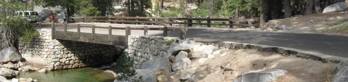
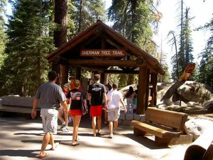
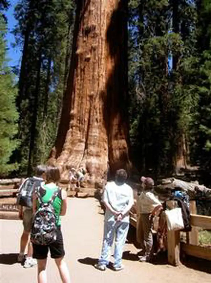
Lodgepole Campground is located in the breathtaking Sequoia and Kings Canyon National Parks in central California's rugged Sierra Nevada range. Lodgepole is perched on the banks of the scenic and lengthy Marble Fork of the Kaweah River, at an elevation of 6,700 ft. The inspiring Giant Forest Grove and the mighty General Sherman Tree - the world's largest tree in volume - are just two miles from the campground.Facilities
Lodgepole Campground is very popular with tent and RV campers alike. It has paved roads, flush toilets, and drinking water. Picnic tables, fire rings, and bear food storage boxes are provided at each site. Lodgepole Village is a quick, 1/4-mile away, offering, a Visitor Center, market and gift shop and coin-operated showers and laundry facilities.
Natural Features
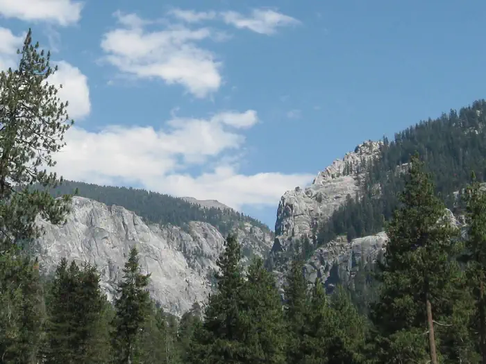
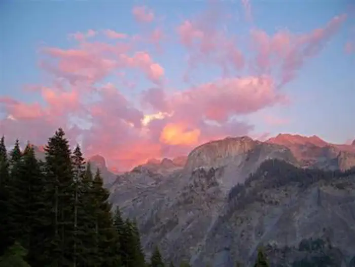
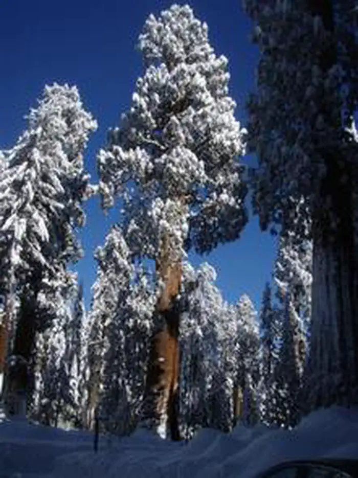
Lodgepole pine, Red fir, and shrubs forest the campground, while towering groves of giant sequoias and craggy granite peaks dot the landscape. The Marble Fork of the Kaweah River is fed by snowmelt and flows seasonally through the site. This region is characterized by warm days and cool nights in the summer and deep snow and cold days in the winter.
Recreation
Forty miles of trails, including the paved Big Trees Trail, invite visitors to immerse themselves in the majesty of the ancient grove. Several additional popular hiking and wilderness trailheads are close by, including the trail to Moro Rock, a granite dome with spectacular views of the Great Western Divide and western half of the park. Tokopah Falls Trail is an easy walk along the Marble Fork of the Kaweah River, leading to an impressive 1200 ft. waterfall. Fly-fishing is also a popular activity on the Marble Fork.
Nearby Attractions
The General Sherman Tree, General Grant Tree, Moro Rock and Tunnel Log are nearby, as is the informative Giant Forest Museum and the Lodgepole Visitor Center.
Colorful Crescent Meadow offers views of vivid summer wildflowers and access to Tharp's Log, a cabin in a fallen sequoia.
Tours into Crystal Cave, one of hundreds of marble caves in the park, give visitors an interesting view of rock formations, fossils, rare minerals, and unique wildlife. Tickets are required, but are not sold at the cave entrance. Reserve in advance at: Crystal Cave - Sequoia Parks Conservancy
Crystal Cave is about a 45 minute drive (13 miles/21 km) from the campground. Vehicles longer than 22 feet long are prohibited on the narrow, winding Crystal Cave Road.
Contact Info
For facility specific information, please call (559) 565-4404.Important Notices
If your campsite remains vacant for 24 hours after your arrival date it will be cancelled and made available on rec.gov. You will be charged for the first night's campsite fee and a $20 cancellation fee, all other fees after that will be refunded. Recreation.gov policies apply to all reservations, cancellations, refunds and date changes. Call (559) 565-4404 if you will be arriving 24 hours after your arrival date so your site won't be cancelled. To leave a message call (559) 565-3714.
Upon making a campground reservation: Site occupants agree to follow ALL campground rules. Failure to comply may result in a fine. You are responsible for your guests.
Campground Rules and Regulations:
• Food Storage- You are in an ACTIVE BEAR AREA. Black Bears are active day and night. When not in arms reach, you must properly store all food, drinks, scented items, coolers, and equipment used to prepare food, inside provided food storage lockers. These items must be stored day and night. Food storage locker dimensions are 28" high x 33" deep x 47" wide.
• 6 Person Limit- There is a maximum of 6 people per campsite. If you exceed this number, purchase 2 sites and spread your group and equipment out evenly between campsites. This is to preserve the natural resources and minimize noise levels. Reservations can be made in advance to accommodate a larger group size at a group campground.
• Check-In and Check-Out is at 12 NOON- Please be prepared to show a screen shot (limited cell service) or printout of your reservation confirmation email upon arrival to the campground. Campsites need to be vacated (vehicles and occupants) by 12:00 NOON.
• Parking Pad- Vehicles must be parked with all four wheels on pavement. Vehicles that do not fit on the provided parking pad must be parked in overflow parking areas.
• Quiet Hours 10pm to 6am- Music, talking, and generators should not be audible beyond your immediate campsite. Unreasonable noise is prohibited any time of day.
• Generator Hours- 8:00AM-11:00AM and 5:00PM-8:00PM
• Fire Restrictions- Check current fire restrictions at nps.gov/seki. Fires must be attended. DO NOT build additional fire rings. Glass, aluminum, and food are prohibited in fire rings. Firewood is sold locally. Dead and down wood may be gathered for your campfire. Logs must fit within the fire ring. Chainsaws are not allowed. Fires must be extinguished completely with water and be cool to the touch before leaving your campsite or going to bed.
• Tents- Pitch tents only on tent pads or within campsite boundaries.
• Dogs/Pets- must always be kept crated, caged, or on a leash no longer than six feet. Pets are allowed in campgrounds and picnic areas. Pets may not be left unattended. Pets are not allowed beyond 100 feet of public roads or parking areas. Pets are not allowed on any Park trails.
• Preserve Natural Resources- Injuring plants or trees by cutting, breaking, or attaching nails or other hardware is prohibited. Driving off pavement is prohibited.
• Bicycles- Helmets required if under 18 years of age. Bicycles are not allowed on any park trails.
• Trash Disposal- Please keep your campsite clean. Place all litter/trash in bear proof campground trash dumpsters. To prevent bears from getting trash please DO NOT forget to lock or relatch the dumpster. Do not leave cigarette butts, bottle caps, confetti or litter on the ground.
• Water Disposal- Do not dump grey-water on the ground or at the water spigots. Bring a tub to wash dishes or to collect shower water. All grey-water must be disposed of at the restrooms, dish sinks, or at a RV dump-station. Used water must not be allowed to run onto the ground.
• Propane Tank Disposal- DO NOT leave in the park. We are unable to recycle your used propane tanks. Please take them home with you and dispose of them properly.
Tire Chains may be required at any time. Be prepared at any time of year for a wide range of temperatures and weather conditions. Check Road Conditions at nps.gov/seki .
Vehicles longer than 22 feet (including trailers) are not advised between Potwisha Campground and the Giant Forest Museum. Visitors with vehicles over 22 feet in total length hoping to visit the Giant Forest or camp at Lodgepole and Dorst Creek Campgrounds are advised to enter via the northern, Highway 180, entrance to these parks.
Dangerous Rivers! Many drowning victims were playing near rivers. Rivers present a far greater danger than lakes or pools. Surfaces may look calm, but strong currents often run below. Be cautious walking near rivers as rocks can be slippery. Getting out of a cold, swift river is often impossible.
Falling Objects - Don't linger under dead, cracked, or broken branches. Run if you hear cracks or snapping from tree roots, trunks, or branches (know that sometimes there is no sound, and very little time to react). Report falling branches or trees to a ranger.
A California state fishing license is required to fish in Sequoia and Kings Canyon National Parks, and Sequoia National Forest lakes and streams. Fishing licenses may be available at National Park and National Forest markets.
Available Activities
- Other Recreation Concession Site - Other Recreation Concession Site
- Hiking - Hiking
- Interpretive Programs - Interpretive Programs
- Camping - Camping
Directions
<p><strong>Both roads leading to Sequoia and Kings Canyon National Parks approach from the west. </strong>They are open all day, every day, depending on weather. <strong>From the east, no roads reach the park boundary.</strong><br> <br><strong>The Main park road, The Generals Highway, connects the north and south entrances. Winter storms may cause temporary closures from Grant Grove to Lodgepole.</strong></p> <ul> <li>It takes about 1 hour to drive to the campground from the south park entrance (198E) or about a 1 hour from the north park entrance (180E).</li> <li><strong>Notice: Vehicles longer than 22 feet (including trailers) are not advised between Potwisha Campground and the Giant Forest Museum. </strong>Visitors with vehicles over 22 feet in total length hoping to visit the Giant Forest or camp at Lodgepole and Dorst Creek Campgrounds are advised to enter via the northern, Highway 180, entrance to these parks.</li> </ul> <p><strong>Arriving from the south (Highway 198):</strong></p> <ul> <li>From Highways 65 or 99: Go east on Hwy 198 E and follow signs for Sequoia National Park to the park entrance. </li> <li>Highway 180 E may be reached from Highway 198 E using Hwy 63 N from Visalia. </li> </ul> <p><br><strong>Arriving from the north (Highway 180):</strong></p> <ul> <li>From Fresno: take Highway 180E, following signs for Kings Canyon National Park to the park entrance. </li> <li>Once in the park, follow signs to Sequoia National Park and Lodgepole.</li> </ul>
Cancellation Policy
<ul><li><p>Payment in full will be charged to your credit card upon completion of the reservation. A $10.00 service fee will apply if you change or cancel your reservation. Additional fees will apply for late cancellations.</p></li><li><p>All cancellations made between midnight on the day before arrival and check out time on the day after arrival are considered late cancellations and will incur a $10.00 cancellation fee and will also forfeit the first night’s use fee. Cancellations for a single night’s reservation will forfeit the entire use fee but no cancellation fee will apply.</p></li><li><p><strong>If your campsite remains vacant for 24 hours after your arrival date it will be cancelled and made available on rec.gov.</strong> You will be charged for the first night's campsite fee and a $20 cancellation fee, all other fees after that will be refunded. Recreation.gov policies apply to all reservations, cancellations, refunds and date changes. Call (559) 565-4404 if you will be arriving 24 hours after your arrival date so your site won't be cancelled.</p></li></ul>
Contact Information
Phone: 559-565-3341
SEQUOIA AND KINGS CANYON NATIONAL PARKS47050 GENERALS HIGHWAY
Three Rivers, CA 93271
Rental Options
Available Campsites
- Site 116, Loop Upper Lodgepole 105-144, Type Tent Only Nonelectric
- Site 032, Loop 23-35, Type Standard Nonelectric
- Site 035, Loop 23-35, Type Standard Nonelectric
- Site 025, Loop 23-35, Type Standard Nonelectric
- Site 060, Loop 36-60, Type Rv Nonelectric
- Site 042, Loop 36-60, Type Walk To
- Site 120, Loop Upper Lodgepole 105-144, Type Tent Only Nonelectric
- Site 090, Loop Upper Lodgepole 69-104, Type Walk To
- Site 027, Loop 23-35, Type Standard Nonelectric
- Site 203, Loop 151-214, Type Standard Nonelectric
- Site 163, Loop 151-214, Type Standard Nonelectric
- Site 092, Loop Upper Lodgepole 69-104, Type Tent Only Nonelectric
- Site 048, Loop 36-60, Type Standard Nonelectric
- Site 188 - A, Loop 151-214, Type Tent Only Nonelectric
- Site 040, Loop 36-60, Type Walk To
- Site 052, Loop 36-60, Type Walk To
- Site 187, Loop 151-214, Type Standard Nonelectric
- Site 211, Loop 151-214, Type Standard Nonelectric
- Site 010, Loop 1-22, Type Rv Nonelectric
- Site 201, Loop 151-214, Type Standard Nonelectric
- Site 159, Loop 151-214, Type Standard Nonelectric
- Site 102, Loop Upper Lodgepole 69-104, Type Walk To
- Site 192, Loop 151-214, Type Tent Only Nonelectric
- Site 134, Loop Upper Lodgepole 105-144, Type Walk To
- Site 202, Loop 151-214, Type Standard Nonelectric
- Site 182, Loop 151-214, Type Standard Nonelectric
- Site 139, Loop Upper Lodgepole 105-144, Type Tent Only Nonelectric
- Site 197, Loop 151-214, Type Rv Nonelectric
- Site 034, Loop 23-35, Type Standard Nonelectric
- Site 036, Loop 36-60, Type Rv Nonelectric
- Site 173, Loop 151-214, Type Walk To
- Site 106, Loop Upper Lodgepole 105-144, Type Tent Only Nonelectric
- Site 124, Loop Upper Lodgepole 105-144, Type Walk To
- Site 108, Loop Upper Lodgepole 105-144, Type Walk To
- Site 156, Loop 151-214, Type Standard Nonelectric
- Site 188, Loop 151-214, Type Tent Only Nonelectric
- Site 170, Loop 151-214, Type Walk To
- Site 082, Loop Upper Lodgepole 69-104, Type Walk To
- Site 151, Loop 151-214, Type Standard Nonelectric
- Site 074, Loop Upper Lodgepole 69-104, Type Walk To
- Site 199, Loop 151-214, Type Standard Nonelectric
- Site 158, Loop 151-214, Type Standard Nonelectric
- Site 210, Loop 151-214, Type Standard Nonelectric
- Site 103, Loop Upper Lodgepole 69-104, Type Walk To
- Site 195, Loop 151-214, Type Standard Nonelectric
- Site 181, Loop 151-214, Type Standard Nonelectric
- Site 185, Loop 151-214, Type Tent Only Nonelectric
- Site 072, Loop Upper Lodgepole 69-104, Type Tent Only Nonelectric
- Site 033, Loop 23-35, Type Standard Nonelectric
- Site 175, Loop 151-214, Type Standard Nonelectric
- Site 083, Loop Upper Lodgepole 69-104, Type Walk To
- Site 118, Loop Upper Lodgepole 105-144, Type Tent Only Nonelectric
- Site 009, Loop 1-22, Type Standard Nonelectric
- Site 121, Loop Upper Lodgepole 105-144, Type Tent Only Nonelectric
- Site 162, Loop 151-214, Type Standard Nonelectric
- Site 026, Loop 23-35, Type Standard Nonelectric
- Site 051, Loop 36-60, Type Rv Nonelectric
- Site 091, Loop Upper Lodgepole 69-104, Type Tent Only Nonelectric
- Site 073, Loop Upper Lodgepole 69-104, Type Walk To
- Site 087, Loop Upper Lodgepole 69-104, Type Walk To
- Site 059, Loop 36-60, Type Standard Nonelectric
- Site 138, Loop Upper Lodgepole 105-144, Type Tent Only Nonelectric
- Site 160, Loop 151-214, Type Standard Nonelectric
- Site 101, Loop Upper Lodgepole 69-104, Type Tent Only Nonelectric
- Site 061, Loop 61-68, Type Tent Only Nonelectric
- Site 031, Loop 23-35, Type Standard Nonelectric
- Site 178, Loop 151-214, Type Standard Nonelectric
- Site 190, Loop 151-214, Type Tent Only Nonelectric
- Site 196, Loop 151-214, Type Rv Nonelectric
- Site 214, Loop 151-214, Type Standard Nonelectric
- Site 126, Loop Upper Lodgepole 105-144, Type Walk To
- Site 140, Loop Upper Lodgepole 105-144, Type Walk To
- Site 021, Loop 1-22, Type Standard Nonelectric
- Site 086, Loop Upper Lodgepole 69-104, Type Walk To
- Site 045, Loop 36-60, Type Walk To
- Site 155, Loop 151-214, Type Standard Nonelectric
- Site 079, Loop Upper Lodgepole 69-104, Type Walk To
- Site 046, Loop 36-60, Type Standard Nonelectric
- Site 096, Loop Upper Lodgepole 69-104, Type Tent Only Nonelectric
- Site 081, Loop Upper Lodgepole 69-104, Type Walk To
- Site 205, Loop 151-214, Type Standard Nonelectric
- Site 166, Loop 151-214, Type Standard Nonelectric
- Site 063, Loop 61-68, Type Standard Nonelectric
- Site 068, Loop 61-68, Type Tent Only Nonelectric
- Site 016, Loop 1-22, Type Rv Nonelectric
- Site 050, Loop 36-60, Type Rv Nonelectric
- Site 142, Loop Upper Lodgepole 105-144, Type Tent Only Nonelectric
- Site 154, Loop 151-214, Type Standard Nonelectric
- Site 047, Loop 36-60, Type Standard Nonelectric
- Site 008, Loop 1-22, Type Standard Nonelectric
- Site 006, Loop 1-22, Type Standard Nonelectric
- Site 109, Loop Upper Lodgepole 105-144, Type Tent Only Nonelectric
- Site 164, Loop 151-214, Type Standard Nonelectric
- Site 054, Loop 36-60, Type Walk To
- Site 161, Loop 151-214, Type Standard Nonelectric
- Site 015, Loop 1-22, Type Rv Nonelectric
- Site 152, Loop 151-214, Type Rv Nonelectric
- Site 003, Loop 1-22, Type Standard Nonelectric
- Site 062, Loop 61-68, Type Standard Nonelectric
- Site 176, Loop 151-214, Type Tent Only Nonelectric
- Site 043, Loop 36-60, Type Walk To
- Site 168, Loop 151-214, Type Standard Nonelectric
- Site 077, Loop Upper Lodgepole 69-104, Type Walk To
- Site 057, Loop 36-60, Type Rv Nonelectric
- Site 204, Loop 151-214, Type Standard Nonelectric
- Site 093, Loop Upper Lodgepole 69-104, Type Tent Only Nonelectric
- Site 069, Loop Upper Lodgepole 69-104, Type Walk To
- Site 213, Loop 151-214, Type Standard Nonelectric
- Site 107, Loop Upper Lodgepole 105-144, Type Tent Only Nonelectric
- Site 125, Loop Upper Lodgepole 105-144, Type Walk To
- Site 017, Loop 1-22, Type Standard Nonelectric
- Site 144, Loop Upper Lodgepole 105-144, Type Tent Only Nonelectric
- Site 104, Loop Upper Lodgepole 69-104, Type Walk To
- Site 165, Loop 151-214, Type Standard Nonelectric
- Site 097, Loop Upper Lodgepole 69-104, Type Walk To
- Site 049, Loop 36-60, Type Standard Nonelectric
- Site 004, Loop 1-22, Type Standard Nonelectric
- Site 056, Loop 36-60, Type Rv Nonelectric
- Site 136, Loop Upper Lodgepole 105-144, Type Tent Only Nonelectric
- Site 085, Loop Upper Lodgepole 69-104, Type Tent Only Nonelectric
- Site 038, Loop 36-60, Type Walk To
- Site 019, Loop 1-22, Type Standard Nonelectric
- Site 022, Loop 1-22, Type Standard Nonelectric
- Site 071, Loop Upper Lodgepole 69-104, Type Walk To
- Site 179, Loop 151-214, Type Standard Nonelectric
- Site 039, Loop 36-60, Type Walk To
- Site 023, Loop 23-35, Type Standard Nonelectric
- Site 194, Loop 151-214, Type Standard Nonelectric
- Site 130, Loop Upper Lodgepole 105-144, Type Walk To
- Site 212, Loop 151-214, Type Standard Nonelectric
- Site 171, Loop 151-214, Type Standard Nonelectric
- Site 153, Loop 151-214, Type Standard Nonelectric
- Site 207, Loop 151-214, Type Standard Nonelectric
- Site 094, Loop Upper Lodgepole 69-104, Type Tent Only Nonelectric
- Site 127, Loop Upper Lodgepole 105-144, Type Walk To
- Site 180, Loop 151-214, Type Standard Nonelectric
- Site 014, Loop 1-22, Type Rv Nonelectric
- Site 084, Loop Upper Lodgepole 69-104, Type Walk To
- Site 183, Loop 151-214, Type Standard Nonelectric
- Site 110, Loop Upper Lodgepole 105-144, Type Tent Only Nonelectric
- Site 200, Loop 151-214, Type Tent Only Nonelectric
- Site 098, Loop Upper Lodgepole 69-104, Type Walk To
- Site 122, Loop Upper Lodgepole 105-144, Type Walk To
- Site 186, Loop 151-214, Type Rv Nonelectric
- Site 020, Loop 1-22, Type Standard Nonelectric
- Site 135, Loop Upper Lodgepole 105-144, Type Walk To
- Site 193, Loop 151-214, Type Standard Nonelectric
- Site 067, Loop 61-68, Type Tent Only Nonelectric
- Site 198, Loop 151-214, Type Standard Nonelectric
- Site 024, Loop 23-35, Type Standard Nonelectric
- Site 078, Loop Upper Lodgepole 69-104, Type Walk To
- Site 123, Loop Upper Lodgepole 105-144, Type Tent Only Nonelectric
- Site 189, Loop 151-214, Type Tent Only Nonelectric
- Site 065, Loop 61-68, Type Tent Only Nonelectric
- Site 143, Loop Upper Lodgepole 105-144, Type Tent Only Nonelectric
- Site 100, Loop Upper Lodgepole 69-104, Type Walk To
- Site 115, Loop Upper Lodgepole 105-144, Type Tent Only Nonelectric
- Site 131, Loop Upper Lodgepole 105-144, Type Walk To
- Site 053, Loop 36-60, Type Walk To
- Site 076, Loop Upper Lodgepole 69-104, Type Walk To
- Site 105, Loop Upper Lodgepole 105-144, Type Tent Only Nonelectric
- Site 169, Loop 151-214, Type Walk To
- Site 119, Loop Upper Lodgepole 105-144, Type Tent Only Nonelectric
- Site 037, Loop 36-60, Type Rv Nonelectric
- Site 167, Loop 151-214, Type Standard Nonelectric
- Site 044, Loop 36-60, Type Walk To
- Site 095, Loop Upper Lodgepole 69-104, Type Tent Only Nonelectric
- Site 075, Loop Upper Lodgepole 69-104, Type Walk To
- Site 117, Loop Upper Lodgepole 105-144, Type Tent Only Nonelectric
- Site 041, Loop 36-60, Type Walk To
- Site 070, Loop Upper Lodgepole 69-104, Type Tent Only Nonelectric
- Site 055, Loop 36-60, Type Walk To
- Site 012, Loop 1-22, Type Rv Nonelectric
- Site 157, Loop 151-214, Type Standard Nonelectric
- Site 080, Loop Upper Lodgepole 69-104, Type Walk To
- Site 128, Loop Upper Lodgepole 105-144, Type Walk To
- Site 007, Loop 1-22, Type Standard Nonelectric
- Site 184, Loop 151-214, Type Standard Nonelectric
- Site 129, Loop Upper Lodgepole 105-144, Type Tent Only Nonelectric
- Site 191, Loop 151-214, Type Tent Only Nonelectric
- Site 058, Loop 36-60, Type Rv Nonelectric
- Site 112, Loop Upper Lodgepole 105-144, Type Tent Only Nonelectric
- Site 013, Loop 1-22, Type Rv Nonelectric
- Site 177, Loop 151-214, Type Standard Nonelectric
- Site 088, Loop Upper Lodgepole 69-104, Type Walk To
- Site 132, Loop Upper Lodgepole 105-144, Type Tent Only Nonelectric
- Site 208, Loop 151-214, Type Standard Nonelectric
- Site 005, Loop 1-22, Type Standard Nonelectric
- Site 172, Loop 151-214, Type Standard Nonelectric
- Site 064, Loop 61-68, Type Tent Only Nonelectric
- Site 089, Loop Upper Lodgepole 69-104, Type Tent Only Nonelectric
- Site 066, Loop 61-68, Type Tent Only Nonelectric
- Site 209, Loop 151-214, Type Standard Nonelectric
- Site 011, Loop 1-22, Type Rv Nonelectric
- Site 028, Loop 23-35, Type Standard Nonelectric
- Site 137, Loop Upper Lodgepole 105-144, Type Tent Only Nonelectric
- Site 174, Loop 151-214, Type Walk To
- Site 141, Loop Upper Lodgepole 105-144, Type Tent Only Nonelectric
- Site 111, Loop Upper Lodgepole 105-144, Type Walk To
- Site 114, Loop Upper Lodgepole 105-144, Type Tent Only Nonelectric
- Site 133, Loop Upper Lodgepole 105-144, Type Tent Only Nonelectric