PSICC
Usda Forest Service, Colorado.
Peaks to Prairies - Tracks to Trails
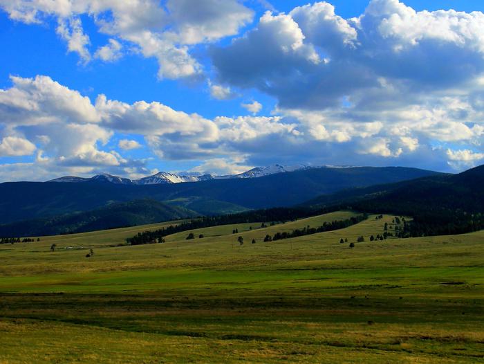
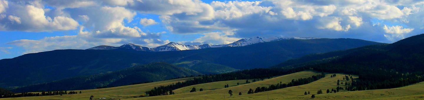
Pike and San Isabel National Forests & Cimarron and Comanche National Grasslands (forest locator map) cover nearly 3 million acres, between the prairies of western Kansas and some of Colorado's highest mountain peaks along the Continental Divide. These sprawling forests and grasslands are an eight hour drive from boundary to boundary. This landscape offers a variety of ecosystems rich in history, geology, scenery, wildlife habitat and recreation opportunities.
The rolling prairies to the east are home to prairie chickens, wildflowers, paleontological resources and historical areas. The snow-capped Rockies to the west are a scenic backdrop to millions of residents and a draw to forest visitors. The forests are home to nearly half of Colorado's fourteeners with numerous alpine lakes, reservoirs and key rivers. Over 385,000 acres of Wilderness, the Continental Divide National Scenic Trail, Colorado Trail, and Santa Fe National Historic Trail are special areas worth exploring.
People who live near these areas maintain a strong relationship to the lands. The commitment and volunteerism that these community members have for these public lands is the foundation for our ability to maintain a quality, sustainable recreation program in the face of intense, and growing, urban demand.
Critical Information about the use of Unmanned Aircraft Systems
Unmanned Aircraft Systems (UAS) or “drones” are increasing in popularity and can provide wonderful opportunities to explore the forest. Please be aware that these drones are regulated and must follow certain laws to be safe and legal.
- Recreational Drone Tips (.pdf)
- Forest Service Unmanned Aircraft Systems policy (fs.fed.us)
Camping and Day Use
- Alvarado Campground
- Angel Of Shavano Group
- Aspen (CO)
- Angel of Shavano
- Baby Doe
- Bassam Guard Station
- Bear Lake Campground (CO)
- Blue Mountain
- Buffalo Campground
- Buffalo Springs
- Burning Bear Campground
- Belle of Colorado
- Blue Lake Campground - San Isabel Nf (CO)
- Bootleg
- Cascade (Colorado)
- Chalk Lake
- Collegiate Peaks
- Colorado Campground
- Cove Campground
- Crescent Mining Camp
- Cordova Pass
- Cottonwood Lake - PSICC (Co)
- Davenport Campground
- Dawson Cabin
- Deer Creek Campground
- Devils Head Campground
- Dexter
- Elbert Creek
- Father Dyer
- Flat Rocks Campground
- Fourmile
- Geneva Park Campground
- Goose Creek Campground
- Green Mountain Campground
- Happy Meadows
- Horseshoe Campground
- Halfmoon East
- Halfmoon West
- Hall Valley
- Handcart
- Hayden Creek
- Indian Creek Equestrian Campground
- Iron City
- Jefferson Creek
- Kelsey Campground
- Kenosha Pass Campground
- LA Vista Campground - Lake Isabel
- Lake Isabel Cabin
- Lakeview Campground
- Lone Rock Campground (CO)
- Lake Creek (Co)
- Lodgepole (Jefferson Lake, Fairplay Colorado)
- Lost Park
- Manitou Lake Pavilion
- May Queen
- Meadow Ridge
- Meadows Group Campground
- Mingus Ranch
- Molly Brown
- Monarch Park
- Mount Princeton
- Matchless
- Meridian Campground
- Michigan Creek
- North Fork Campground (Salida, CO)
- Ohaver Lake
- Ophir Creek Campground (CO)
- Osprey (CO)
- Ouzel
- Painted Rocks
- Pike Community
- Ponderosa Group - Lake Isabel
- Printer Boy
- Purgatoire Campground
- Parry Peak
- Platte River
- Pulver Mountain Group Site
- Red Rocks Group Campground
- Riverside (CO)
- Roberts Cabin
- Round Mountain
- Rampart Range Recreation Area Designated Dispersed Camping
- Silver Dollar
- Southside Campground - Lake Isabel
- Spillway Campground
- Springer Gulch
- Spruce Group - Lake Isabel
- Spruce Grove Campground
- St Charles Campground - Lake Isabel
- Selkirk
- South Meadows - Pike San Isabel Nf (CO)
- Springdale
- Thunder Ridge
- Timberline Campground
- Tabor
- The Crags
- Twin Eagle
- Twin Peaks (CO)
- White Star
- Weston Pass
Activities and Experiences
Nearby Activities
- Biking
- Boating
- Camping
- Climbing
- Fire Lookouts/Cabins Overnight
- Fishing
- Hiking
- Horse Camping
- Horseback Riding
- Off Highway Vehicle
- Picnicking
- Wildlife Viewing