New Look!
New Trip Ideas!
Learn More...

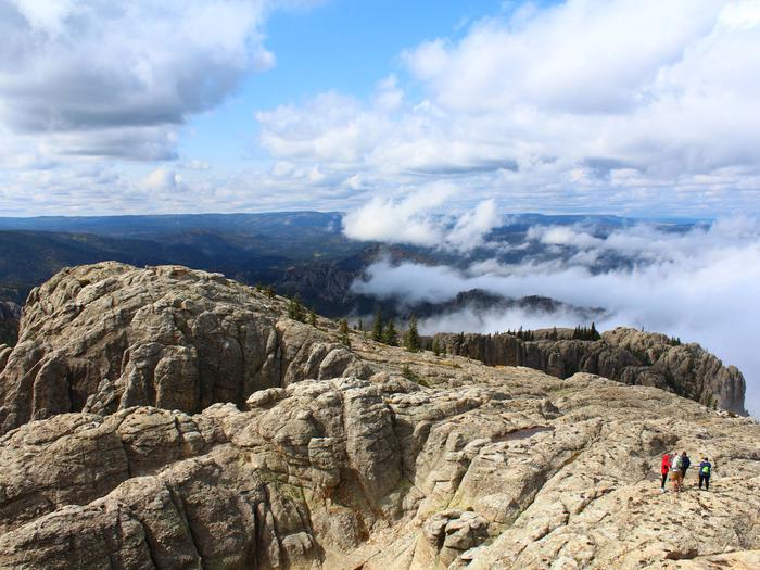
Black Hills National Forest, SD

US Forest Service

Overview

The name "Black Hills" comes from the Lakota words Paha Sapa, which mean "hills that are black". Seen from a distance, these pine-covered hills, rising several thousand feet above the surrounding prairie, appear black. The Black Hills are in western South Dakota and northeastern Wyoming, covering an area 125 miles long and 65 wide. They encompass rugged rock formations, canyons and gulches, open grassland parks, tumbling streams, deep blue lakes, and unique caves.

Amid the splendid scenery are 11 reservoirs, 30 campgrounds, 26 picnic areas, 2 scenic byways, 1,300 miles of streams, 13,605 acres of wilderness, over 450 miles of trails, and much more.

Recreational Activities:

  • AUTO TOURING
  • CAMPING
  • CLIMBING
  • FISHING
  • HIKING
  • HISTORIC & CULTURAL SITE
  • HORSEBACK RIDING
  • HUNTING
  • INTERPRETIVE PROGRAMS
  • OFF HIGHWAY VEHICLE
  • PICNICKING
  • RECREATIONAL VEHICLES
  • VISITOR CENTER
  • WILDLIFE VIEWING

Address:

25041 N Highway 16
Custer,SD,57730
Phone: 605-673-2251
Email: Mailroom_R2_Black_Hills@fs.fed.us

Directions:

Primary access is from I90 north of Rapid City and US Highways 16 and 385 to the west and south of Rapid City, the office is located on the west side of Highway 16. See our map for help in getting there.

Recreation.gov helps you discover and book trips to all of America's public places.
Learn more about us, or about any of our agency partners below:
Bureau of Land Management Federal Highway Administration National Oceanic Atmosphere Administration Smithsonian Institution USDA Forest Service US Army Corps of Engineers US Fish and Wildlife Service National Park Service Bureau of Engraving and Printing Tennessee Valley Authority Bureau of Reclamation National Archives Records Administration