Tyler Bend Campground
TYLER BEND CAMPGROUND
Part of Buffalo National River
Overview
Campers will delight in the picturesque river views at Tyler Bend. Located 11 miles (18 km) northwest of Marshall, Arkansas, Tyler Bend is set on a quiet, peaceful section of the great Buffalo National River. Known as the middle river region, the campground offers tranquil views of the river beside pastures.
Facilities
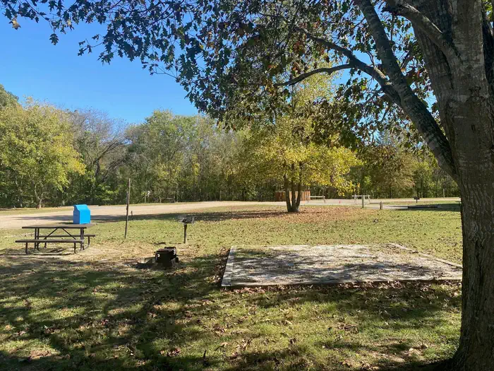
The Tyler Bend Visitor Center is open year-round and has interesting exhibits on the history of flora and fauna in the Buffalo National River area. It's the primary visitor center for the region and provides several educational programs in the auditorium. The campground has 10 walk-in and 28 drive-in sites available, plus a day-use pavilion and five group sites.Natural Features
The Buffalo National River flows free over swift running rapids and quiet pools for its 135-mile (217 km) length. One of the few remaining rivers in the lower 48 states without dams, the Buffalo cuts its way through massive limestone bluffs traveling eastward through the Arkansas Ozarks and into the White River.
Recreation
Small-mouth bass, catfish and sunfish are the most popular fish to catch on the Buffalo River, but visitors should be aware that an Arkansas fishing license is required to fish anywhere on the river.
The middle river location also allows for extended seasons for kayaking and tubing. If there's enough rain, the sports can go through mid- to late summer.
Get a dose of history by hiking to the Collier Homestead, a restored Ozark dwelling from the 1930's. The homestead remembers one of the homes built by settlers in response to the Homestead Act of 1862.
Nearby Attractions
The Buffalo River Trail is accessible from the Collier trailhead parking area. This trail joins the Ozark Highlands Trail at Woolum, 14 miles (22.5 km) upstream from Tyler Bend.
Important Notices
The facility is available for camping free of charge outside of the reservation season (generally November 15th to March 14th every year).
Climbing and/or diving from the bluffs is dangerous and highly discouraged.
Do not swim alone during high water.
All park trails are closed to pets with the exception of the Buffalo River Trail, only on the section of trail between Ponca and Steel Creek, the Villines Homestead Trail at Ponca, the Mill Creek Trail (trailhead is at the Pruitt river access area in the Upper District), the Tyler Bend Campground trails (Spring Hollow, Buck Ridge, and Rock Wall in the Middle District), and all three Buffalo Point Campground trails (Forest Trail, Overlook Trail, and Campground Trail in the Lower District). For more information visit the Pets page on the park website.
Don't Move Firewood: Help protect our forests! Prevent the spread of tree-killing pests by obtaining firewood at or near your destination and burning it on-site. Moving firewood is illegal in some states.
Please be aware that some special events held at the pavilions or anywhere in the park (such as weddings, press receptions, concerts, et al) require a Special Use Permit in addition to the pavilion reservation. To obtain a Special Use Permit or additional information, please contact the Commercial Services office at (870) 365-2724.for more information vist the Special Park Uses page on the park website.
Please be advised that providing business services within an NPS unit is prohibited per CFR 5.3 without a written Authorization or Permit approved by the Superintendent. This includes services such as RV or tent delivery & set-up, firewood sales and delivery, shuttle (transportation) services, and guided hikes, floats, etc. For a list of approved visitor services and to learn more about doing business at Buffalo National River, visit the Doing Business With The Park web page.
Available Activities
- Day Use Area - Day Use Area
- Visitor Center - Visitor Center
- Fishing - Fishing
- Camping - Camping
- Canoeing - Canoeing
- Hiking - Hiking
- Photography - Photography
- River Trips - River Trips
- Swimming - Swimming
Directions
<p>From Springfield, Missouri take U.S. Highway 65 south for 109 miles (175 km); then turn right at Ranger Road (follow signs) and drive another 2 miles (3.2 km) to visitor center and campground. From Little Rock, Arkansas take Interstate 40 West for 34 miles (55 km), then exit "U.S. 65/Skyline Drive." From here continue on U.S. Highway 65 north for 74 miles (119 km) and turn left at Ranger Road (follow signs) to the visitor center and campground.</p>
Cancellation Policy
<p><a href="https://www.recreation.gov/rules-reservation-policies" rel="nofollow">Rules and Reservation Policies</a> </p>
Contact Information
Phone: 870-439-2502
TYLER BEND VISITOR CENTER170 RANGER ROAD
ST. JOE, AR 72675
Rental Options
Available Campsites
- Site Site# 12, Loop Main Loop, Type Rv Nonelectric
- Site Site# 13, Loop Main Loop, Type Standard Nonelectric
- Site Site# 06, Loop Main Loop, Type Standard Nonelectric
- Site G2, Loop Group Sites, Type Group Tent Only Area Nonelectric
- Site Site# 11, Loop Main Loop, Type Standard Nonelectric
- Site Site# 16, Loop Main Loop, Type Standard Nonelectric
- Site G5, Loop Group Sites, Type Group Tent Only Area Nonelectric
- Site G1, Loop Group Sites, Type Group Tent Only Area Nonelectric
- Site Walk-in: A, Loop Tent only, Type Tent Only Nonelectric
- Site Walk-in: D, Loop Tent only, Type Tent Only Nonelectric
- Site Site# 09, Loop Main Loop, Type Standard Nonelectric
- Site G4, Loop Group Sites, Type Group Tent Only Area Nonelectric
- Site Site# 14, Loop Main Loop, Type Standard Nonelectric
- Site Pavilion, Loop Pavilion, Type Group Shelter Electric
- Site Walk-in: J, Loop Tent only, Type Tent Only Nonelectric
- Site Site# 04, Loop Main Loop, Type Standard Nonelectric
- Site Site# 20, Loop Main Loop, Type Standard Nonelectric
- Site Walk-in: E, Loop Tent only, Type Tent Only Nonelectric
- Site Site# 08, Loop Main Loop, Type Standard Nonelectric
- Site Walk-in: I, Loop Tent only, Type Tent Only Nonelectric
- Site Walk-in: C, Loop Tent only, Type Tent Only Nonelectric
- Site Site# 28, Loop Main Loop, Type Standard Nonelectric
- Site Walk-in: B, Loop Tent only, Type Tent Only Nonelectric
- Site Site# 24, Loop Main Loop, Type Standard Nonelectric
- Site Site# 02, Loop Main Loop, Type Standard Nonelectric
- Site Site# 15, Loop Main Loop, Type Standard Nonelectric
- Site Site# 27, Loop Main Loop, Type Standard Nonelectric
- Site Site# 21, Loop Main Loop, Type Standard Nonelectric
- Site Walk-in: G, Loop Tent only, Type Tent Only Nonelectric
- Site Site# 19, Loop Main Loop, Type Standard Nonelectric
- Site Walk-in: H, Loop Tent only, Type Tent Only Nonelectric
- Site Site# 05, Loop Main Loop, Type Standard Nonelectric
- Site Site# 18, Loop Main Loop, Type Standard Nonelectric
- Site Site# 10, Loop Main Loop, Type Standard Nonelectric
- Site Site# 22, Loop Main Loop, Type Standard Nonelectric
- Site G3, Loop Group Sites, Type Group Tent Only Area Nonelectric
- Site Walk-in: F, Loop Tent only, Type Tent Only Nonelectric
- Site Site# 26, Loop Main Loop, Type Standard Nonelectric
- Site Site# 23, Loop Main Loop, Type Standard Nonelectric
- Site Site# 07, Loop Main Loop, Type Standard Nonelectric
- Site Site# 25, Loop Main Loop, Type Standard Nonelectric
- Site Site# 03, Loop Main Loop, Type Standard Nonelectric
- Site Site# 17, Loop Main Loop, Type Standard Nonelectric