Warner Mountain Lookout
WARNER MOUNTAIN LOOKOUT
Part of Willamette National Forest
Overview
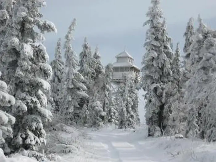
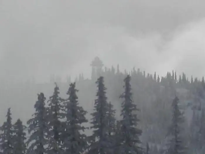
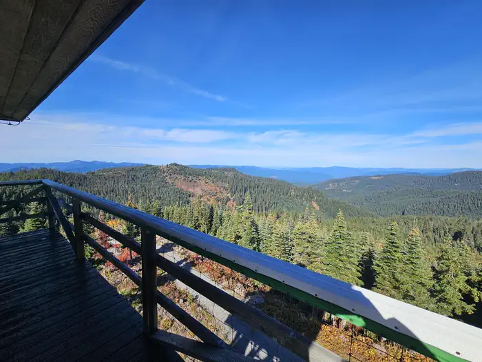
Warner Mountain Lookout is the winter wonderland destination for avid winter sports enthusiasts looking for a challenge. This replica of an old cupola-style lookout sits on a high vantage point of Warner Ridge at an altitude of 5,300 feet in the Willamette National Forest approximately 75 miles southeast of Eugene, Oregon.This is a very remote location; the road to the lookout is not plowed or maintained for winter travel. The lookout can only be accessed by skis, snowmobiles or snowshoes, a distance of 2-10 miles. Conditions on the mountain change rapidly. You need to be evaluating conditions and weather throughout your stay. Sudden storms and high winds may make skiing and driving conditions difficult. Experience in cross-country skiing or snowshoe travel is highly recommended. Guests are responsible for their own travel arrangements and safety, and must bring several of their own amenities.
The reward is worth the effort of getting there. Guests will enjoy panoramic views of the pristine snow-covered landscape and starry skies on clear nights.
Facilities
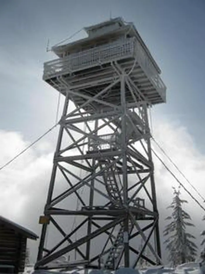
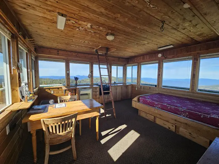
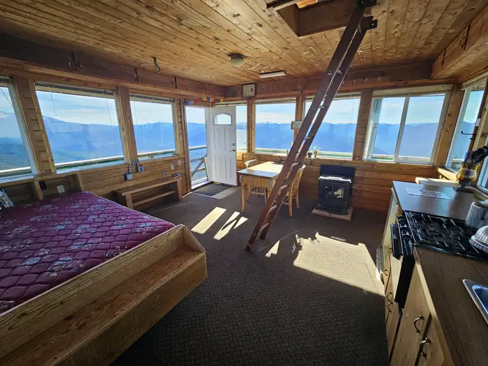
The 14x14-ft. cabin sits atop a 40-foot tower and is surrounded by a catwalk. The cabin accommodates 4 people and is furnished with one double bed that comfortably sleeps two, a table and chairs, propane stoves for heating and cooking, cookware, dishes, and a broom and dust pan. Propane is provided. Cell service may be available from the tower depending on your service provider. There is a vault toilet nearby. No water or electricity is provided. Guests typically melt snow for their supply of water for drinking, cooking and washing. A large pot is provided for this purpose. Items such as bedding, extra mattresses, flashlights, matches, extra toilet paper, first aid supplies, trash bags, dish soap, and towels are not reliably available after mid-season. Guests are expected to pack out their trash and clean the cabin before leaving. Absolutely no pets are allowed.Natural Features
The lookout towers over forest cover of noble fir, mountain hemlock and silver fir at the crest of Warner Mountain. The lookout is close to Middle Fork Willamette River - Moon Point Trail Area, with a diverse habitat ranging from meadows to rocky cliffs and dotted with high-elevation conifers. Willamette National Forest offers prime habitat for such species as Roosevelt elk, black bears, bald eagles, black tail deer and bobcats, among other wildlife.Recreation
Winter recreationists can enjoy cross-country skiing, snowshoeing and snowmobiling on the terrain in the nearby Middle Fork Willamette River - Moon Point Trail Area.Reaching the cabin on the 10-mile access road is part of the snow sport fun. Visitors might also catch a glimpse of any number of wildlife that lives in the area.
Important Notices
- It is highly recommended that visitors reserving the lookout follow the directions and the route shown below in 'Getting There.' Do not attempt to access the lookout from Forest Road 23.
- Experience in cross-country skiing or snowshoe travel is highly recommended; renters should plan an entire day of travel to reach the lookout. Make sure you leave early enough and account for short winter days.
- Be prepared for extreme winter weather conditions; guests should be experienced in back country travel and survival skills
- Carry adequate clothing, food, water and equipment
- There is no water; guests must provide their own water for drinking, cooking and washing
- No open flames, including candles, are permitted
- Cabin access is on steep, narrow metal gripping stairs up the 41 foot tower.
Guests should come prepared for rapidly changing winter conditions and carry tire chains and a shovel; this is a high wind and storm area and there can be up to a foot of snowfall overnight
- A high-clearance vehicle is recommended
- Guests can contact the Ranger District prior to arrival to check on any restrictions or conditions, road closures, weather or storms, which might affect their visit.
- Refunds will not be granted due to weather or snow conditions which may make access extremely challenging
- Guests must pack out all trash and clean the cabin before departure
- Smoking is not permitted
- Learn more about the Willamette National Forest
- Pets are not allowed.
- Don't Move Firewood: Please protect Pacific Northwest forests by preventing the spread of invasive species. Firewood can carry insects and diseases that can threaten the health of our western forests. You can make a difference by obtaining and burning your firewood near your camping destination. Visit Dontmovefirewood.org for further information.
Available Activities
- Wildlife Viewing - Wildlife Viewing
- Cross Country Skiing - Cross Country Skiing
- Camping - Camping
- Birding - Birding
- Snowshoeing - Snowshoeing
- Star Gazing - Star Gazing
Directions
From Eugene, Oregon, take I-5 south to the exit for Highway 58 East. Drive east 34 miles on Highway 58 through Oakridge. Continue on Highway 58 about 1 to 1.5 miles east of Oakridge. Turn right towards Hills Creek Reservoir on Kitson Springs Road and proceed 0.2 mile to Forest Service Road (FSR) 21. Turn right and follow double lane FSR 21 south and southeast for approximately 18 miles. Turn left on gravel FSR 2129. Proceed on 2129 for 8 miles to Spur 439. (You may encounter snow before you reach 439). Turn right at this junction; follow this road for 4 miles to the 342 spur on the left. This is the road to the lookout. The road is gated, but the gate is usually buried under snow during the winter season and not visible. Lookout signs along FSR 21 and FSR 2129 will help identify the routes. Orange poles identify the final route through a meadow to the lookout. If a low-elevation storm is predicted at the time of arrival, be sure to park vehicle facing downhill before reaching the snow zone. It is the responsibility of cabin guests to arrange for towing if their vehicle gets stuck in snow.
Contact Information
Phone: 541-782-2283
46375 HIGHWAY 58WESTFIR, OR 97492