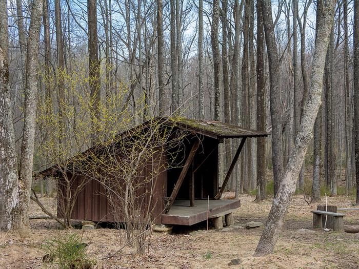
Adirondack Shelters
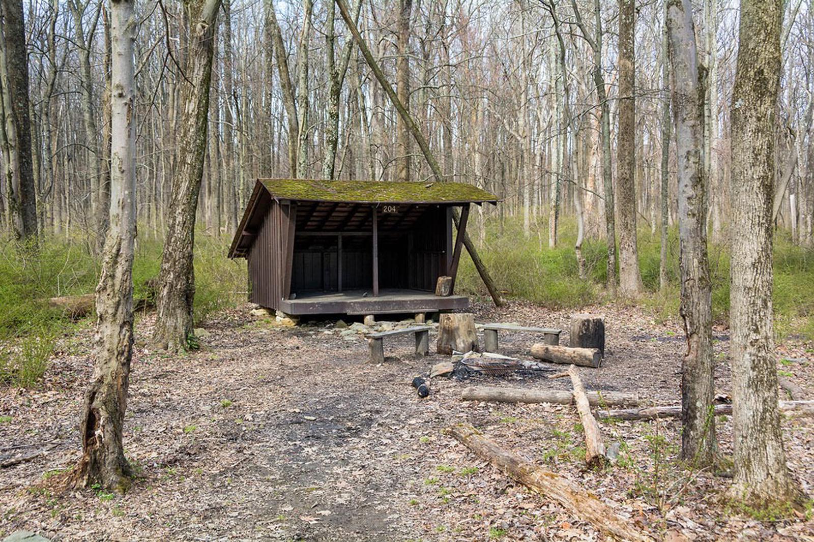
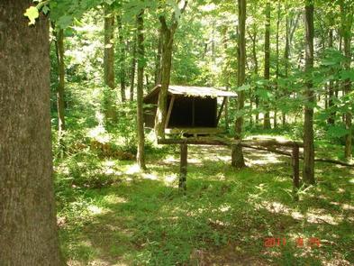
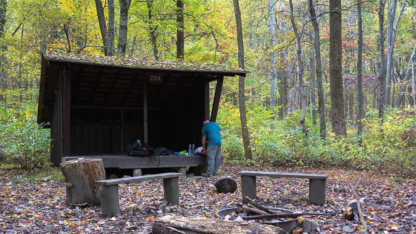
The Adirondack Shelters, located near the northern most point of Catoctin Mountain Park, provide a destination for true nature immersion and an alternative to drive-up camping. A moderate three-mile uphill hike over rocky but generally gently rolling terrain leads to the three-sided shelters similar to those found on the Appalachian Trail. Please plan to pack out everything you bring to the site.
At Catoctin Mountain Park, the beauty and solitude of nearly 6,000 acres of mature Eastern Hardwood Forest beckon visitors in need of an escape.
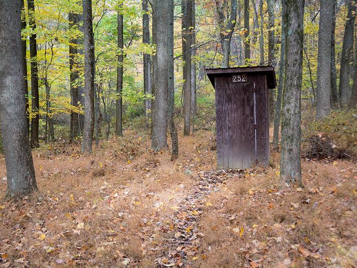
This is a rustic backcountry area with no vehicle access or potable water. There is one pit toilet shared between the two shelters. Campers must carry adequate drinking water and supplies and pack trash out at the conclusion of their stay. The two shelters are several hundred feet apart, making them close enough for groups to use both, but far enough away to offer privacy.
The sites are available year-round and can accommodate five campers. Tents or temporary structures are not permitted inside the shelters or surrounding area. Campfire rings are provided.
Need to Know
The Adirondack shelters are available year-round. Reservations may be made six months in advance. RESERVATIONS ARE REQUIRED.
Adirondack shelters are free, however an $8 reservation fee applies for web reservations or $10 for call center reservations.
Overnight vehicles must park in the Camp Round Meadow gravel lot.
A moderate 3-mile hike is required to reach the shelters.
Tents or temporary overnight structures are not permitted in the Adirondack shelters or surrounding area.
No pets or alcohol are permitted.
Shelter sites are not accessible by vehicle. All camping supplies, food and water must be carried in.
All waste must be removed from site upon departure.
No motorized vehicles or bicycles are permitted.
Dead/downed wood may be collected for campfires.
Firewood: The transportation of firewood into the park is not permitted. Dead/downed wood may be collected.
- Don't Move Firewood: Help protect our forests! Prevent the spread of tree-killing pests by obtaining firewood at or near your destination and burning it on-site. Moving firewood is illegal in some states. Visit dontmovefirewood.org to learn more.
Emergencies should be reported to the National Park Service, National Capital Area Communications Center at 866-677-6677 or 301-714-2235.
Natural Features
Located about 60 miles from Washington, DC and Baltimore, Maryland, Catoctin Mountain Park lies within the mountainous Blue Ridge Province of north-central Maryland. Scenic overlooks extend across the Monocacy Valley.
Nearby Attractions
Head to Wolf Rock for scenic vistas and thrilling rock climbing and rappelling. Or tour historic Camp Misty Mount, which is listed in the National Register of Historic Places.
Recreation
The shelters are for backcountry hikers looking for a remote getaway. Birdwatching, or birding is a popular form of wildlife observation.
Catoctin offers a 25-mile hiking trail system, fishing, picnic areas, and multiple camping options.
Contact Information
Default
Catoctin Mountain Park, 6602 Foxville Road Thurmont MD 21788
Phone Number
For campground inquiries, please call: 301-663-9388
Rental Options
Learn more about gear rental options for your trip
Driving Directions
GPS information is provided as verification of Shelter # 1, which is near Shelter #2. Users are asked to help protect park resources by using the trail system when accessing the shelters or other park features. Trail maps can be obtained at the park Visitor Center or downloaded from the Catoctin Mountain Park Website, www.nps.gov/cato. Hilly terrain and the forest canopy can prevent satellite signals from reaching your unit increasing the importance of a back-up strategy.
Take route 77 west 5 miles to Foxville Road, turn right and follow signs to Camp Round Meadow parking area.
Available Campsites
- Site 001, Loop Adirondack Shelters, Type Shelter Nonelectric
- Site 002, Loop Adirondack Shelters, Type Shelter Nonelectric