Benton Lake National Wildlife Refuge
Fish and Wildlife Service, Montana.
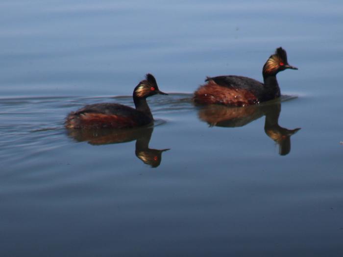
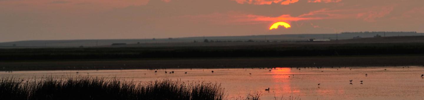
The gently rolling terrain of Benton Lake National Wildlife Refuge is dominated by native mixed-grass prairie and surrounded by mountain ranges on three sides: the Highwood Mountains to the east, the Big Belt Mountains to the south, and the Rocky Mountains to the west. The Refuge is located at the western edge of the famed Prairie Pothole Region (PPR), an area characterized by millions of wetlands or "potholes" which serve as the breeding ground for most of the Nation's waterfowl. These wetlands also harbor scores of other wetland-dependent wildlife, including many endangered species. The PPR is characterized by boom and bust cycles tied to precipitation and runoff.
The Refuge includes over 6,000 acres of wetland habitat. The once seasonally flooded wetland basin was transformed to a semi-permanent wetland basin in the early 1960's and is now returning to a seasonal basin with a variety of wetland flooding and drying regimes.
When the Refuge was established in 1929, the flooding of the wetland basin fluctuated with the amount of natural runoff received. This included large shifts in the duration and depth of flooding in the wetland basin from several hundred acres to over 6,000 acres. These shifts corresponded to the wet and dry cycle of the Northern Great Plains prairies.
Concern with the fluctuations in flooding and extended dry periods prompted members of the Cascade County Wildlife Association to secure Congressional funding to transform the marsh into a consistently wet environment. From 1958-1962, a pump station, pipeline, and multiple impoundments with water-control structures were constructed to bring irrigation return flow water from Muddy Creek about 15 miles west of the Refuge. This management regime was implemented with some modifications until 2012.
The consistent flooding regime resulted in unexpected consequences including: selenium toxicity, domination of single vegetative species, establishment and aggressive expansion of non-native vegetative species, and loss of production. The Service in cooperation with local interest groups and Montana Fish, Wildlife, and Parks recently developed an alternative management plan that will restore the wetland health and strive to provide reliable fall waterfowl hunting opportunity. More information about this management direction can be found in the Final Comprehensive Conservation Management Plan for the Benton Lake National Wildlife Refuge Complex.
The Refuge includes nearly 6,000 acres of intact, northern mixed-grass prairie.
Since sixty to ninety percent of the original native grasslands have been lost in the Prairie Pothole Region of Montana, preservation of native prairie is extremely important. Visitors to the Refuge can experience the vastness of the "big sky" and relatively undisturbed prairie landscapes. Native prairie areas are important to grassland-dependent species such as northern pintail, burrowing owl, chestnut-collared longspur, and Sprague's pipit as well as other species of concern. These wildlife species favor large expanses of native prairie and are negatively impacted by its development and conservation to agricultural uses. Large, intact native prairie communities can still be found throughout the Refuge Complex.
Nearby Activities
- Auto Touring
- Biking
- Boating
- Cross Country Skiing
- Fishing
- Hiking
- Hunting
- Photography
- Wildlife Viewing
Directions
To get to the Refuge, follow Highway 87 (Havre Highway) north out of Great Falls for about a mile and turn left onto Bootlegger Trail. Travel approximately 9 miles to well-marked Refuge entrance.