Mattamuskeet National Wildlife Refuge
Fish and Wildlife Service, North Carolina.
In the early 20th century, farmers and developers attempted to drain Lake Mattamuskeet, building what was at the time the world’s largest pumping plant. The lake was drained several times to convert the lake bottom to farmland. Eventually, the effort was abandoned as impractical and too expensive.
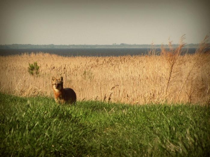
Mattamuskeet National Wildlife Refuge, located on the Albemarle-Pamlico Peninsula in Hyde County, North Carolina, was established in 1934. The refuge consists of 50,180 acres of open water, marsh, timber, and croplands. The refuge’s main feature is the shallow 40,000 acre Lake Mattamuskeet, the largest natural lake in North Carolina.
Lake Mattamuskeet, dotted with bald cypress trees, is 14 miles long and 5 miles wide and varies in depth from 0.5 to 4 feet, with an average depth of 1.5 feet. Dense beds of submerged aquatic vegetation desired by swan, diving ducks, and some puddle ducks are produced naturally. The lake level fluctuates with rainfall, wind tides, and evapo-transpiration.
A system of 15 man-made wetland impoundments, totaling nearly 2,505 acres, surround the south and east sides of the lake, providing feeding and resting areas for many species of migratory birds as well as resident wildlife. A farming area contributes another 125 acres of cropland and 275 acres of grassland to the diversity of habitat types on the refuge. Refuge forests consist of approximately 1,000 acres of loblolly pine, including the 153-acre Salyer’s Ridge Natural Area, and 2,000 acres of mixed hardwoods and bald cypress. These woodlands occur in narrow strips along the refuge boundary between the marsh and higher private lands.
The refuge’s strategic location along the Atlantic Flyway makes it a vitally important stopover for wintering waterfowl. Over the past 35 years, up to 80 percent of the northern pintail and up to 30 percent of green-winged teal that annually migrate along the Flyway utilize Mattamuskeet NWR. In total, the refuge attracts more than 200,000 ducks, geese and swans from November through February. About 58,000 visitors use the refuge annually to hunt, fish, and observe and photograph wildlife.
Nearby Activities
- Auto Touring
- Birding
- Boating
- Educational Programs
- Environmental Education
- Fishing
- Hiking
- Hunting
- Interpretive Programs
- Motor Boat
- Non-Motorized Boating
- Photography
- Wildlife Viewing
Directions
The refuge is located approximately 70 miles east of Washington, North Carolina. The headquarters entrance road is located off Highway 94, 1.5 miles north of U.S. 264 between Swan Quarter and Engelhard.
Detailed directions to the Mattamuskeet National Wildlife Refuge Visitor Center:
Driving south from Columbia, NC: Start out going south on S Broad St/Alligator River Route/NC-94 toward Branning St. Continue to follow Alligator River Route/NC-94. In 33.4 miles turn left onto Mattamuskeet Refuge Rd. In 1.39 miles, the Visitor Center is on the left.
Driving east from Belhaven, NC: Start out going northwest on W Main St/US-264 Bus W toward Quidley Ln. Take the 3rd right onto US Highway 264 Byp/Pamlico Scenic Byway/US-264 E. Continue to follow Pamlico Scenic Byway/US-264 E. In 33.57 miles turn left onto NC Highway 94/Alligator River Route/NC-94. In 1.5 miles turn right onto Mattamuskeet Refuge Rd. In 1.39 miles Visitor Center is on the left.
Driving west or north starting from Engelhard, NC: Start out going west on US Highway 264/Pamlico Scenic Byway/US-264 W toward Roper Ln. In 11.83 miles turn right onto New Holland Rd. New Holland Rd becomes Mattamuskeet Refuge Rd. Visitor Center is on the left.