Trempealeau National Wildlife Refuge
Overview
Trempealeau National Wildlife Refuge is managed by Fish and Wildlife Service and is located near Trempealeau, Wisconsin.
Trempealeau National Wildlife Refuge was established by Executive Order in 1936, by President Franklin D. Roosevelt as a refuge and breeding ground for migratory birds and other wildlife. The original refuge consisted of a 706.9 acre upland portion with open areas of former hay, pasture and croplands. An office and maintenance shop complex was constructed in 1936, along with temporary facilities for a Civilian Conservation Corps camp, which was located on refuge lands until the advent of World War II.
For more than 40 years, the refuge remained small, despite several attempts to purchase more than 5,000 acres of the surrounding Delta Fish and Fur Farm, Inc. In 1975, Dairyland Power Cooperative acquired the entire Delta Fish and Fur Farm. Dairyland wanted to construct a rail loop for a coal off-loading facility near their power generating plant at Alma, Wisconsin. The land they would need for constructing the loop was part of the Upper Mississippi River National Wildlife and Fish Refuge. As part of a land exchange, Dairyland divested about 120 acres of the Delta property and sold an additional 4,778 acres to the U.S. Fish and Wildlife Service in 1979. This addition, plus other recent acquisitions, has brought Trempealeau National Wildlife Refuge to its present size of 6,808 acres.
Today, the oak savannas of the midwest are considered by some to be the world’s most threatened communities. A savanna is generally defined as a plant community where trees are present but are sparse. The open nature of the oak savanna results in the establishment of numerous kinds of prairie plants, both grasses and forbs. Trempealeau National Wildlife Refuge has remnants of prairie-oak savanna habitats and management objectives support restoration efforts to maintain and establish additional oak savanna landscapes.
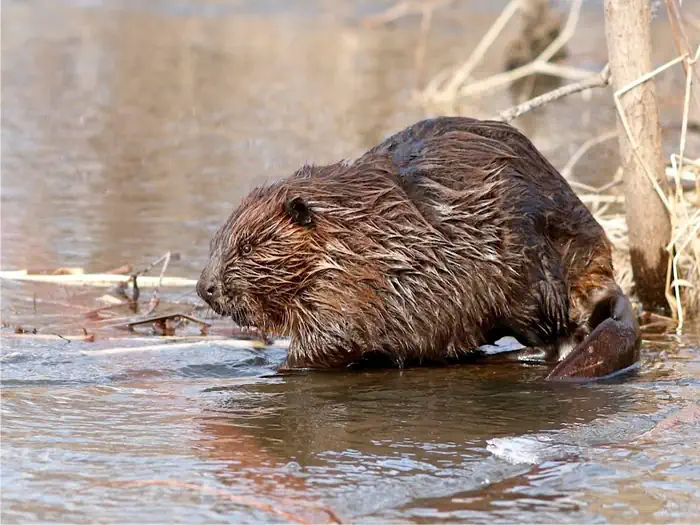
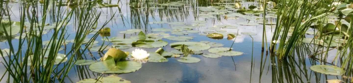
Marsh and aquatic vegetation occupies almost half of the refuge. Wetlands provide a multitude of ecological, economic and social benefits. They provide habitat for fish, wildlife and a variety of plants. Wetlands are also important landscape features because they hold and slowly release flood water and snow melt, recharge groundwater, act as filters to cleanse water of impurities, recycle nutrients and provide recreation and wildlife viewing opportunities for millions of people.
Bottomland hardwood forests cover about 16% of the refuge. Bottomland forests that are located along rivers are generally linear in shape. These linear corridors serve as pathways wildlife can use to move from one habitat patch to another. The dense vegetation of these forests provides cover to hide from predators and an escape from the sun during hot temperatures. Restoration of the forest habitat can make these areas more attractive to species like the red-shouldered hawk and cerulean warbler. Bottomland hardwood forests are rich, diverse ecosystems that benefit the environment, people and wildlife.
Things to Do at Trempealeau National Wildlife Refuge
Recreation Activities
Popular activities at Trempealeau National Wildlife Refuge include:
Nearby Activities
- Archery
- Auto Touring
- Biking
- Birding
- Boating
- Cross Country Skiing
- Fishing
- Hiking
- Hunting
- Interpretive Programs
- Non-Motorized Boating
- Photography
- Snowshoeing
- Wildlife Viewing
- Wood Cutting
Plan Your Visit
Getting There
From Winona, MN: Take Rt. 43 across the Mississippi River into Wisconsin. Turn right onto Rt. 54 east. Travel 5.7 miles, and take a right onto West Prairie Road. Refuge entrance is on the right after about one mile. From LaCrosse, WI: Take Rt. 53 north to Rt. 54 west. Follow 54 west to Centerville and continue 3.1 miles to West Prairie Road. Turn left on West Prairie Road and drive one mile to refuge entrance.
GPS Coordinates: 44.04494090000000, -91.53537600000000
Contact & Resources
Phone: 608-539-2311
Additional Information: