Argus Range Wilderness
Bureau of Land Management, California.
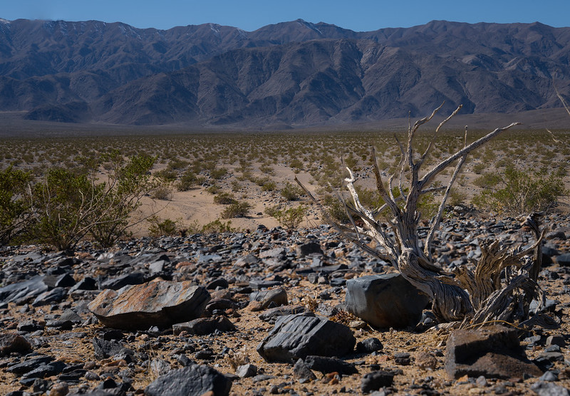
Nestling in the Argus Range, a thin and narrow north-south mountain chain, this Wilderness stretches for 28 miles along the west side of the Panamint Valley, just south and west of Death Valley National Park and just east of the China Lake Naval Weapons Center. Elevations here vary from about 2,800 feet on the east side to more than 7,500 feet on the west.
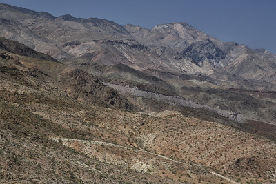
The Argus Range is comprised of dry desert mountains with steep slopes and highly dissected canyons. Remains of old mining activity and a few prehistoric sites are scattered throughout the Wilderness. You may find several springs supporting a small population of desert bighorn sheep. Vegetation dominated by creosote scrub communities on the lower slopes, with occasional piñon-juniper communities at higher elevations.
Trails are not maintained here, but you should find some relatively easy hiking up several canyons that open on the east side.
For more information about this wilderness, please visit Wilderness Connect.
Leave No Trace
How to follow the seven standard Leave No Trace principles differs in different parts of the country (desert vs. Rocky Mountains). For more information on any of the principles listed below, please visit Leave No Trace, Visit the Leave No Trace, Inc. website..
- Plan Ahead and Prepare
- Travel and Camp on Durable Surfaces
- Dispose of Waste Properly
- Leave What You Find
- Minimize Campfire Impacts
- Respect Wildlife
- Be Considerate of Other Visitors
Rules and Regulations
Motorized equipment and equipment used for mechanical transport are generally prohibited on all federal lands designated as wilderness. This includes the use of motor vehicles (including OHVs), motorboats, motorized equipment, bicycles, hang gliders, wagons, carts, portage wheels, and the landing of aircraft including helicopters, unless provided for in specific legislation. In a few areas some exceptions allowing the use of motorized equipment or mechanical transport are described in the special regulations in effect for a specific area. Contact the agency for more information about regulations.
Nearby Activities
- Camping
- Hiking
- Horseback Riding
- Hunting
- Photography
- Wilderness
- Wildlife Viewing
Directions
Access this wilderness via State Highways 190 or 178 to Panamint Valley Road through Panamint Valley. Numerous four wheel drive routes turn off Nadeau Trail providing access to canyons on the east side. On the south side, access is via Homewood Canyon off State Highway 178.