Kingston Range Wilderness
Bureau of Land Management, California.
Overview
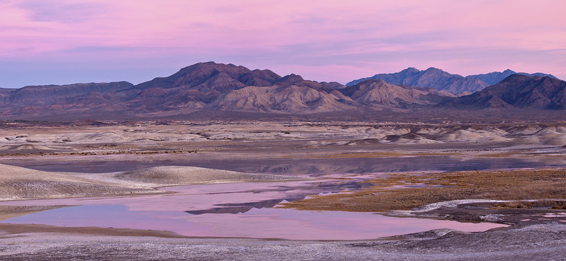
The Kingston Range Wilderness is divided into three units by non-wilderness corridors or 'cherrystems': Sperry Wash and Kingston Wash. The Amargosa Unit's (the northern unit) most striking feature is Amargosa Canyon, which contains a perennial stream. This perennial surface flow supports wetland habitats offering food, cover, and nesting opportunities for a wide variety of bird life. Those habitats also sustain fish, mammals, insects, and mollusks having low population numbers and/or very limited distributions.
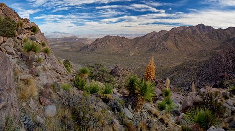
The Kingston Unit (center unit) covers seventeen miles of continuous ridgeline above 6,000 feet known as the Kingston Range. Elevations reach 7,323 at the top of Kingston Peak.
The Shadow Mountain Unit (southern unit) covers much of the Shadow Mountains, a large series of low-lying rounded peaks with gently meandering interior canyons and numerous erosion channels.
The wilderness is botanically one of the most diverse areas within the California Desert. Botanists have identified 505 native plant species and 32 are viewed as endangered, rare, or limited in distribution. Cresote bush scrub vegetation is found at lower elevations and juniper-pinyon woodland at higher elevations. The only stand of giant Nolina in the eastern Mojave Desert is found in Kingston Range, and a relic stand of white fir trees clings (one of only three stands found in the California Desert) to the slopes of two drainages just below Kingston Peak. Also located in the wilderness is a portion of the Shadow Valley-Cima Dome Joshua tree forest (one of the densest concentrations in the world).
The vegetation and perennial water support a variety of wildlife species which do not occur in nearby drier habitats. Bird densities are many times higher and contain higher species diversity. The Kingston Mountains are one of the four localities in California in which confirmed sightings of the banded gila monster have been made.
Other wildlife species include bighorn sheep, wild burros, coyote, black-tailed jackrabbits, ground squirrels, kangaroo rats, roadrunners, quail, rattlesnakes, tarantulas, and several species of lizards. The southeastern portion of the wilderness provides critical habitat for the threatened desert tortoise.
The wilderness area is an ecological transition zone between the Great Basin and Mojave Desert with numerous species of flora and fauna reaching their northern and southern most distribution limits.
For more information about this wilderness, please visit Wilderness Connect.
Leave No Trace
How to follow the seven standard Leave No Trace principles differs in different parts of the country (desert vs. Rocky Mountains). For more information on any of the principles listed below, please visit Leave No Trace, Visit the Leave No Trace, Inc. website..
- Plan Ahead and Prepare
- Travel and Camp on Durable Surfaces
- Dispose of Waste Properly
- Leave What You Find
- Minimize Campfire Impacts
- Respect Wildlife
- Be Considerate of Other Visitors
Rules and Regulations
Motorized equipment and equipment used for mechanical transport are generally prohibited on all federal lands designated as wilderness. This includes the use of motor vehicles (including OHVs), motorboats, motorized equipment, bicycles, hang gliders, wagons, carts, portage wheels, and the landing of aircraft including helicopters, unless provided for in specific legislation. In a few areas some exceptions allowing the use of motorized equipment or mechanical transport are described in the special regulations in effect for a specific area. Contact the agency for more information about regulations.
Nearby Activities
- Wilderness
Directions
Kingston Range Wilderness is approximately 15 miles northeast of Baker, California. Except for its northernmost tip (Inyo County), this wilderness is in northern San Bernardino County, California. It is located 8 miles north of I-15 and 9 miles east of Highway 127. Maps of the area can be obtained from the Bureau of Land Management Field Offices in Needles and Barstow, California.