Edwin B. Forsythe National Wildlife Refuge
Fish and Wildlife Service, New Jersey.
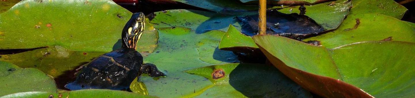
Edwin B. Forsythe Refuge was originally two distinct refuges: Brigantine and Barnegat. They were established in 1939 and 1967 respectively, to protect tidal wetland and shallow bay habitat for migratory water birds. In 1984 they were combined under the Edwin B. Forsythe name, in honor of the late conservationist Congressman from New Jersey. The refuge protects more than 48,000 acres of southern New Jersey coastal habitats which is actively managed for migratory birds. More than 82 percent of Forsythe refuge is wetlands, of which 78 percent is salt marsh, interspersed with shallow coves and bays. The refuge’s location in one of the Atlantic Flyway’s most active flight paths makes it an important link in seasonal bird migration. Its value for the protection of water birds and their habitat continues to increase as people develop the New Jersey shore for our own use.
The refuge lies on the indigenous homelands of the Lenni Lenape. Lenni Lenape Indians were the first people to enjoy the wealth of seafood available in New Jersey. Lenni Lenape means “true people” in the language of the Delaware Indians.
The Brigantine National Wilderness Area comprises 6,681 acres of pristine saltmarsh and barrier beach/sand dune habitats subdivided into the Holgate (barrier beach and sand dunes), Little Beach Island (barrier beach, sand dunes, maritime forest, and saltmarsh islands), and Motts-Mullica (saltmarsh) units. The United States Congress designated the Brigantine National Wilderness Area in 1975 to preserve refuge wetlands for the benefit of waterfowl, wading birds, shorebirds, beach-nesting birds and other wildlife. Both the Holgate and Little Beach Island units are two of the few remaining undeveloped barrier beaches in New Jersey in addition to being one of the most important nesting areas in the State for the piping plover listed as threatened under the U.S. Endangered Species Act.
The Wilderness also preserves the original site of one of the many life-saving stations found along the Atlantic coast before the creation of the Coast Guard. Station #120 was built on the edge of Pullen's Island (present day Little Beach) in the early 1870s.
In 1977, Congress acknowledged the uniqueness of the Brigantine Wilderness Area by naming it as a Class I air quality area. Congress charged the Service with the responsibility of protecting the air quality and air quality related values (AQRVs) of the area from manmade pollution.
For more information about Brigantine Wilderness, visit wilderness.net.
Nearby Activities
- Auto Touring
- Biking
- Birding
- Environmental Education
- Fishing
- Hiking
- Hunting
- Interpretive Programs
- Motor Boat
- Non-Motorized Boating
- Photography
- Picnicking
- Visitor Center
- Wildlife Viewing
Directions
Garden State Parkway Southbound
The refuge is easily accessed using Parkway Exit 48. You will exit onto US Route 9 South. The refuge entrance is at the 3rd traffic light (Great Creek Road). Turn left on Great Creek Road, which ends at the Refuge.
Garden State Parkway Northbound
Use Parkway Exit 41. This exit is for Pomona, Galloway, and Stockton University. At the bottom of the exit ramp, you will come to a traffic light. This is County Route 561 (Jimmie Leeds Road). Turn right onto Jimmie Leeds Road (Route 561 North). Follow Jimmie Leeds Road to the traffic light at US Route 9. (Jimmie Leeds Road ends at this intersection.) Turn left onto US Route 9 North. The next traffic light is at intersection of US Route 9 and Great Creek Road. Turn right onto Great Creek Road and follow it to the refuge entrance.
Atlantic City Expressway
The refuge is easily accessed using Atlantic City Expressway Exit 7N to the Garden State Parkway northbound. Follow the directions listed above for Garden State Parkway Northbound.
US Route 9
The refuge entrance is at the intersection of Great Creek Road and US Route 9. If you are traveling on US Route 30 (White Horse Pike) or US Route 40 (Black Horse Pike), turn left onto US Route 9 northbound. Follow US Route 9 to the traffic light at Great Creek Road. Turn right onto Great Creek Road and follow it to the refuge entrance.
The deCamp Wildlife Trail
From the Garden State Parkway, take Exit 90 for County Road 549. Merge onto Chambers Bridges Road, which will become Hooper Avenue for a total of two miles. Take the left fork onto Mantoloking Road and continue for 2.5 miles. The small parking lot is located at the intersection of Adamston and Mantoloking Roads in Brick Township.
Eno's Pond (joint trail with Ocean County Parks)
From the Garden State Parkway north or southbound, take Exit 74 toward Forked River. Take Lacey Road east for about four miles, crossing Route 9. The entrance will be almost at the end of the road, and on your left.
Barnegat Observation Platform
From the Garden State Parkway, take Exit 67 and go east on Bay Avenue. Follow Bay Avenue as it turns into Plank Road and then Bay Shore Drive. Follow Bay Shore Drive around until you see a small parking lot on your right.
Cedar Bonnet Island Trail
From the Garden State Parkway (north or south), take Exit 63 (Highway 72) east toward Long Beach Island. The entrance lot is approximately 3/4 of a mile before reaching Long Beach Island. The Cedar Bonnet Island trail can also be reached heading west on Highway 72, off Long Beach Island by turning left at the U-turn between the West Thorofare Bridges and main Causeway Bridge.
Holgate Wilderness Area (open Sept 1 - March 31)
From the Garden State Parkway (north or south): Take Exit 63 (Highway 72) east toward Long Beach Island. Once on the Island, take a right on Long Beach Boulevard. Follow all the way to the end where you will see a parking lot. During the off season, all 3.5 miles is open to walking and surf fishing vehicles with a permit (contact Long Beach Township at 609-361-1200 to obtain a beach buggy permit).
Graveling Point
From the Garden State Parkway north or southbound, take Exit 58 for Tuckerton. Take 539 south until it ends at Route 9. Turn right on Route 9 (south) for about a mile and then take a left on Radio Road. Follow Radio Road all the way to the end.
Scott's Landing
From the Garden State Parkway: Southbound, take Parkway Exit 48. You will exit onto US Route 9. Follow Route 9 several miles. Turn left on Moss Mill Road and follow it until it curves sharply to the left. Take the next right immediately after the curve and follow the road to the end. Northbound, use the Atlantic City Service Center's access ramp to Jimmie Leeds Road. Turn right on Jimmy Leeds Road. Go to the traffic light at US Route 9 and turn left (north). Drive past the first set of lights. Shortly, you will come upon a V in the road. Take the right fork which is Leed's Point Road. Take it to the T intersection, then turn right. Follow the sharp curve to the left, and take the next right immediately after the curve.