Recreation.gov
Find Your Next Adventure
We're here to help you dream up your next trip, figure out the details, and reserve experiences at over 3,600 facilities and 103,000 individual sites across the country. There's something for everyone on Recreation.gov, so get out there, experience the USA, and bring home a story!
Explore Destinations & Activities
Discover new experiences, historic landmarks, and outdoor escapes right down the road or across the country. From camping, hiking, and horseback riding to wildlife viewing, monument tours, and ranger-led activities – you can find it on Recreation.gov!
Explore By State
Alabama Alaska Arizona Arkansas California Colorado Connecticut Delaware Florida Georgia Hawaii Idaho Illinois Indiana Iowa Kansas Kentucky Louisiana Maine Maryland Massachusetts Michigan Minnesota Mississippi Missouri Montana Nebraska Nevada New Hampshire New Jersey New Mexico New York North Carolina North Dakota Ohio Oklahoma Oregon Pennsylvania Rhode Island South Carolina South Dakota Tennessee Texas Utah Vermont Virginia Washington West Virginia Wisconsin WyomingExplore Most Popular Locations
Acadia National Park Alabama River Lakes Allatoona Lake Allegheny National Forest Apache-Sitgreaves National Forest Arapaho & Roosevelt National Forests Pawnee National Grasslands Arches National Park Arkansas River - Murray Lock and Dam Ashley National Forest Assateague Island National Seashore Barren River Lake Beaver Lake Belton Lake Big Bend National Park Bighorn National Forest Bitterroot National Forest Black Hills National Forest Blue Ridge Parkway Boise National Forest Bryce Canyon National Park Canyon Lake Cape Hatteras National Seashore Capitol Reef National Park Caribou-Targhee National Forest Carlyle Lake Cherokee National Forest Chugach National Forest Clearwater Lake Cleveland National Forest Coconino National Forest Recreation Columbia River Gorge National Scenic Area Coralville Lake Cordell Hull Lake Custer Gallatin National Forest Custer National Forest Dale Hollow Lake Daniel Boone National Forest Degray Lake Denali National Park & Preserve Deschutes National Forest Dinosaur National Monument Dixie National Forest Eldorado National Forest El Yunque National Forest Eufaula Lake Flathead National Forest Georgetown Lake George Washington & Jefferson National Forest Gifford Pinchot National Forest Glacier National Park Grand Canyon National Park Grand Mesa, Uncompahgre and Gunnison National Forest Great Sand Dunes National Park & Preserve Great Smoky Mountains National Park Greers Ferry Lake Gulf Islands National Seashore Haleakalā National Park Harry S. Truman Lake Hartwell Lake Hiawatha National Forest Humboldt-Toiyabe National Forest Headquarters Huron-Manistee National Forests Idaho Panhandle National Forests Inyo National Forest John H. Kerr Dam and Reservoir Joshua Tree National Park J Percy Priest Lake J. Strom Thurmond Lake Kaibab National Forest Lake Cumberland Lake O' The Pines Lake Red Rock Lake Shelbyville Lake Sidney Lanier Lake Tahoe Basin Management Unit Lake Texoma Lassen Volcanic National Park Los Padres National Forest Lower Deschutes Wild and Scenic River Mammoth Cave National Park Manti-La Sal National Forest Mark Twain Lake Melvern Lake Mississippi River - Pools 11-22 Mount Rainier National Park Mount Rushmore National Memorial Mt. Baker-Snoqualmie National Forest Mt. Hood National Forest National Forests in Florida National Forests in North Carolina National Mall and Memorial Parks New Melones Lake Nolin River Lake Norfork Lake North Cascades National Park Okanogan-Wenatchee National Forest Olympic National Park Ouachita Lake Paria Canyon-Vermilion Cliffs Wilderness (The Wave) Pearl Harbor National Memorial Pictured Rocks National Lakeshore Pinnacles National Park Plumas National Forest Point Reyes National Seashore Pomme De Terre Lake Prescott National Forest PSICC Raystown Lake Rend Lake Rocky Mountain National Park Rogue River-Siskiyou National Forest Rough River Lake Salmon-Challis National Forest Sam Rayburn Reservoir San Bernardino National Forest San Juan National Forest San Juan River Sawtooth National Forest Saylorville Lake Sequoia & Kings Canyon National Parks Sequoia National Forest Shasta-Trinity National Forest Shenandoah National Park Sierra National Forest Siuslaw National Forest Sleeping Bear Dunes National Lakeshore Stanislaus National Forest Stockton Lake Superior National Forest Table Rock Lake Tahoe National Forest Tenkiller Ferry Lake Tennessee-Tombigbee Waterway Tonto National Forest Uinta-Wasatch-Cache National Forest Umpqua National Forest Voyageurs National Park Waco Lake Wallowa Whitman National Forest Walter F. George Lake Wappapello Lake West Point Lake White Mountain National Forest White River National Forest Whitney Lake Willamette National Forest W. Kerr Scott Dam & Reservoir Wright Patman Lake Yosemite National Park Zion National ParkPlan for Your Trip
Access tools and resources to chart the course for your next getaway or dream vacation, manage your trip details, and enter for the chance to attend special events and excursions that ensure you get the most out of your Recreation.gov experience.
Camping & Day Use
Return to your favorite camping spot or discover a new one that’s right for you.
Interagency & Site Passes
Cover admission and / or amenity fees for federal lands, waterways, and monuments with annual or lifetime interagency passes that provide access to more than 2,000 federal recreation locations or site passes for multiple visits to your favorite spot.
Find Tours & Tickets
Reserve tours and tickets to participate in special events and experiences.
Christmas Tree Permits
National Forests across the country are now offering permits to cut down a Christmas Tree through Recreation.gov. Buy your permit online before you arrive, gather your family and friends, and create memories that help you #BringHomeaStory this holiday season!
Learn More about Christmas Tree Permits
Rent Gear and a Ride
Planning a trip with Recreation.gov is even easier with rental options. Whether it's an RV to hit the road or outdoor gear like tents, packs, and sleeping bags, enjoy the convenience of renting equipment for your next trip.
Find Inspiration & Information
Our library of travel guides, tips and recommendations, insider insights, and visitor stories provides inspiration and information to help you plan your next adventure.
What’s New on Recreation.gov
We’re always adding new locations and activities to help you get outdoors, and bring home a story!
-
Enchantment Permit Area Daily Lottery
Okanogan-Wenatchee National Forest
Near Leavenworth, Washington
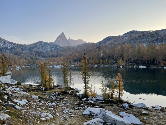
There are two options to get an overnight Enchantment Area permit: 1. Enchantment Permit Area Daily Lottery; apply on this webpage using your mobile device. You must be in the geofence area to apply. 2. Enchantment Permit Area (Advanced Lottery) ; offered annually in February The Enchantmen...
View all of the new locations on Recreation.gov
Stay in the Know
Check here for the latest updates and access to Recreation.gov news, events, and contests.