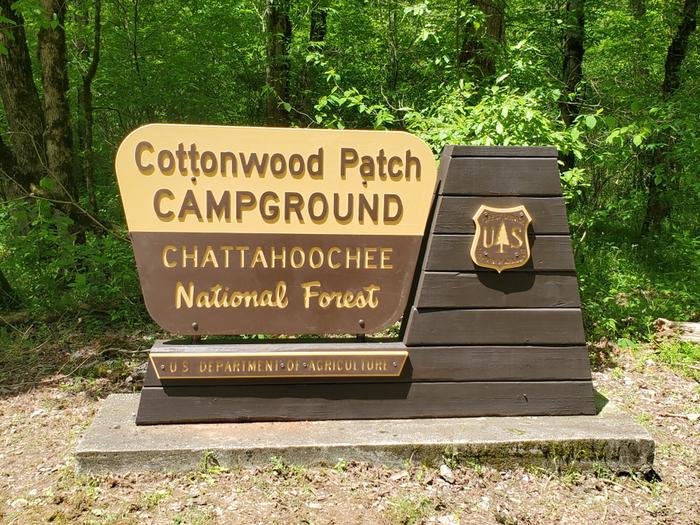
Cottonwood Patch Campground
Chattahoochee-Oconee National Forest
Cottonwood Patch Campground is a multi-use campground focused primarily on equestrian camping, but welcomes traditional "car" camping. The campground is located within the Chattahoochee-Oconee National Forest in the Alaculsy Valley of the Cohutta Mountains in north Georgia. Cottonwood Patch Campground is a quaint campground found along the Conasauga River, just above its junction with the Jacks River. Mixed hardwood forest surrounds the campground. The campground is partially shaded most of the summer with planted cottonwoods and sawtooth oaks. Average daytime summer temperatures are in the mid-80s with average daytime winter temperatures in the 50s.
In the late 1800s into the 1930s, Alaculsy Valley was a thriving community. The valley contained homes, farms, a church, a post office, a grist mill, a school, cemeteries, and possibly a furnace for smelting iron. Across the Jacks River, in Tennessee, were other similar communities, a Civilian Conservation Corps work camp, and the location of the original U.S. Forest Service facility that managed the area. Some of the most development in the area was during the logging boom of the early 1900s. This area was the main hub for logging operations in the Cohutta Mountains. Train tracks followed the Conasauga and Jacks Rivers deep into the mountains. Lumbermen in logging camps far back in the mountains would cut timber and have it loaded onto flat cars. These loaded railroad cars would be pulled by the powerful Shay locomotives owned by the Conasauga River Lumber Company to its mill in Conasauga, Tennessee. Once an area was logged, the camp buildings would be loaded up onto the flat cars by small steam cranes and unloaded at the next area prepared for a camp. The Conasauga Trail in Tennessee follows the old railroad bed downstream and the Jacks River Trail in Georgia follows the old railroad bed upstream into the Cohutta Wilderness.
Looking at the area today, one would never know such development once existed. The U.S. Forest Service, along with partnerships with other agencies and organizations, work together to manage the National Forest lands.
Recreation activities around the Cottonwood Patch Campground include camping, picnicking, hiking, hunting, fishing, and horseback riding (visitors must provide their own horses). Hunting and fishing regulations are set by the Georgia Department of Natural Resources.
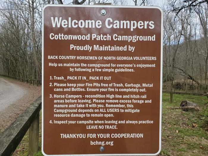
This campground and its facilities are maintained by dedicated volunteers of the Back Country Horsemen of North Georgia (BCHNG) with the support of the U.S. Forest Service. Please help this campground stay clean by cleaning up after yourselves and your horses.
For more information about the Back Country Horsemen of North Georgia, or volunteer information at this campground, visit the link: Back Country Horsemen of North Georgia
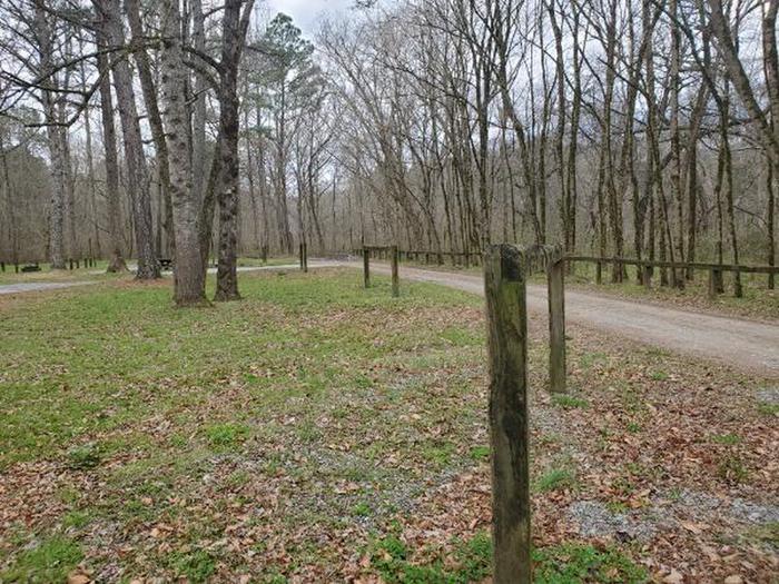
This campground is gated and a combination is needed for access. This combination will be given upon making a reservation. Do Not Share this combination with anybody outside of your party. Please keep the farm gate closed and locked at all times.
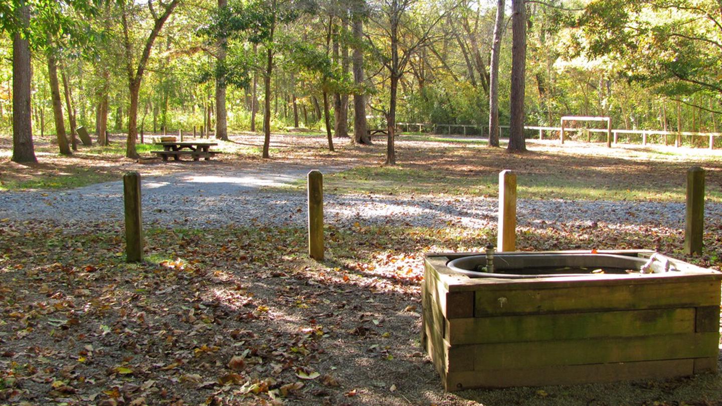
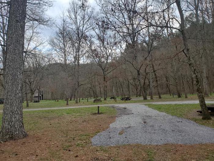
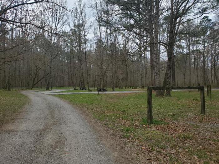
Cottonwood Patch Campground is an eight (8) site campground with one main loop. The campground is flat and open, with large trees scattered throughout. Sites are designated by a unit number at their entrance.
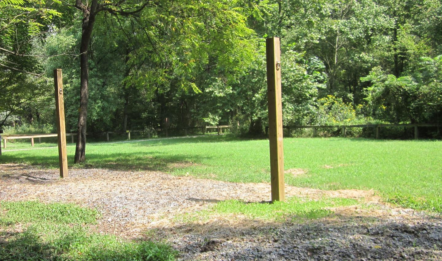
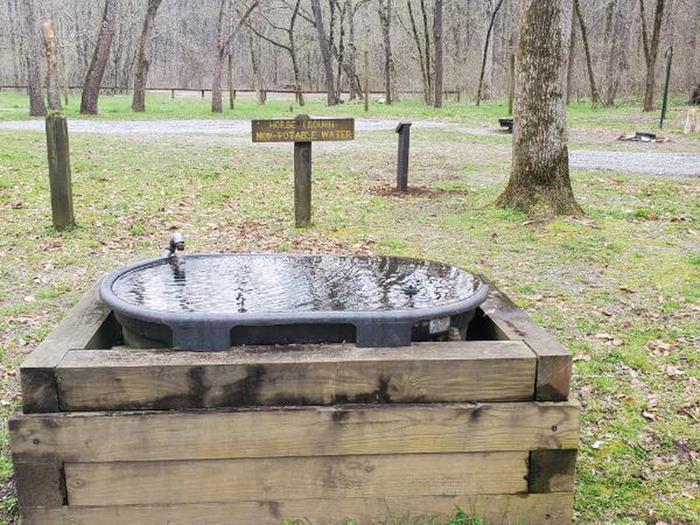
Each campsite has a graveled trailer parking spur, picnic table, fire ring, and lantern post. Hitching rails and high line posts are located along the perimeter of the campground. Two horse watering troughs are located in the campground. Cold water is piped from a nearby stream to keep fresh water flowing through the troughs. This water is not meant for human consumption.
Visitors must bring their own drinking water. There is no potable water located at this campground.
Campsites vary in size. There are three (3) sites that can accommodate two (2) horse trailers with two trucks and five (5) sites that can accommodate a single truck and trailer. Please respect the occupancy limits of the campsites and park on the gravel parking spurs, these limits are set to help protect the resource from damage and to provide access for future generations. Extra vehicles are more than welcome to park in the parking lot adjacent to the campground.
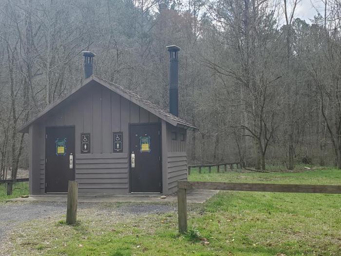
A free Day Use and Trailhead Parking Area is located just before entering the campground and a free single unit picnic site is located across from the vault toilet for day users.
Cell phone service is unreliable in this area.
Need to Know
Curves, steepness, bridges, and other road features limit the length and type of equipment that can be safely maneuvered on Forest Service Roads.
Coming from Georgia: Horse trailers, 5th wheel trailers, and RVs more than 25 ft in length are not recommended.
Coming from Tennessee: trailers over 16 ft in length are not recommended.
This campground is subject to flooding when large amounts of rain occurs in a short period of time. For public saftey, there are times the U.S. Forest Service may administratively close this campground and cancel reservations during a weather event. You will be notified of reservation options via email if this occurs.
This is a gated campground and can only be accessed by a combination. Do Not Share the combination with anybody outside of your party. Please keep the farm gate locked and closed at all times.
Campsite Sizes: Campsites 2,4, and 6 are double sites. A double site means that two horse trailers and two tow vehicles can fit in that sites. Campsites 1,3,5,7, and 8 are single sites. A single site means that one horse trailer, a tow vehicle, and a second vehicle can fit in that site.
Check-Out time: 2:00 pm
Check-In time: 3:00 pm
Your reservation confirmation will show the Arrival date and the Departure date for your reservation. These dates will be used in case of reservation disputes at this recreation site. Please have your confirmation available upon request.
Bring your own equipment and supplies. The nearest gas station and store is 12 miles away in Crandall, GA.
Be Bear Aware: Store food and trash properly. Never leave food/trash out on tables or in the open. Store unattended food/trash in bear-resistant containers, in a vehicle in solid non-pliable material, or suspend food/trash at least ten feet off the ground. Remember to use the bear resistant trash receptacles provided at this facility. (36 CFR 261.58cc)
14-Day Forest Stay Limit: Camping or maintaining a campsite in developed and dispersed areas in excess of 14
days within any 30-day time period. After the camper(s) has accumulated 14 days
within any 30-day time period, the camper(s) must leave that area/campground and
move from Chattahoochee-Oconee National Forest land before returning for
another stay. (36 CFR Section 261.58a)
Fireworks and other Pyrotechnics are Prohibited. (36 CFR 261.52f)
On all National Forest property, it is prohibited to cut live vegetation or any standing tree whether dead or alive. Firewood may be collected from the forest for use while camping. Only collect wood that is dead and down. Dead trees play an important role as homes for wildlife and insects. (36 CFR 261.6a)
Pets must be leashed at all times (36 CFR 261.16J)
For all Chattahoochee-Oconee National Forest Rules, Regulations, and Forest Supervisor's Orders please visit: Chattahoochee-Oconee National Forest Rules, Regulations, and Forest Supervisor's Order
Natural Features
Cottonwood Patch Campground is located in the Georgia mountains near the Tennessee/Georgia state line. It is surrounded by thousands of acres of national forest, free flowing mountain rivers, and babbling streams. It is located along the Conasauga River and near the border of the the Cohutta Wilderness.
The Conasauga River watershed is one of the most ecologically diverse watersheds in the United States. This watershed contains 76 species of fish, more than the entire Columbia and Colorado Watersheds combined. Rare crayfish, mollusks, and even the Federally Endangered Blue Shiner are found in the Conasauga River. The U.S. Forest Service along with conservation partners annually place spawning logs in the river to provide habitat for Blue Shiners.
Adjacent to Cottonwood Patch Campground is the 45,000 acre Cohutta/Big Frog Wilderness (the largest Federally Designated Wilderness Area east of the Mississippi River). The Cohutta Wilderness contains 91 miles of arduous backpacking trails. The 1964 Wilderness Act requires Federally established Wilderness Areas to maintain a wild character about them. Wilderness trails are maintained by volunteers, Forestry Technicians, and partner organizations. Directed by the Wilderness Act, trails are cleared using traditional hand tools, such as crosscut saws and sling blades. The use of gas powered and mechanized equipment is prohibited, even for forest managers in the Cohutta Wilderness. These trails are minimally managed and minimally marked, keeping with Wilderness character. These trails are not meant for simple strolls through the forest. Trails are frequently blocked by trees and undergrowth, making them difficult to follow at times. Orienteering skills using terrain features, map, and compass are extremely important and essential in the Cohutta Wilderness, as GPS is unreliable and not recommended.
An array of colorful wildflowers can be found throughout spring and summer months. In spring, the beautiful purple/blue flowers of Virginia Bluebells can be found in large colonies along the Conasauga River. Numerous trilliums carpet the forest floor. Wild Geraniums, Blood Root, Mayapple and many other wildflowers provide flashes of color to the the new spring forest. Summer gives way to asters, rhododendron, and other flowers, providing a splash of color until the changing leaves provide the color in fall. Please only look at wildflowers, do not pick them.
Nearby Attractions
Conasauga River Blue Hole:
The Conasauga River has an array of colorful and unique fish species. The best way to see them is to get in the water with them. The Cherokee National Forest in Tennessee maintains a small picnic area and snorkeling area located 1.5 miles north of Cottonwood Patch Campground in Tennessee. Visitors can either snorkel on their own (provide your own equipment) or take a guided tour with the Cherokee National Forest. For guided tours and more infomation visit the Cherokee National Forest at the following link. Conasauga River Blue Hole
Directions: Turn left out of the campground onto Forest Service Road 16. Follow FSR 16 for 3/4 mile. Cross the metal Jacks River Bridge and turn left onto Sheeds Creek Road. Follow Sheeds Creek road 3/4 mile until reaching the entrance to the Conasauga River Blue Hole parking lot on the left.
Sumac Creek Shooting Range (Digital Fee Area, see Recreation.gov page): A U.S. Forest Service shooting range provided to hone your shooting skills. You must provide your own firearm, ammunition, and targets. For more information visit: Sumac Creek Shooting Range
Directions: Leaving the campground, turn right onto Forest Road 16. Follow this road for approximately 7 miles. The entrance to the shooting range is on the left where gravel road turns back into pavement.
Recreation
The Cottonwood Patch Campground not only serves as a place to rest and relax by the campfire, but it serves as a base camp for activities located throughout the National Forest, such as hiking, horseback riding, hunting, fishing, and birdwatching.
Cottonwood Patch Campground is a popular area for equestrian users. The start of the Iron Mountain trail is located in the campground. The County Line Trail is located across the road from the campground. These trails can be used by both horse riders and hikers. Horses are permitted on numbered Forest Service Roads that are both open to traffic and gated. Please be aware and mindful of vehicular traffic on Forest Service Roads.
Hunting is also a popular activity near the Cottonwood Patch Campground area. The 96,583 acre Cohutta Wildlife Management Area (WMA) is a cooperatively managed area within the boundaries of the Chattahoochee National Forest. The U.S. Forest Service and Georgia Department of Natural Resources work together to provide hunters opportunities to harvest bear, deer, wild hog, and various species of small game. The Georgia DNR maintains the majority of wildlife openings/food plots, conduct wildlife surveys, and set the hunting regulations. The U.S. Forest Service manages the receation facilities, roads, vegetation, fire, vegetation, and general forest. When hiking or riding horses during hunting seasons, wear blaze orange and be aware that hunters are out legally participating in their version of recreational activities.
Amateur naturalists can have a great time seeking out non-game species, such as birds, small mammals, amphibians, and reptiles, along with hundreds of species of plants to check off their life lists.
Contact Information
Phone Number
For campground inquiries, please call: 706-695-6736
Rental Options
Learn more about gear rental options for your trip
Driving Directions
From US Highway 411, turn east onto Old Highway 2 in Cisco, Ga.
Follow Old Highway 2 for approximately 7 miles, upon crossing the Conasauga River the road turns into Forest Service Road 16
Approximately 1 miles, turn left onto Forest Service Road 16A
Available Campsites
- Site 6, Loop main, Type Standard Nonelectric
- Site 7, Loop main, Type Standard Nonelectric
- Site 4, Loop main, Type Standard Nonelectric
- Site 5, Loop main, Type Standard Nonelectric
- Site 2, Loop main, Type Standard Nonelectric
- Site 3, Loop main, Type Standard Nonelectric
- Site 8, Loop main, Type Standard Nonelectric
- Site 1, Loop main, Type Standard Nonelectric