Steel Creek Campground
Steel Creek Campground
Part of Buffalo National River
Overview
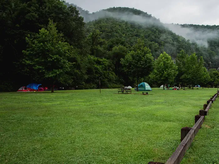
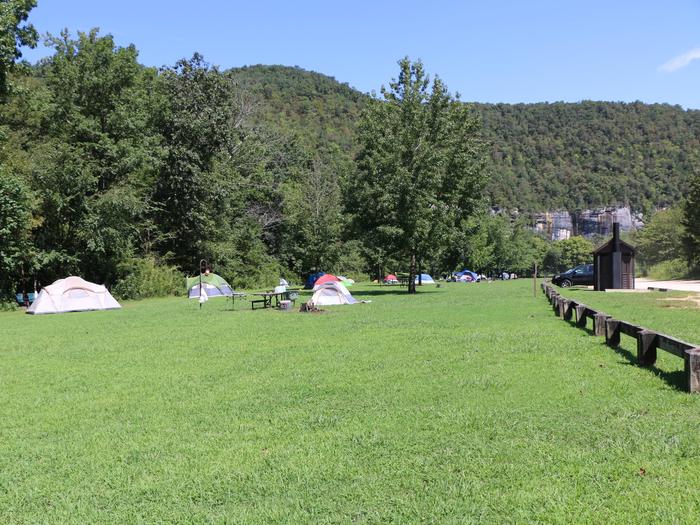
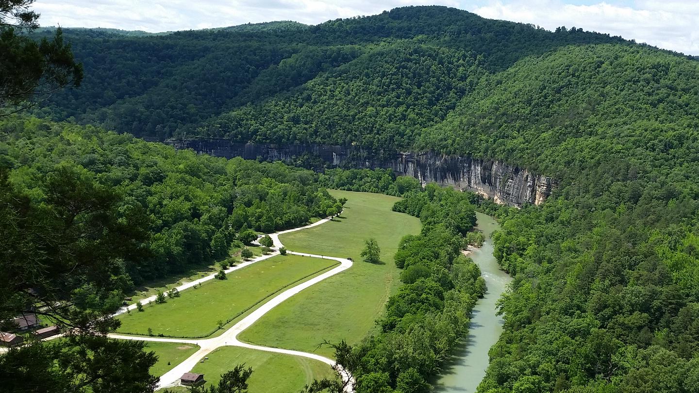
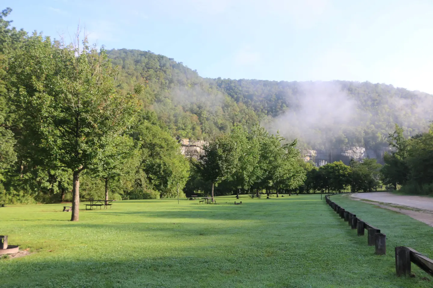
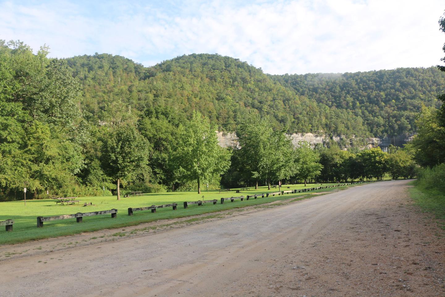
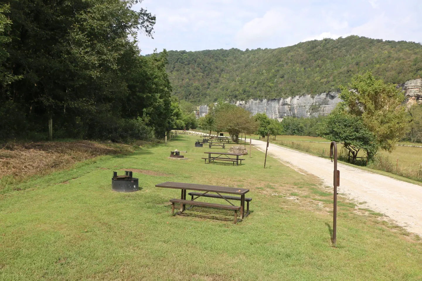
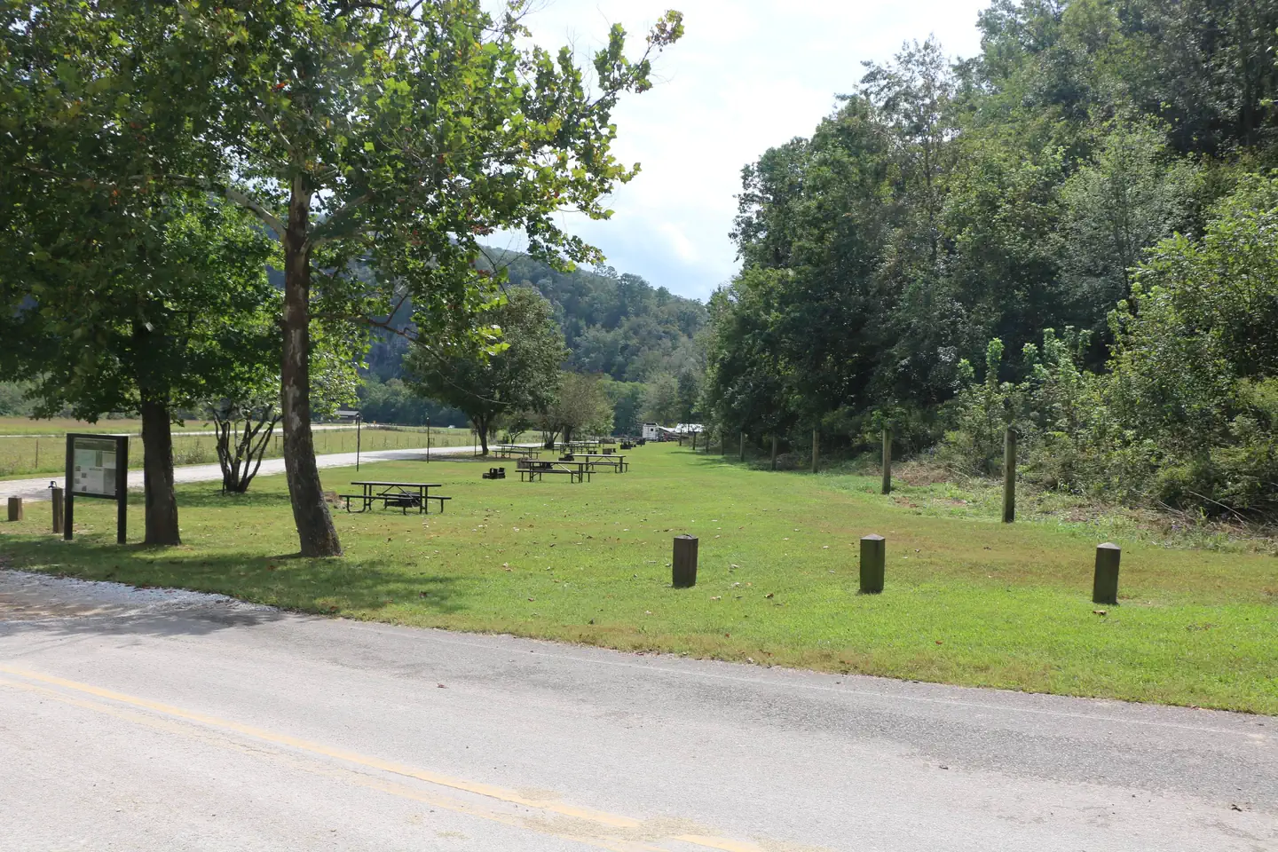
Steel Creek Campground is situated along the Buffalo River under the towering and picturesque Roark Bluff. One section of the campground offers 26 walk-in tent sites and another section of the campground offers 13 sites for those camping with horses. All sites are available by reservation only. Steel Creek is located about 3 miles (5 km) east of Ponca, just off Highway 74.
Facilities
Steel Creek has 26 tent only sites and 13 sites for campers with horses/stock animals (six people and four stock animals allowed per site). All sites are available by reservations only. There are no electrical amenities or water hookups, but flush restrooms and water spigots are available from approximately March 15 through November 15 each year.
Natural Features
The Buffalo National River flows free over swift running rapids and quiet pools for its 135-mile (217 km) length. One of the few remaining rivers in the lower 48 states without dams, the Buffalo cuts its way through massive limestone bluffs traveling eastward through the Arkansas Ozarks and into the White River.
Recreation
Paddling conditions in the upper (westernmost) district of Buffalo National River are extremely dependent upon rainfall. On an average year, the upper river is only navigable by boat in the spring and early summer when consistent rainfall feeds into the watershed. Some sections on the upper end of the river are technical and should not be attempted by novices. For current paddling conditions, please check with an outfitter (visit our Guided Services web page ), call the Tyler Bend Visitor Center at 870-439-2502, or check the Buffalo National River Float Guide Dashboard
Nearby Attractions
The Buffalo River Trail runs through Steel Creek and offers great day hiking or overnight backcountry opportunities.
Boxley Valley is nearby and is home to Lost Valley, an easy to moderate trail that leads hikers past geologic and water formations. Visit the park's Hiking Trails web page for more information..
Contact Info
For facility specific information, please call (870) 439-2502.Important Notices
All sites at Steel Creek are available by reservation only.
Sites 27 - 39 are equestrian camping sites only for campers with horses.
The facility is available for camping free of charge outside of the reservation season, generally November 15th to March 15th every year.
Climbing and/or diving from the bluffs is dangerous and highly discouraged.
Don't Move Firewood: Help protect our forests! Prevent the spread of tree-killing pests by obtaining firewood at or near your destination and burning it on-site. Moving firewood is illegal in some states.
All park trails are closed to pets with the exception of the Buffalo River Trail, only on the section of trail between Ponca and Steel Creek, the Villines Homestead Trail at Ponca, the Mill Creek Trail (trailhead is at the Pruitt river access area in the Upper District), the Tyler Bend Campground trails (Spring Hollow, Buck Ridge, and Rock Wall in the Middle District), and all three Buffalo Point Campground trails (Forest Trail, Overlook Trail, and Campground Trail in the Lower District). For more information visit the Pets page on the park website.
Do not swim alone during high water.
Please be aware that some special events held at the pavilions or anywhere in the park (such as weddings, press receptions, concerts, et al) require a Special Use Permit in addition to the pavilion reservation. To obtain a Special Use Permit or additional information, please contact the Commercial Services office at (870) 365-2724. For more information visit the Special Park Uses page on the park website.
Please be advised that providing business services within an NPS unit is prohibited per CFR 5.3 without a written Authorization or Permit approved by the Superintendent. This includes services such as RV or tent delivery & set-up, firewood sales and delivery, shuttle (transportation) services, and guided hikes, floats, etc. For a list of approved visitor services and to learn more about working with Buffalo National River, please visit the Doing Business with the Park page on the park website.
Available Activities
- Canoeing - Canoeing
- Camping - Camping
- Fishing - Fishing
- Historic & Cultural Site - Historic & Cultural Site
- Horse Camping - Horse Camping
- Hiking - Hiking
- Horseback Riding - Horseback Riding
- Kayaking - Kayaking
- Ranger Station - Ranger Station
- Picnicking - Picnicking
- Swimming - Swimming
- Star Gazing - Star Gazing
Directions
<p><strong>From Fayetteville, Arkansas</strong> drive north and take US Highway 412 East for approximately 42 miles (67.5 km) to the intersection with State Highway 21. Take highway 21 South for approximately 17 miles (27 km) to the intersection of State Highway 43. Here, take highway 43 East for about 5 miles (8 km) to the intersection of State Highway 74. Here, turn right onto highway 74 and drive about 2 miles (3.2 km) to Steel Creek Road. Turn left and drive approximately .5 miles (.8 km) down into the campground. At the bottom of the hill the main campground will be to your left and the horse camp will be to your right. </p> <p><strong>From Little Rock, Arkansas</strong> take Interstate 40 West for approximately 93 miles (150 km) to Exit 64. At Exit 64 take Business Highway 64 west through the town of Lamar for about 4 miles (6.5 km) to the intersection of State Highway 21. Take Highway North for about 48 miles (77 km) to the intersection of State Highway 43. Here, take highway 43 East for about 5 miles (8 km) to the intersection of State Highway 74. Here, turn right onto highway 74 and drive about 2 miles (3.2 km) to Steel Creek Road. Turn left and drive approximately .5 miles (.8 km) down into the campground. At the bottom of the hill the main campground will be your left and the horse camp will be on your right. </p> <p><strong>From Springfield, Missouri</strong> take US Highway 65 South for approximately 70 miles (112.6 km) to the town of Harrison. In Harrison, take State Highway 7 South about 1 mile (1.6 km) through downtown Harrison until you come to the intersection of State Highway 43 on your right. Follow highway 43 for about 25 miles (40 km) until to get to the intersection of State Highway 74. Turn left onto highway 74 and drive about 2 miles (3.2 km) to Steel Creek Road. Turn left and drive approximately .5 miles (.8 km) down into the campground. At the bottom of the hill the main campground will be your left and the horse camp will be on your right. </p>
Cancellation Policy
<p><a href="https://www.recreation.gov/rules-reservation-policies" rel="nofollow">rules and reservation policies</a> </p>
Contact Information
Phone: 870-861-2570
386 NC 2104Jasper, AR 72641
Rental Options
Available Campsites
- Site 18 - Tent Site, Loop Main Loop, Type Tent Only Nonelectric
- Site 12 - Tent Site, Loop Main Loop, Type Tent Only Nonelectric
- Site 07 - Tent Site, Loop Main Loop, Type Tent Only Nonelectric
- Site 26 - Tent Site, Loop Main Loop, Type Tent Only Nonelectric
- Site 04 - Tent Site, Loop Main Loop, Type Tent Only Nonelectric
- Site 11 - Tent Site, Loop Main Loop, Type Tent Only Nonelectric
- Site 05 - Tent Site, Loop Main Loop, Type Tent Only Nonelectric
- Site 31 - Horse Site, Loop Horse Camp, Type Equestrian Nonelectric
- Site 15 - Tent Site, Loop Main Loop, Type Tent Only Nonelectric
- Site 08 - Tent Site, Loop Main Loop, Type Tent Only Nonelectric
- Site 36 - Horse Site, Loop Horse Camp, Type Equestrian Nonelectric
- Site 37 - Horse Site, Loop Horse Camp, Type Equestrian Nonelectric
- Site 23 - Tent Site, Loop Main Loop, Type Tent Only Nonelectric
- Site 34 - Horse Site, Loop Horse Camp, Type Equestrian Nonelectric
- Site 19 - Tent Site, Loop Main Loop, Type Tent Only Nonelectric
- Site 25 - Tent Site, Loop Main Loop, Type Tent Only Nonelectric
- Site 14 - Tent Site, Loop Main Loop, Type Tent Only Nonelectric
- Site 06 - Tent Site, Loop Main Loop, Type Tent Only Nonelectric
- Site 20 - Tent Site, Loop Main Loop, Type Tent Only Nonelectric
- Site 28 - Horse Site, Loop Horse Camp, Type Equestrian Nonelectric
- Site 35 - Horse Site, Loop Horse Camp, Type Equestrian Nonelectric
- Site 01 - Tent Site, Loop Main Loop, Type Tent Only Nonelectric
- Site 02 - Tent Site, Loop Main Loop, Type Tent Only Nonelectric
- Site 22 - Tent Site, Loop Main Loop, Type Tent Only Nonelectric
- Site 10 - Tent Site, Loop Main Loop, Type Tent Only Nonelectric
- Site 39 - Horse Site, Loop Horse Camp, Type Equestrian Nonelectric
- Site 30 - Horse Site, Loop Horse Camp, Type Equestrian Nonelectric
- Site 17 - Tent Site, Loop Main Loop, Type Tent Only Nonelectric
- Site 33 - Horse Site, Loop Horse Camp, Type Equestrian Nonelectric
- Site 27 - Horse Site, Loop Horse Camp, Type Equestrian Nonelectric
- Site 09 - Tent Site, Loop Main Loop, Type Tent Only Nonelectric
- Site 32 - Horse Site, Loop Horse Camp, Type Equestrian Nonelectric
- Site 29 - Horse Site, Loop Horse Camp, Type Equestrian Nonelectric
- Site 16 - Tent Site, Loop Main Loop, Type Tent Only Nonelectric
- Site 03 - Tent Site, Loop Main Loop, Type Tent Only Nonelectric
- Site 24 - Tent Site, Loop Main Loop, Type Tent Only Nonelectric
- Site 13 - Tent Site, Loop Main Loop, Type Tent Only Nonelectric
- Site 38 - Horse Site, Loop Horse Camp, Type Equestrian Nonelectric
- Site 21 - Tent Site, Loop Main Loop, Type Tent Only Nonelectric