Lake Ottawa Campground
Lake Ottawa Campground
Part of Ottawa National Forest
Overview
Planning a trip to the Lake Ottawa Campground? Watch for Alerts at the top of the page for any Alerts regarding this facility.
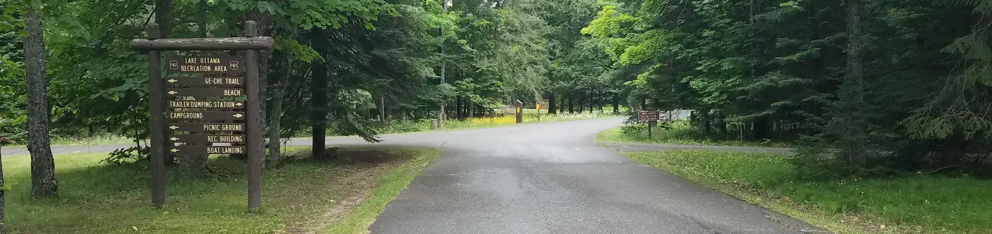
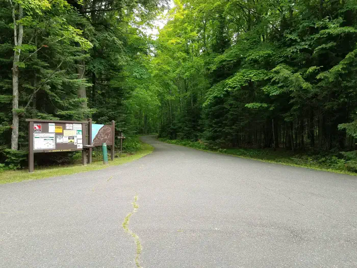
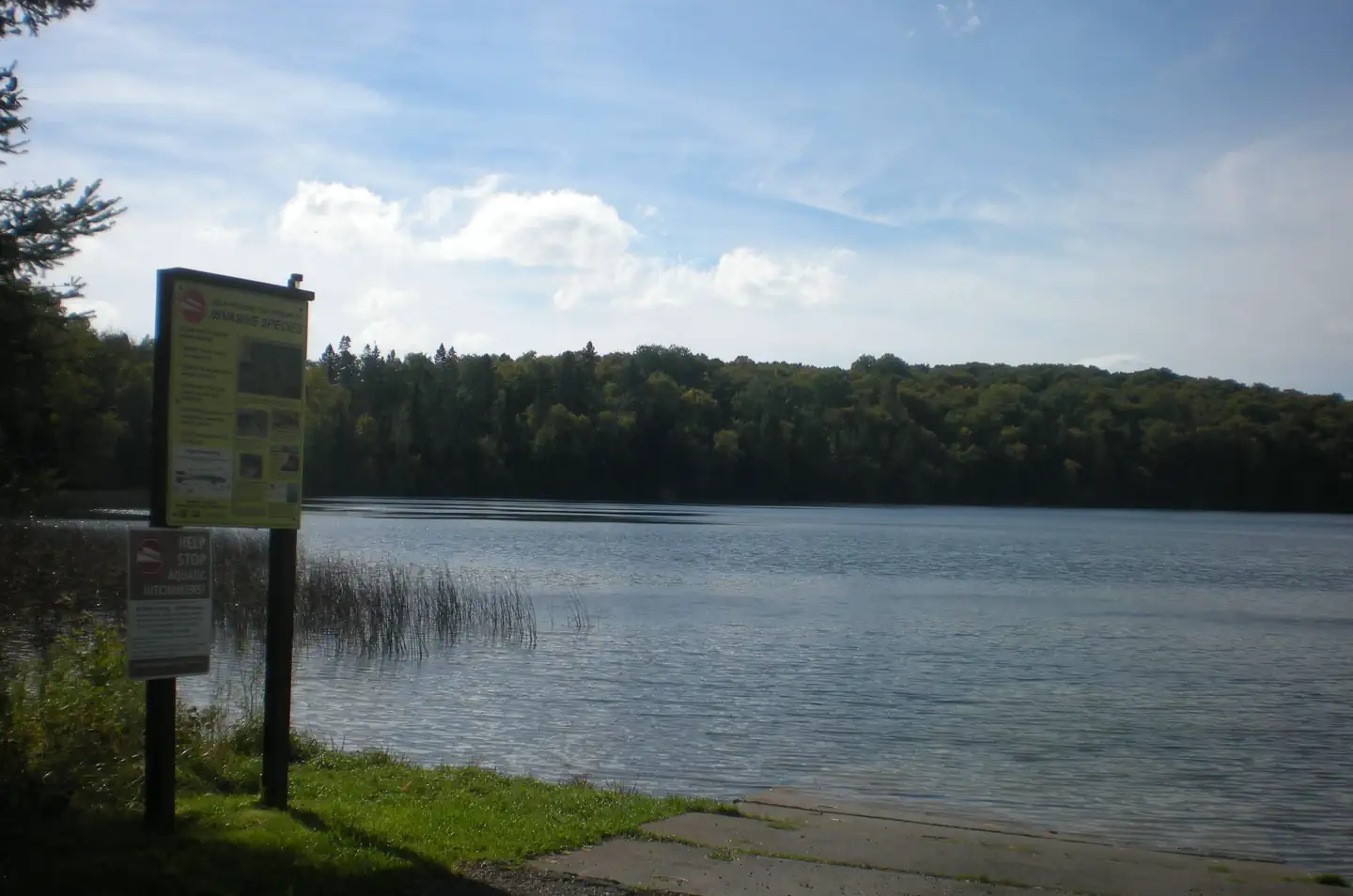
Lake Ottawa Campground is in a beautiful forested northwoods setting located 5 miles southwest of Iron River, MI, on the Iron River Ranger District.
Facilities
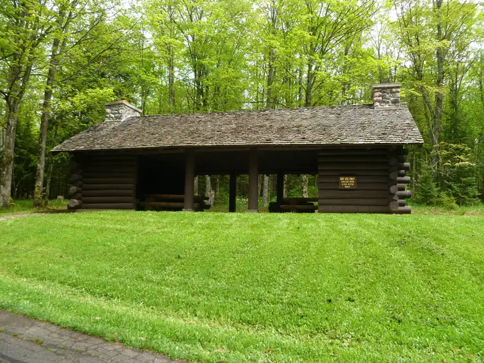
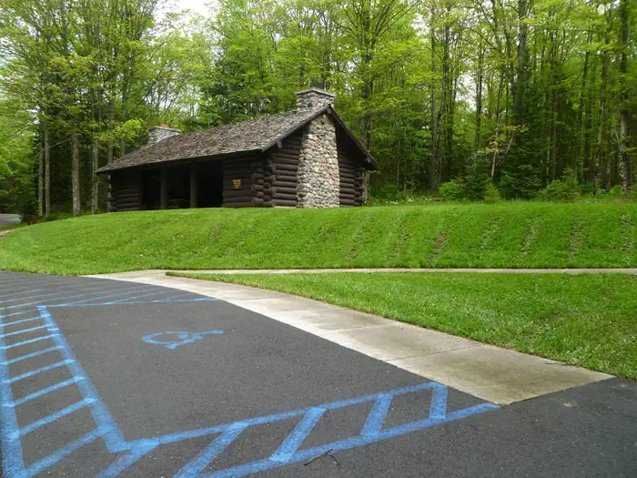
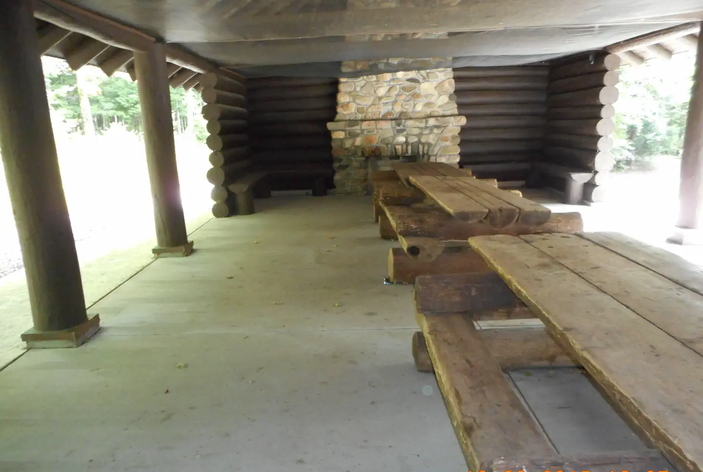
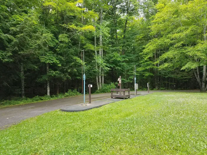
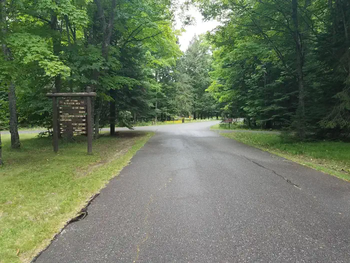
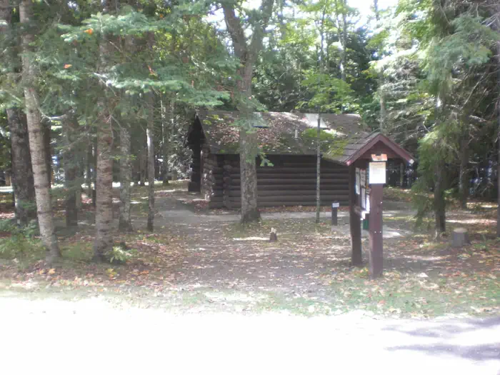
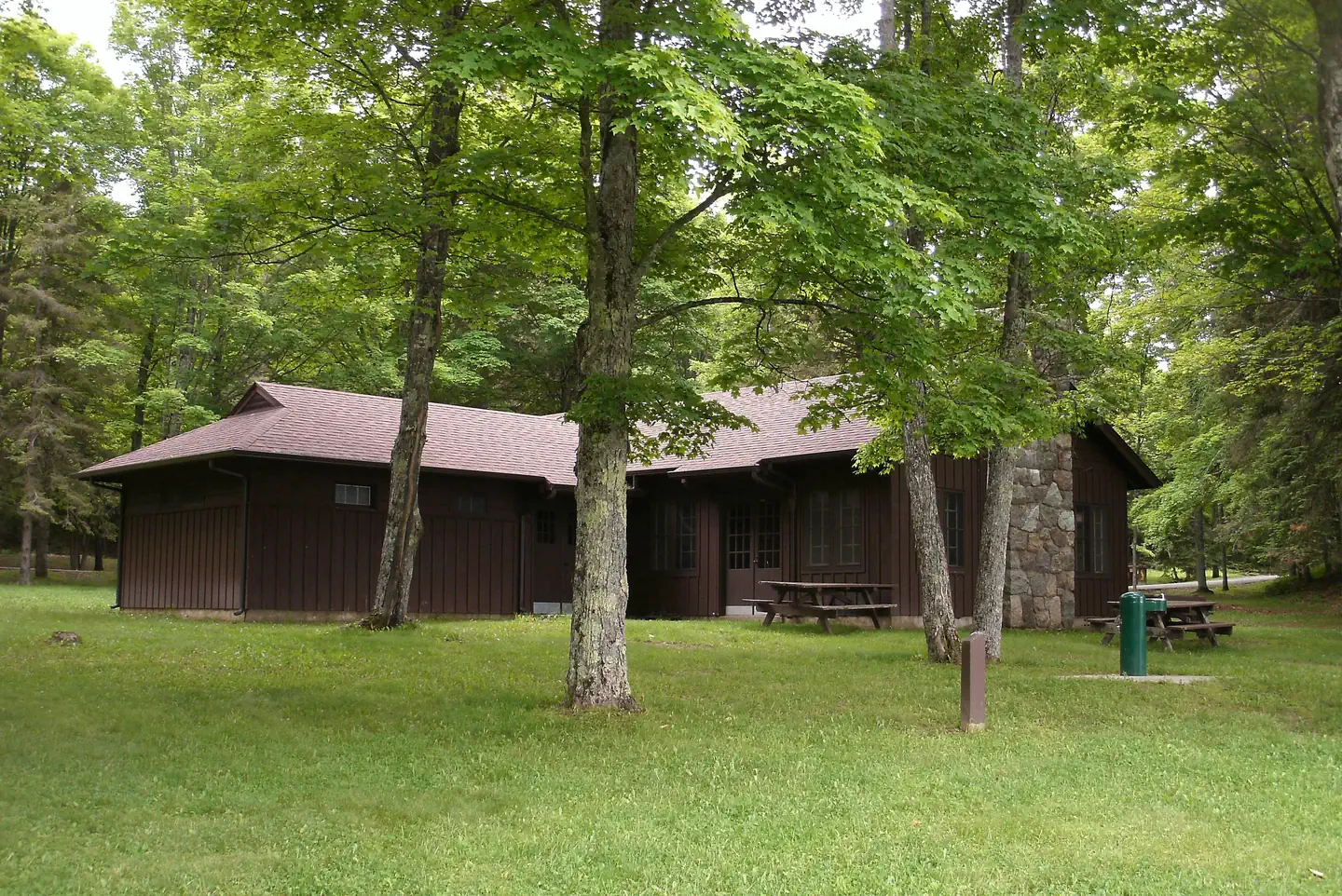
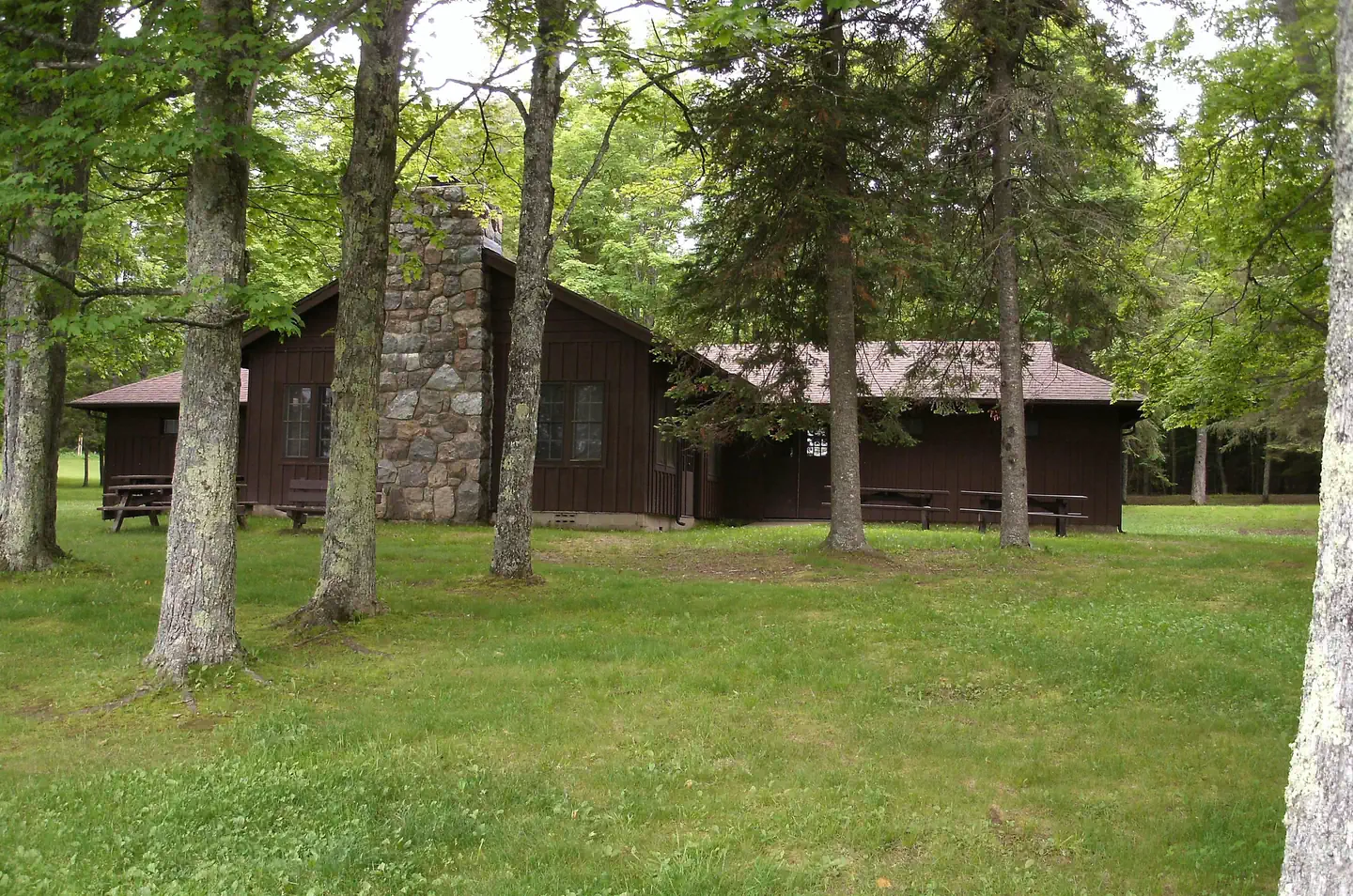
Lake Ottawa Campground is 95% surrounded by National Forest System Land and offers 32 campsites, a picnic shelter with two stone fireplaces and original log picnic tables, and two log toilet buildings with flush toilets. A pressurized water system and RV dump station are located in the campground. Adjacent to the campground, in the day use area, is a CCC era recreation building, with flush toilets, swimming beach, playing field, picnic areas and boat launch.
Recreation
- Located adjacent to the Campground is Lake Ottawa, a deep cold water lake that provides fishermen with a good variety of game fish. There is a boat ramp with ample parking for trailers.
- Ge-Che Trail - Length is approximately 9 miles on a dirt trail. This trail provides scenery of primarily hardwood forest. The trail can be accessed from Lake Ottawa boat landing, and from within the campground.
- Lake Ottawa Recreation Area day use area provides indoor facilities for a group picnic, and a large outdoor picnic area complete with picnic tables and grills. The area is large enough to provide plenty of space for all. Also located in the same area is an athletic field. The day use building provides indoor seating for eating or parties. The building has a fireplace, electricity, and flush toilets.
Nearby Attractions
- Stateline-Mile Post Zero Trail - Scenery is hardwood, forested with two destination points on the Brule River. The trail is not a loop, it is a relatively flat dirt trail. The length of the trial is approximately 4/10 of a mile and takes you to the historic Stateline Mile Post Zero location indicating the border between Michgian and Wisconsin.
- The combination of topography and thousands of miles of rivers and streams have created hundreds of waterfalls throughout the Upper Peninsula, with several of the waterfalls located on the Ottawa. The Ottawa National Forest has 18 named waterfalls, 53,637 acres of lakes, 2,366 miles of perennial streams, 2,890 miles of intermittent (occasional) streams, and 210,761 acres of wetlands. The falls vary in size and some are easier to get to than others. For more information on the most visited waterfalls on and around the Ottawa National Forest, visit the Ottawa National Forest website waterfall page.
Contact Info
For facility specific information, please call (906) 661-8870.Important Notices
Camping in a developed recreation site is allowed for a period not longer than 14 days. After this time, you must move to another campground or dispersed site for at least 24 hours.
Campers must occupy the site the first night.
Eight people and two motorized vehicles are allowed per campsite with a maximum of one RV or camper trailer and two tents per camping site or three tents per camping site.
Don't Move Firewood: Prevent the spread of tree-killing pests by obtaining firewood near your destination and burning it on-site. For more information visit dontmovefirewood.org.
This campground is open to OHV’s. OHV’s must stay on the roadway or camping spur.
This campground is operated by Camp Host, LLC under a special use permit with the Ottawa National Forest.
Lake Ottawa Pavillion will be closed for the 2026 season due to rehabilitation work needed to the interior and exterior of the building. We are sorry for the inconvenience and thank you for your patience
Notifications and Alerts
The Lake Ottawa Pavilion will be closed for the 2026 season due to rehabilitation work needed to the interior and exterior of the building.
Please check back for updates and the status of this facility. We are sorry for any inconvenience and thank you for your patience.
Available Activities
- Biking - Biking
- Boating - Boating
- Canoeing - Canoeing
- Camping - Camping
- Day Use Area - Day Use Area
- Fishing - Fishing
- Hiking - Hiking
- Kayaking - Kayaking
- Mountain Biking - Mountain Biking
- Swimming - Swimming
Directions
<ul> <li>From Iron River, Mi., travel west on US 2, turn south on M 73, travel approximately 3/4 mile, turn west on Lake Ottawa Road and travel approximately 4 miles to the campground. </li> <li>From Watersmeet, Mi., travel 28 miles east on US 2, turn south on M 73, travel approximately 3/4 mile, turn west on Lake Ottawa Road and travel approximately 4 miles to the campground.</li> </ul>
Contact Information
Phone: 906-396-5428
2832 Lake Ottawa RoadIron River, MI 49935
Rental Options
Available Campsites
- Site 11, Loop Loop 1, Type Standard Nonelectric
- Site 18, Loop Loop 1, Type Standard Nonelectric
- Site 30, Loop Loop 2, Type Standard Nonelectric
- Site 22, Loop Loop 1, Type Standard Nonelectric
- Site 14, Loop Loop 1, Type Standard Nonelectric
- Site 31, Loop Loop 2, Type Standard Nonelectric
- Site 16, Loop Loop 1, Type Standard Nonelectric
- Site 02, Loop Loop 1, Type Standard Nonelectric
- Site 24, Loop Loop 1, Type Standard Nonelectric
- Site 04, Loop Loop 1, Type Standard Nonelectric
- Site 23, Loop Loop 1, Type Standard Nonelectric
- Site 06, Loop Loop 1, Type Standard Nonelectric
- Site 21, Loop Loop 1, Type Standard Nonelectric
- Site 10, Loop Loop 1, Type Standard Nonelectric
- Site 17, Loop Loop 1, Type Standard Nonelectric
- Site 26, Loop Loop 1, Type Standard Nonelectric
- Site 29, Loop Loop 2, Type Standard Nonelectric
- Site 07, Loop Loop 1, Type Standard Nonelectric
- Site 12, Loop Loop 1, Type Standard Nonelectric
- Site 01, Loop Loop 1, Type Standard Nonelectric
- Site 08, Loop Loop 1, Type Standard Nonelectric
- Site 20, Loop Loop 1, Type Standard Nonelectric
- Site 03, Loop Loop 1, Type Standard Nonelectric
- Site 09, Loop Loop 1, Type Standard Nonelectric
- Site 28, Loop Loop 2, Type Standard Nonelectric
- Site 15, Loop Loop 1, Type Standard Nonelectric
- Site 25, Loop Loop 1, Type Standard Nonelectric
- Site 32, Loop Loop 2, Type Standard Nonelectric
- Site 05, Loop Loop 1, Type Standard Nonelectric
- Site 13, Loop Loop 1, Type Standard Nonelectric
- Site 19, Loop Loop 1, Type Standard Nonelectric