Turkey Fork Recreation Area
Turkey Fork Recreation Area
Part of National Forests in Mississippi
Overview
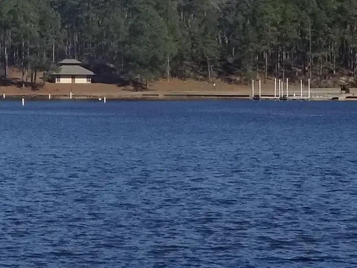
Turkey Fork Recreation Area is the most popular recreation area on the DeSoto National Forest and one of the most visited outdoor recreation areas in south Mississippi, offering three bathhouses, a picnic area, two swim areas, a boat ramp, a floating pier, 20 RV campsites, and 8 primitive camping sites, which surround a 240-acre lake
The lake is stocked with catfish, bass, and bluegill. Recreational opportunities at Turkey Fork include fishing, water sports, camping, picnicking, and hiking. With all these opportunites, a visit to Turkey Fork Recreation Area will provide its visitors with an enjoyable outdoor experience and memories to take home.
Facilities
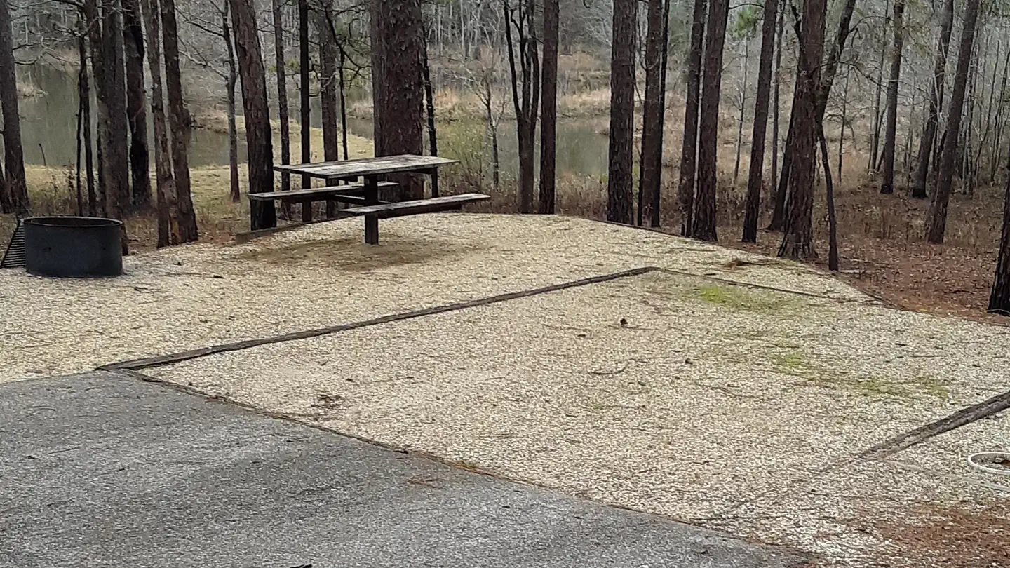
The campground has six RV campsites available for reservation. Additional RV campsites are available on a first-come, first served basis. Each campsite has water and electric hookups, picnic table, and fire-ring with grill. Flush toilets, and showers is available at the campground bathhouse. A campground host is on-site.
Natural Features
Turkey Fork Recreation Area is built around the 240-acre Turkey Fork Reservoir.
Recreation
Turkey Fork is a popular recreation destination offering premier fishing, camping, picnicking and watersports activities, such as swimming and skiing.
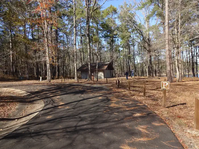
It has a boat ramp, floating dock, two swim areas, and three bathhouses. The 240 acre lake stocked with bass, crappie, and bluegill. Day use visitors will find secluded picnicking sites located near the beach. A ¾ mile hiking trail connects the day use area to the camping area.
Important Notices
Ski hours are 10:00am to 6:00 pm
Jet propelled boats or boats with open exhaust systems are not allowed on the lake
Dogs must be on a leash no longer than 6 feet
If possible, please keep a copy of your camping reservation on the dashboard of your vehicle.
Available Activities
- Camping - Camping
- Swimming - Swimming
- Water Activities - Water Activities
- Water Skiing - Water Skiing
Directions
<p>From Hattiesburg</p> <p>Travel East on U.S. Hwy. 42 approximately 21 miles to Richton. From Richton continue east on Hwy. 42 approximately 12 miles to Sandhill.</p> <p> </p> <p>From Laurel</p> <p>Travel South on Hwy. 15 approximately 27 miles to Richton. Turn left onto U.S. Hwy. 42 and travel 12 miles to Sandhill.</p> <p> </p> <p>From Mobile, Alabama</p> <p>Drive approximately 55 miles on U.S. Hwy. 45 North to the MS-AL state lines and travel west on Hwy. 42 for 19 miles to Mississippi County Road 232. Turn left (south) and travel two miles to Turkey Fork. </p>
Contact Information
Phone: 601-428-0594
746 Turkey fork RoadRichton, MS 39476 Chickasawhay Ranger District
968 Highway South
Laurel, MS 39443
Rental Options
Available Campsites
- Site 20, Loop RV Loop, Type Rv Electric
- Site 11, Loop RV Loop, Type Rv Electric
- Site 13, Loop RV Loop, Type Rv Electric
- Site 17, Loop RV Loop, Type Rv Electric
- Site 4, Loop RV Loop, Type Rv Electric
- Site 18, Loop RV Loop, Type Rv Electric
- Site 10, Loop RV Loop, Type Rv Electric
- Site 19, Loop RV Loop, Type Rv Electric
- Site 7, Loop RV Loop, Type Rv Electric
- Site 3, Loop RV Loop, Type Rv Electric
- Site 16, Loop RV Loop, Type Rv Electric
- Site 2, Loop RV Loop, Type Rv Electric
- Site 5, Loop RV Loop, Type Rv Electric
- Site 14, Loop RV Loop, Type Rv Electric
- Site 8, Loop RV Loop, Type Rv Electric
- Site Turkey Fork Pavilion, Loop Turkey Fork Pavilion, Type Group Shelter Nonelectric
- Site 15, Loop RV Loop, Type Rv Electric
- Site 12, Loop RV Loop, Type Rv Electric
- Site 1, Loop RV Loop, Type Rv Electric
- Site 6, Loop RV Loop, Type Rv Electric
- Site 9, Loop RV Loop, Type Rv Electric