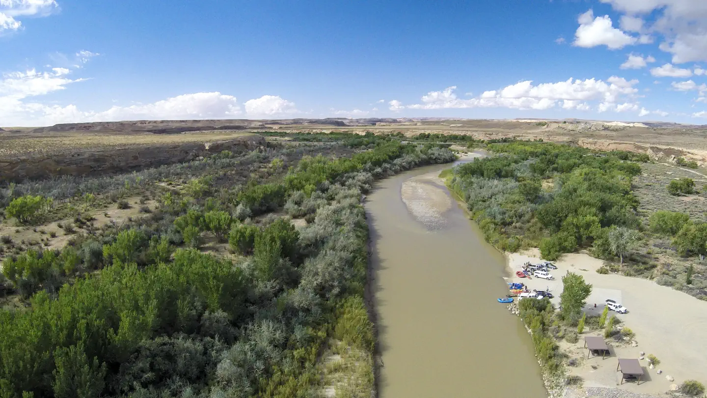
Sand Island Recreation Area
Sand Island Recreation Area
Part of Bears Ears National Monument
Overview
Sand Island Recreation Area is a good camping option for visitors launching San Juan River float trips, or wishing to camp close to the town of Bluff or the Cedar Mesa area of Bears Ears National Monument. The campground provides 21 campsites that each feature a tent/trailer space, a picnic table, a fire ring, and vault toilets. Drinking water is available seasonally (typically March through October). Each campsite can hold 8 people and 2 vehicles. Reservations are not available for camping at this location. Individual campsites are available on a first come, first served basis upon arrival at the self-register kiosk at the site. The Sand Island Group Sites are available for larger groups, and may be reserved here.
Natural Features
Sand Island is located along the San Juan River. Cottonwood trees line the banks of the river and are scattered throughout the campground, providing shade at many of the sites. The north side of the campground is lined with red sandstone walls.
Recreation
Sand Island is the primary launch point for multi-day San Juan River float trips. San Juan River trips provide boaters with access to spectacular canyons rich in scenery, geology, archeology, history and wildlife. A river permit is required in advance. The Sand Island Petroglyph Panel site is located on the sandstone walls on the north side of the recreation area. There are many nearby hiking and scenic driving opportuites in the Cedar Mesa area of Bears Ears National Monument.
Nearby Attractions
- Bears Ears National Monument
- San Juan River
- Cedar Mesa
- Valley of the Gods
- Goosenecks State Park
Contact Info
For facility specific information, please call (435) 587-1500.Important Notices
A permit is required in advance for floating on the San Juan River.
Drinking water is seasonal and is typically available March through October.
Notifications and Alerts
IMPORTANT VISITOR ADVISORY – LOCAL FLOODING AND EMERGENCY CONDITIONS
Due to recent flooding and significant storm damage throughout the county, please consider avoiding travel within the Monticello Field Office area, particularly on dirt roads.
Flooding has damaged roads, bridges and impacted local communities. Emergency response may be limited in some areas and take longer to arrive, with resources already stretched thin responding to these events. Please avoid unnecessary travel.
If you decide to travel to the region, please take extra precautions and check local conditions before departing. Local highways may be closed, and dirt roads may be impassable due to erosion.
For questions, please call the Monticello Field Office at 435-587-1500. We appreciate your understanding and cooperation.
- A location closure has been issued, and the facility is closed at this time. Reservation-holders will receive an email with additional information. Please check back for location closure updates.
Available Activities
- Camping - Camping
- Hiking - Hiking
- Historic & Cultural Site - Historic & Cultural Site
- River Trips - River Trips
- Photography - Photography
- Scenic Drive - Scenic Drive
Directions
<p>The recreation area is located off U.S. Route 191 approximately three miles west of Bluff, UT and approximately one mile east of the junction of U.S. Routes 163 and 191. It is accessible by all passenger vehicles.</p>
Cancellation Policy
<p>No refunds are available.</p>
Contact Information
BLM Monticello Field OfficePO Box 7
Monticello, UT 84535 BLM Monticello Field Office
365 N Main St
Monticello, UT 84535
Rental Options
Available Campsites
- Site 5, Loop , Type Standard Nonelectric
- Site 4, Loop , Type Standard Nonelectric
- Site 1, Loop , Type Standard Nonelectric
- Site 15, Loop , Type Standard Nonelectric
- Site 16, Loop , Type Standard Nonelectric
- Site 7, Loop , Type Standard Nonelectric
- Site 12, Loop , Type Standard Nonelectric
- Site 19, Loop , Type Standard Nonelectric
- Site 11, Loop , Type Standard Nonelectric
- Site 10, Loop , Type Standard Nonelectric
- Site 23, Loop Loop B, Type Standard Nonelectric
- Site 13, Loop , Type Standard Nonelectric
- Site 17, Loop , Type Standard Nonelectric
- Site 2, Loop , Type Standard Nonelectric
- Site 18, Loop , Type Standard Nonelectric
- Site 14, Loop , Type Standard Nonelectric
- Site 2, Loop , Type Standard Nonelectric
- Site 20, Loop , Type Standard Nonelectric
- Site 8, Loop , Type Standard Nonelectric
- Site 3, Loop , Type Standard Nonelectric
- Site 21, Loop , Type Standard Nonelectric
- Site 6, Loop , Type Standard Nonelectric
- Site 9, Loop , Type Standard Nonelectric