Lake Conasauga Campground
Lake Conasauga Campground
Part of Chattahoochee-Oconee National Forest
Overview
The Lake Conasauga Recreation Area is a remote recreation area located within the Chattahoochee National Forest in northwest Georgia. Getting to Lake Conasauga involves a beautiful forested drive along 15 or more miles of graveled mountain roads through the Cohutta Mountains. Visitors may occasionally see bear, deer, and turkeys on their drive. Wildflowers can be found blooming from February through November in various parts of the mountains.
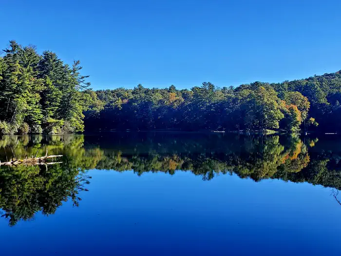
Completed in 1940, Lake Conasauga was built by the Civilian Conservation Corps (CCC) under the guidance of the U.S. Forest Service. Tucked between Grassy Mountain and Little Bald Mountain, the 17 acre lake sits at an elevation of 3,150 feet, making it the highest elevation lake in the State of Georgia. At this elevation, air temperatures at Lake Conasauga are usually 10-15 degrees cooler than the surrounding valleys, allowing for a comfortable camping experience even in the middle of summer.
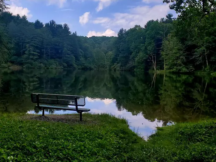
Outdoor activities at the Lake Conasauga Recreation Area include camping, hiking, boating, fishing, picnicking, and swimming.
Facilities
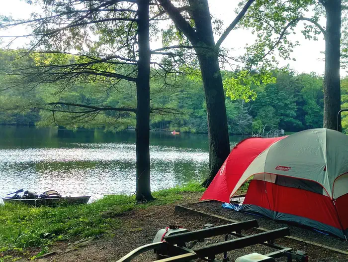
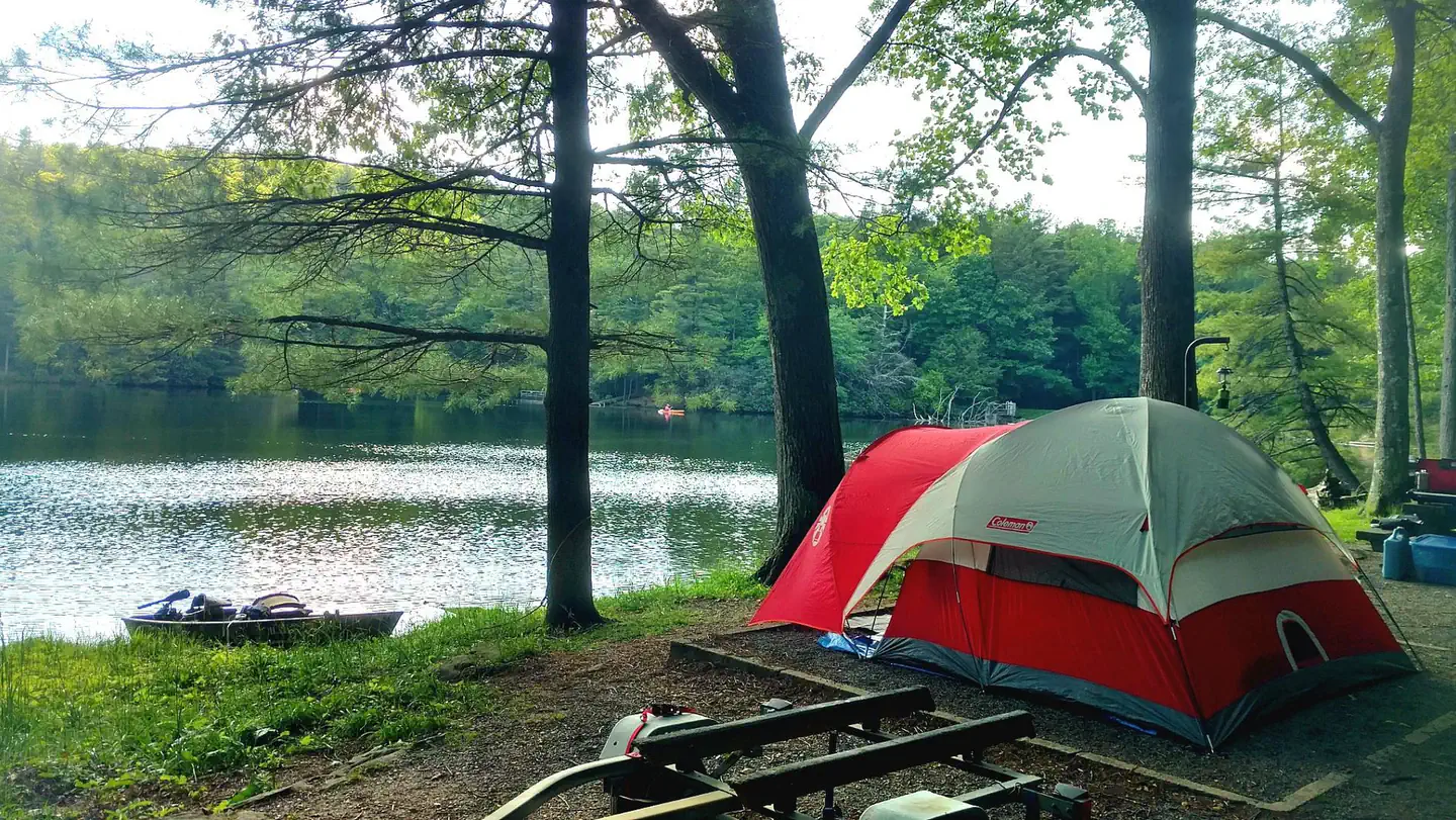
The Lake Conasauga Campground is a 30 site campground with two camping loops. The Lower Loop is located within view of the lake. The Upper Loop is a forested loop above the lake.
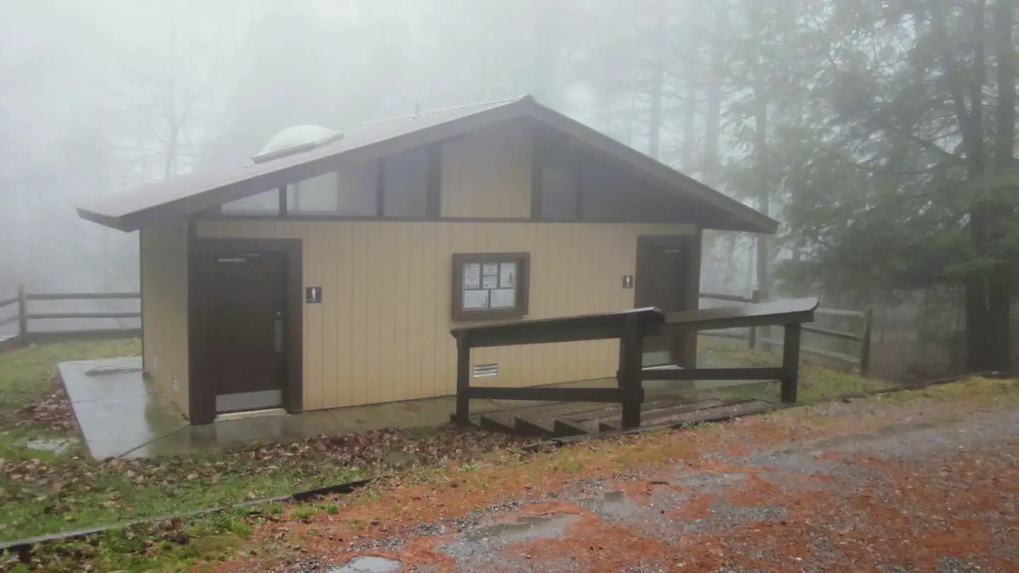
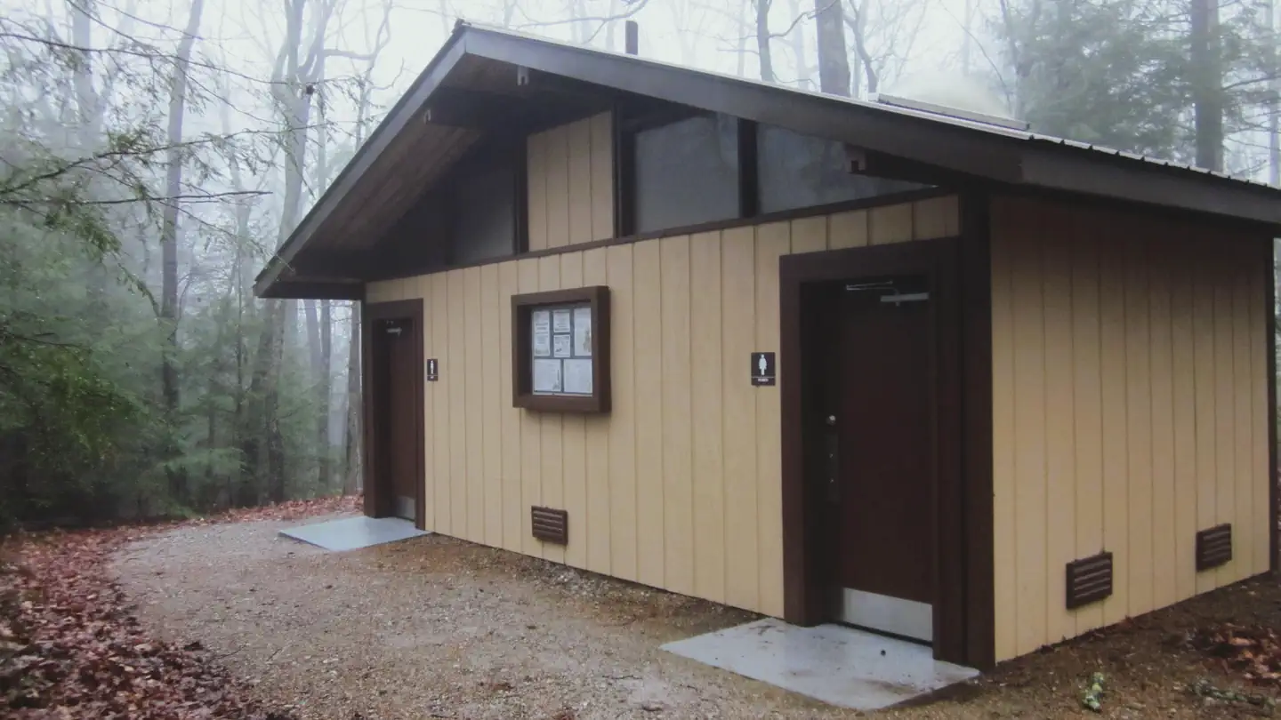
Each campsite has a gravel parking spur, a gravel tent pad, picnic table, lantern post, and a fire ring with a grill. There is a restroom with flush toilets located in both camping loops (no showers, no hot water). Water hydrants are located throughout the campground. There is no electricity at this campground. There is no dump station at this campground. Cell phone service is very limited.
A cabin for the campground host is located in the campground. This cabin is a private residence for the host and is not an office or a store. Please respect their space and privacy.
Driving on steep, narrow, winding, mountain roads is required to get to this campground. Tents, pop-up campers, and travel trailers under 25 feet are recommended for this campground due to access and campsite size limitations.
GPS is not recommended for navigating to this area as satellite service is regularly interrupted by mountains and trees.
Natural Features
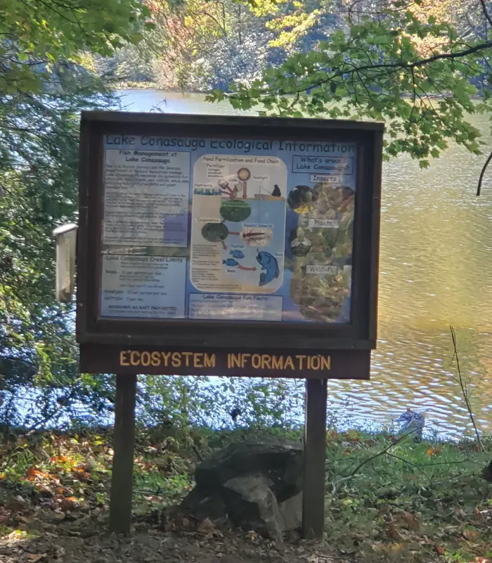
Surrounded by forested mountains, Lake Conasauga is a 17 acre man-made lake located near the summit of Grassy Mountain in northwest Georgia. It is the highest elevation lake in Georgia, sitting at an elevation of 3,150 feet. No matter the route taken to get to Lake Conasauga, visitors will pass mountain streams, overlooks, and beautiful scenery.
The Songbird Management Area is located within the Lake Conasauga Recreation Area. Centered around a large beaver pond, the Songbird Management Area provides a peaceful interpretive nature hike. Many bird species and wildflowers can be found along the interpretive nature hike in this area.
Adjacent to the Lake Conasauga Recreation area is the 45,000 acre Cohutta/Big Frog Wilderness (the largest designated wilderness area east of the Mississippi River.). The Cohutta Wilderness contains 91 miles of arduous backpacking trails.
Recreation
A swimming and picnic area with a picnic shelter is located across the lake opposite the campground. A swimming dock is provided for visitors to take a swim in the cold natural spring waters of Lake Conasauga. There is no lifeguard on duty, so please swim at your own risk.
Hiking trails include the Lake Loop Trail (1 mile loop), the Songbird Trail (2.8 mile loop), and the Tower Trail (4 miles round trip).
A small boat launch provides boating access for canoes, kayaks, and small boats (electric motors only). Fishermen may catch bass, bream, and even an occasional catfish. A fishing dock is provided. The Lake Loop Trail provides various locations along the shoreline for fishermen to cast. A Georgia fishing license is required for those 16 and older.
Nearby Attractions
Barnes Creek Picnic Area:
This small picnic area was historically used as a rock quarry by the Civilian Conservation Corps and U.S. Forest Service in the 1930s. The picnic tables sit near the base of a waterfall. A short trail from the parking area leads to an observation deck above the waterfall.
Turn left out of the Lake Conasauga Campground and follow Forest Road 68 for 4.5 miles. Turn right and continue following Forest Road 68 for another 2.5 miles.
Gennett Poplar:
The Gennett Poplar is the second largest tree in the state of Georgia with a circumference of 18 feet. This tree was left by the Conasauga River Lumber Company as a tribute to the size of the trees that once inhabited the Appalachian Mountains.
Turn left out of the Lake Conasauga Campground and follow Forest Road 68 for 4.5 miles. Turn right and continue following Forest Road 68 for 3.5 miles and turn left onto Forest Road 90. Follow Forest Road 90 for 2 miles and turn left onto Forest Road 241. Follow Forest Road 241 for 2 miles until it dead ends. Follow the trail upstream for 3/4 mile.
Important Notices
Access to this campground requires a 15+ mile drive on steep, narrow, winding, bumpy, rough, gravel roads in mountainous terrain. Road conditions change with the weather and at times can be hazardous. Trees occasionally fall and block roadways, especially after rainy or windy weather. Travel Trailers over 25 feet are not recommended. Forest Road 68 is the recommended route for pulling trailers.
Check-Out time: 2:00 pm
Check-In time: 3:00 pm
It is your responsibility to know your Arrival date and Departure date.
Your reservation confirmation will show the Arrival date and the Departure date for your reservation. These dates will be used in case of reservation disputes at this recreation site. It is required to have your confirmation and proof of reservation available upon request of Forest Service Officers and Volunteer Campground Hosts.
Be Bear Aware: Store food and trash properly. Never leave food/trash out on tables or in the open. Store unattended food/trash in bear-resistant containers, in a vehicle in solid non-pliable material, or suspend food/trash at least ten feet off the ground. Remember to use the bear resistant trash receptacles provided at this facility. (36 CFR 261.58cc)
Bring your own firewood, equipment, and supplies. No store or office at Lake Conasauga. The nearest gas station and store is 15 miles away in Crandall, GA. It is prohibited to cut live vegetation or any standing tree whether dead or alive. Firewood may be collected from the National Forest surrounding Lake Conasuaga for use while camping. Only collect wood that is dead and down. Dead trees play an important role as homes for wildlife and insects. (36 CFR 261.6a)
Cell phone service is extremely limited and unreliable in this area.
Alcoholic beverages are prohibited. (36 CFR 261.58bb)
Five (5) people per site and two (2) vehicles per site. The following are prohibited:
Parking or leaving a vehicle outside a parking space assigned to one's own campsite. (36 CFR 261.58h)
Possessing, parking, or leaving more than two (2) motorized vehicles per campsite for the purpose of camping. (36 CFR 261.58i)
Using a campsite in a developed camping area by other than immediate family, or by a group of more than five (5) persons. (36 CFR 261.58f)
Quiet hours are from 10 p.m. to 6 a.m. Generators are allowed during daylight hours, but may not be used in a manner or at a time which unreasonably disturbs other forest visitors. (36 CFR 261.10i)
Fireworks and other pyrotechnics are prohibited. (36 CFR 261.52f)
14-Day Forest Stay Limit: Camping or maintaining a campsite in developed and dispersed areas in excess of 14
days within any 30-day time period. After the camper(s) has accumulated 14 days
within any 30-day time period, the camper(s) must leave that area/campground and
move from Chattahoochee-Oconee National Forest land before returning for
another stay. (36 CFR Section 261.58a)
Pets must be leashed at all times (36 CFR 261.16J) and are prohibited in the swimming area (36 CFR 261.16k).
For the safety of campers, vounteers, and employees: Disposing of Human Waste in Campground Trash Cans is Prohibited. (36 CFR 261.11d)
Functioning restrooms with flush toilets are located at the campground for use.
Possessing or operation a motorboat powered by an internal combustion engine is prohibited. (36 CFR 261.58n)
Available Activities
- Canoeing - Canoeing
- Boating - Boating
- Day Use Area - Day Use Area
- Fishing - Fishing
- Kayaking - Kayaking
- Star Gazing - Star Gazing
- Swimming - Swimming
- Water Access - Water Access
- Wildlife Viewing - Wildlife Viewing
- Wilderness - Wilderness
- Swimming Site - Swimming Site
- Scenic Drive - Scenic Drive
- Picnicking - Picnicking
- Paddling - Paddling
- Non-Motorized Boating - Non-Motorized Boating
- Hunting - Hunting
- Hiking - Hiking
- Camping - Camping
- Birding - Birding
- Backpacking - Backpacking
- Mountain Biking - Mountain Biking
Directions
<p><strong>From Atlanta:</strong> take I-75 N to I-575. I-575 turns into Hwy 515 and continue to Ellijay. From Ellijay, take GA Hwy 52 west for 5 miles to Gates Chapel Road on the right. Turn right and travel about 7 miles to end of pavement. Continue on dirt/gravel road (Forest Service Road #90) about 2 miles to stop sign. Turn right onto Forest Service Road #68. Continue 3-4 miles to T-intersection. Turn left to continue on Forest Service Road #68. Continue about 4-5 miles to entrance to Lake Conasauga Campground.</p> <p><strong>From Chattanooga:</strong> take I-75 S to Exit #336 (Dalton/Rocky Face). Go right off exit ramp onto N. Dalton Bypass. Continue on N. Dalton Bypass about 5.5 miles to intersection with GA Hwy 76. Turn left on GA Hwy 76. Continue about 7 miles to Chatsworth and intersection with US Hwy 411. Turn left on US Hwy 411. See <strong>From Chatsworth</strong> directions for continuation.</p> <p><strong>From Chatsworth:</strong> take US Hwy 411 N. 3 miles to Eton. Turn right on Old CCC Camp Road. After about 5 miles the pavement ends and you will be on a dirt/gravel road (Forest Service Road #18). Continue on for about 3-4 miles to fork. Take left fork, Forest Service Road #68. Continue on Forest Service Road #68 for about 5-6 miles to T-intersection. Turn left to continue on Forest Service Road #68. Continue about 4-5 miles to entrance to Lake Conasauga Campground.</p>
Contact Information
Phone: (706) 695-6736
Rental Options
Available Campsites
- Site 7, Loop Upper, Type Standard Nonelectric
- Site 17, Loop Lower, Type Standard Nonelectric
- Site 5, Loop Upper, Type Standard Nonelectric
- Site 25, Loop Lower, Type Standard Nonelectric
- Site 24, Loop Lower, Type Standard Nonelectric
- Site 2, Loop Upper, Type Standard Nonelectric
- Site 18, Loop Lower, Type Standard Nonelectric
- Site 6, Loop Upper, Type Standard Nonelectric
- Site 28, Loop Lower, Type Standard Nonelectric
- Site 8, Loop Upper, Type Standard Nonelectric
- Site 1, Loop Upper, Type Standard Nonelectric
- Site 16, Loop Lower, Type Standard Nonelectric
- Site 14, Loop Lower, Type Standard Nonelectric
- Site 27, Loop Lower, Type Standard Nonelectric
- Site 26, Loop Lower, Type Standard Nonelectric
- Site 22, Loop Lower, Type Standard Nonelectric
- Site 20, Loop Lower, Type Standard Nonelectric
- Site 4, Loop Upper, Type Standard Nonelectric
- Site 13, Loop Lower, Type Standard Nonelectric
- Site 3, Loop Upper, Type Standard Nonelectric
- Site 21, Loop Lower, Type Standard Nonelectric
- Site 23, Loop Lower, Type Standard Nonelectric
- Site 10, Loop Upper, Type Standard Nonelectric
- Site 12, Loop Upper, Type Standard Nonelectric
- Site 15, Loop Lower, Type Standard Nonelectric
- Site 11, Loop Upper, Type Standard Nonelectric
- Site 29, Loop Lower, Type Standard Nonelectric
- Site 19, Loop Lower, Type Standard Nonelectric
- Site 9, Loop Upper, Type Standard Nonelectric