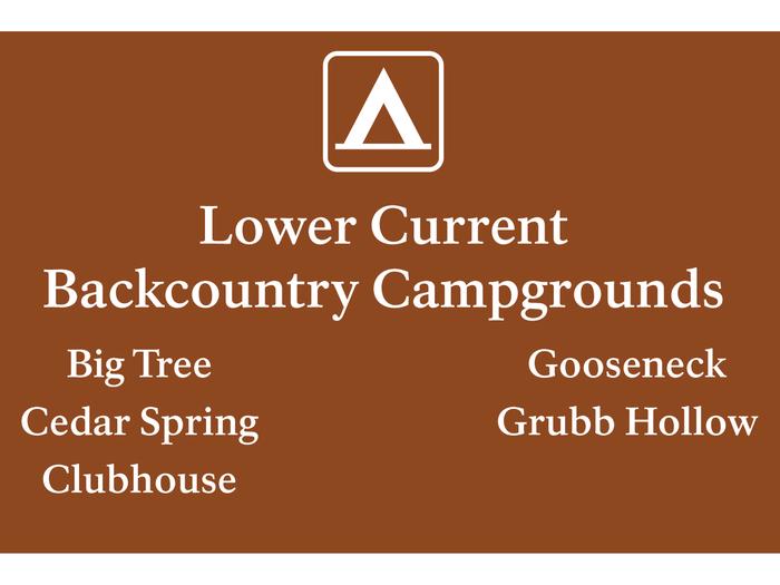
Lower Current District Backcountry Campsites
Lower Current District Backcountry Campsites
Part of Ozark National Scenic Riverways
Overview
Lower Current District Backcountry Campsites will be reservable in advance beginning October 1st, 2025. If calling the Recreation.gov Call Center to make your reservation, please state the campsite you are wanting to reserve is in the “Lower Current District” of Ozark National Scenic Riverways and then state the campground and site number. Please download the Recreation.gov app before starting your journey to the backcountry sites, as cell service can be limited or simply non existent in these remote areas of the park.
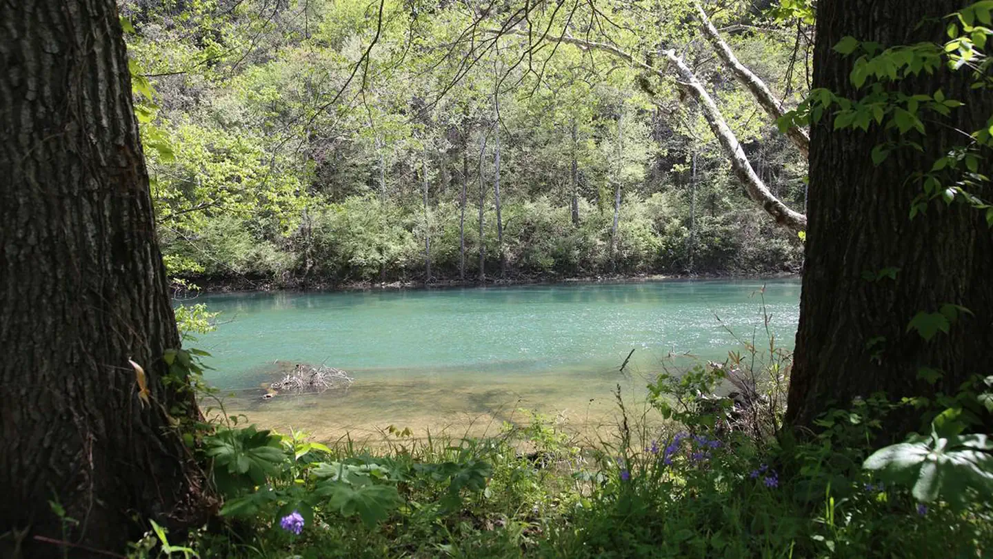
Within Ozark National Scenic Riverways, a "backcountry campground" refers to campgrounds with some basic amenities, but not as many as developed campgrounds. All backcountry sites have picnic tables, fire rings, lantern posts, and vault toilets.
These campgrounds may have fewer amenities, but they are some of the most beautiful locations in the park. Certain sites are located right on the river's edge, allowing quick water access. Some sites are far away from other campers, giving you a chance to enjoy natural peace and quiet. If you crave a camping experience that is off the beaten path, these are the sites for you!
Keep in mind that these campgrounds are often harder to reach due to their location. Most backcountry sites require driving down gravel roads. Some roads are unsuitable for vehicles with low clearance.
Horse camping is not allowed within ONSR. Trail riders who desire to camp should contact local campgrounds with stables. Day trail riders can park horse trailers during daylight hours at Shawnee Staging Area and Broadfoot Staging Area.
Facilities
These campgrounds have vault toilets available. Picnic tables, fire rings and lantern posts are provided.
Natural Features
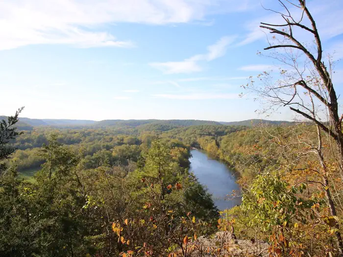
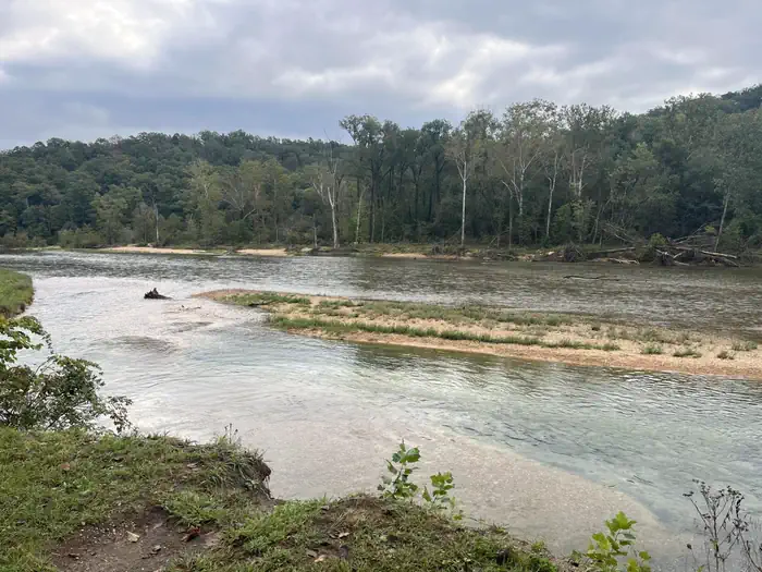
The Ozark National Scenic Riverways protects 134 miles of the Current and Jacks Fork Rivers and some 80,000 acres of river, forest, open field and glade environments. Riparian habitats are a major component of the park. Typified by sycamores, maples, cottonwoods and willows, floodplain forests line the rivers. These provide habitat for Swainson's warblers, wood ducks, great blue herons and a wide variety of other species. As a significant karst resource, the park contains the world's largest collection of first magnitude springs. It also contains over 300 known caves, numerous sinkholes and losing streams.
The park also contains several "Missouri Natural Areas", parcels set aside due to their unique scenic beauty or scientific value.
Recreation
The Current River flows past the campground, offering excellent canoeing, tubing, swimming and fishing. Over 130 miles (209 km) of waterways exist within the park. Canoe and kayak rentals and outfitters can be found nearby.
Several miles of hiking and horseback riding trails crisscross the region, include the Alley Overlook Trail, Chubb Hollow Trail, Ozark Trail, Cave Spring Trail and Big Springs Trail.
Nearby Attractions
Round Spring Cave is nearby, with ranger-guided tours offered daily during summer months. Historic and picturesque Alley Mill and Alley Spring are also nearby. The mill is open daily in the summer and ranger-guided tours are available upon request.
Scenic Big Spring is the largest freshwater spring in North America and produces an outflow of 280 million gallons a day.
Important Notices
If you arrive and another party is occupying your reserved campsite, please call Arrowhead Dispatch at 1-844-460-3604 for a Law Enforcement officer to be dispersed to your location for removal of the unauthorized party.
In our park, "backcountry campground" refers to sites that have some basic amenities, but not as many as developed campgrounds. All backcountry sites have picnic tables, fire rings, lantern posts, and vault toilet restrooms.
These campgrounds may have less amenities, but they are some of the most beautiful locations in the park. Certain sites are located right on the river's edge, allowing quick water access. Some sites are far away from other campers, giving you a chance to enjoy natural peace and quiet. If you crave a camping experience that is off the beaten path, these are the sites for you!
Keep in mind that these campgrounds are often harder to reach due to their location. Most backcountry sites require driving down gravel roads. Some roads are unsuitable for vehicles with low clearance. Be sure to double-check the location of your site before making a reservation.
Available Activities
- Hiking - Hiking
- Biking - Biking
- Boating - Boating
- Camping - Camping
- Fishing - Fishing
- Hunting - Hunting
- Scenic Drive - Scenic Drive
- Swimming - Swimming
- Wild Horse Viewing - Wild Horse Viewing
- Wildlife Viewing - Wildlife Viewing
Directions
<p><strong><em>BIG TREE:</em></strong></p><p><strong>Physical Address</strong></p><p>NPS Road 219 Kelly Township, MO 63965</p><p><strong>Directions</strong></p><p>Big Tree Campground is located roughly 20 minutes south of Van Buren, MO. Starting in Van Buren, take Highway 60 south to Highway 103. Turn southeast onto 103, then follow that road for roughly 4 miles. Next, turn south onto Highway Z. Follow Highway Z for about 7.5 miles, then turn east onto a gravel road. Follow this road for about a half mile, at which point it will dead-end into Big Tree Campground. This route requires driving on gravel roads for about 1/2 mile.</p><p><strong><em>CLUBHOUSE:</em></strong></p><p><strong>Physical Address</strong></p><p>NPS Road 107 Kelly Township, MO 63965</p><p><strong>Directions</strong></p><p>Clubhouse Campground can be found at the end of County Road 60-221, in Carter County, MO. From Ellsinore, drive about 6.5 miles west on Highway 60. From there, turn west onto State Highway ZZ. Drive 1 mile to the bend of Highway ZZ, where it intersects with County Road 60-221. From there, follow the county road south for about 4.75 miles. The campground is located near the bottom of a hill, along the Current River. This route requires driving on gravel roads for almost 5 miles. Some areas are steep.</p><p><strong><em>GRUBB:</em></strong></p><p><strong>Physical Address</strong></p><p>NPS Road 223 Kelly Township, MO 63965</p><p><strong>Directions</strong></p><p>Grubb Campground is located roughly 30 minutes south of Van Buren, MO. Starting in Van Buren, drive west on Highway 60 for about 5 miles. Then, turn south onto State Highway C. Follow Highway C for 7 miles, then turn left onto State Highway F (intersection in Eastwood). Drive down Highway F for roughly 5.75 miles, then turn right onto County Road F-227. Stay on this road for about 2.5 miles, then turn right into Grubb Hollow Campground. This route requires driving on gravel roads for about 2.5 miles.</p><p><strong><em>CEDAR SPRING:</em></strong></p><p><strong>Physical Address</strong></p><p>NPS Road 103 Kelly Township, MO 63965</p><p><strong>Directions</strong></p><p>Cedar Spring Campground is located roughly 30 minutes south of Van Buren, MO. Starting in Van Buren, drive west on Highway 60 for about 5 miles. Then, turn south onto State Highway C. Follow Highway C for 7 miles, then turn left onto State Highway F (intersection in Eastwood). Drive down Highway F for roughly 5.75 miles, then turn right onto County Road F-227. Stay on this road until it dead-ends into Cedar Spring Campground (approximately 1 mile past Grubb Campground). This route requires driving on gravel roads for about 3.5 miles.</p><p><strong><em>GOOSENECK:</em></strong></p><p><strong>Physical Address</strong></p><p>NPS Road 106 Kelley Township, MO 63965</p><p><strong>Directions</strong></p><p>Gooseneck Campground is located roughly half an hour south of Van Buren, MO. Starting from Van Buren, head west on Highway 60. Around the 5-mile mark, turn south onto Highway C. Stay on Highway C for approximately 11 miles, then turn east onto Big Barren Creek Road. Follow this road (without turning) for about 1.2 miles. The road will eventually dead-end into Gooseneck Campground. This route requires driving on gravel roads for ~1.2 miles.</p><p></p>
Contact Information
Phone: 573-323-4236
404 Watercress DriveVan Buren, MO 63965 PO Box 490
Van Buren, MO 63965
Rental Options
Available Campsites
- Site Gooseneck Campground - Site 5, Loop Gooseneck Campground, Type Standard Nonelectric
- Site Gooseneck Campground - Site 3, Loop Gooseneck Campground, Type Standard Nonelectric
- Site Grubb Hollow Campground - Site 5, Loop Grubb Hollow Campground, Type Standard Nonelectric
- Site Clubhouse Campground - Site 6, Loop Clubhouse Campground, Type Standard Nonelectric
- Site Big Tree Campground - Site 6, Loop Big Tree Campground, Type Standard Nonelectric
- Site Clubhouse Campground - Site 2, Loop Clubhouse Campground, Type Standard Nonelectric
- Site Cedar Spring Campground - Site 6, Loop Cedar Spring Campground, Type Standard Nonelectric
- Site Gooseneck Campground - Site 8, Loop Gooseneck Campground, Type Standard Nonelectric
- Site Gooseneck Campground - Site 7, Loop Gooseneck Campground, Type Standard Nonelectric
- Site Gooseneck Campground - Site 6, Loop Gooseneck Campground, Type Standard Nonelectric
- Site Gooseneck Campground - Site 1, Loop Gooseneck Campground, Type Tent Only Nonelectric
- Site Clubhouse Campground - Site 1, Loop Clubhouse Campground, Type Standard Nonelectric
- Site Big Tree Campground - Site 5, Loop Big Tree Campground, Type Standard Nonelectric
- Site Gooseneck Campground - Site 2, Loop Gooseneck Campground, Type Tent Only Nonelectric
- Site Big Tree Campground - Site 2, Loop Big Tree Campground, Type Standard Nonelectric
- Site Clubhouse Campground - Site 4, Loop Clubhouse Campground, Type Standard Nonelectric
- Site Big Tree Campground - Site 3, Loop Big Tree Campground, Type Standard Nonelectric
- Site Grubb Hollow Campground - Site 2, Loop Grubb Hollow Campground, Type Standard Nonelectric
- Site Cedar Spring Campground - Site 7, Loop Cedar Spring Campground, Type Standard Nonelectric
- Site Grubb Hollow Campground - Site 1, Loop Grubb Hollow Campground, Type Standard Nonelectric
- Site Clubhouse Campground - Site 5, Loop Clubhouse Campground, Type Standard Nonelectric
- Site Big Tree Campground - Site 7, Loop Big Tree Campground, Type Standard Nonelectric
- Site Grubb Hollow Campground - Site 3, Loop Grubb Hollow Campground, Type Standard Nonelectric
- Site Grubb Hollow Campground - Site 4, Loop Grubb Hollow Campground, Type Standard Nonelectric
- Site Gooseneck Campground - Site 4, Loop Gooseneck Campground, Type Standard Nonelectric
- Site Big Tree Campground - Site 1, Loop Big Tree Campground, Type Standard Nonelectric
- Site Big Tree Campground - Site 4, Loop Big Tree Campground, Type Standard Nonelectric
- Site Clubhouse Campground - Site 3, Loop Clubhouse Campground, Type Standard Nonelectric