Lower Camp Creek Campground
Lower Camp Creek Campground
Part of Malheur National Forest
Overview
A pleasantly small campground tucked among ponderosa pines along a forest creek. This campground is popular with hunters. Just a short drive away from the beautiful Middle Fork of the John Day River. Less than a mile away is Arch Rock Trail #258, an ash flow tuff with a scenic arch and several small rock shelters eroded into the outcrop, allowing visitors a place to see fascinating geological features. A bit further at 13 miles away is Magone Lake Campground, a great place to swim, fish or hike.
Facilities
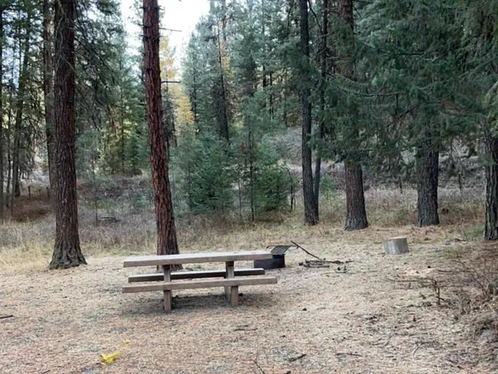
Each campsite has a picnic table, fire ring, and parking for camp trailers. Accessible vault toilet is conveniently located in the middle of the campground.
Recreation
Visitors can enjoy easy access to the Arch Rock Trail, where eroded ash flows and rock shelters offer a chance to experience fascinating geological features up close. The Middle Fork John Day River is just a short drive away, providing scenic landscapes and additional outdoor exploration. The campground is also a popular starting point for hunters.
Nearby Attractions
Contact Info
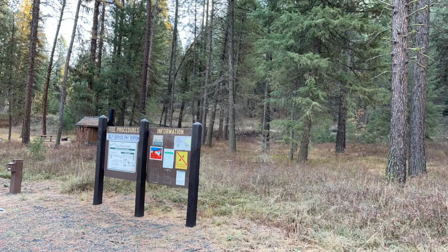
For facility specific information, please call (541) 575-3000.Important Notices
Don't Move Firewood: Please protect Pacific Northwest forests by preventing the spread of invasive species. Firewood can carry insects and diseases that can threaten the health of our western forests. You can make a difference by obtaining and burning your firewood near your camping destination. Visit Dontmovefirewood.org for further information.
No cell phone coverage.
No trash service; Pack it in/Pack it out
Notifications and Alerts
All campsites are first come, first serve. No reservations required.
Available Activities
- Fishing - Fishing
- Hunting - Hunting
- Camping - Camping
- Hiking - Hiking
- Water Access - Water Access
Directions
<p>From the town of Prairie City, OR, travel west 3 miles on US Highway 26 to the junction with County Road 18. Turn right, follow County Road 18 approximately 9 miles to the junction with Forest Road 36, turn right and follow Forest Road 36 approximately 11 miles. The camp ground will be on the left.</p>
Contact Information
Blue Mountain Ranger District431 Patterson Bridge Rd
John Day, OR 97845
Rental Options
Available Campsites
- Site 1, Loop Lower Camp Creek, Type Standard Nonelectric
- Site 5, Loop Lower Camp Creek, Type Standard Nonelectric
- Site 6, Loop Lower Camp Creek, Type Standard Nonelectric
- Site 4, Loop Lower Camp Creek, Type Standard Nonelectric
- Site 2, Loop Lower Camp Creek, Type Standard Nonelectric
- Site 3, Loop Lower Camp Creek, Type Standard Nonelectric