Houston Shelter
HOUSTON SHELTER
Part of National Forests in Alabama
Overview
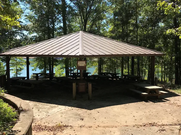
Houston Shelter is a group picnic site nestled on the shore of Lake Lewis Smith in Bankhead National Forest. This is a popular recreation area offering a variety of activities. Shelter is first come first served. Site is walk-up only.Facilities
The picnic facility offers tables, flush toilets, grills and drinking water. A boat ramp and showers are nearby.Natural Features
Bankhead National Forest is located in northwestern Alabama. The prominent feature of the area is the Sipsey Wilderness.Known as "The Land of a Thousand Waterfalls," the Sipsey Wilderness encompasses an area of abundant streams, old-growth forests, limestone bluffs and lush canyons.
Lake Lewis Smith boasts more than 500 miles of shoreline marked by high rock bluffs. The water is clear and deep and provides excellent fishing.
Recreation
Day users can enjoy a beautiful sand swimming beach. Other activities include motorized and non-motorized boating and water skiing.Anglers can fish for Kentucky Spotted Bass and Hybrid Striped Bass. There are also hiking trails in the area, including the 1.4 mile High Rock Loop and the nearly 2 mile Fox Run Loop.
Important Notices
- Gate hours are from 9 a.m. to 7 p.m.; after hours access is available
- Fee authorizes 1 vehicle; additional vehicles must purchase a day-use permit for $4
- Parking is 300 feet away from the shelter; people may be dropped off at the shelter
- Click here for more information about National Forests in Alabama
- Don't Move Firewood: Help protect our forests! Prevent the spread of tree-killing pests by obtaining firewood at or near your destination and burning it on-site. Moving firewood is illegal in some states. Visit dontmovefirewood.org to learn more.
- Site is walk-up only.
Available Activities
- Swimming Site - Swimming Site
- Hiking - Hiking
- Boating - Boating
- Day Use Area - Day Use Area
- Fishing - Fishing
- Water Activities - Water Activities
- Water Access - Water Access
- Swimming - Swimming
- Birding - Birding
- Canoeing - Canoeing
- Kayaking - Kayaking
- Jet Skiing - Jet Skiing
- Ranger Station - Ranger Station
- Water Skiing - Water Skiing
- Wilderness - Wilderness
Directions
About 50 miles southwest of Decatur, take Highway 278 east from Double Springs for 8 miles. Turn south on County Road 63 and continue for 4 miles. Turn right onto Forest Service Road 118 and travel a mile to the campground.
Contact Information
Phone: 205-489-5111
PO BOX 278DOUBLE SPRINGS, AL 35553