Timber Butte Cabin
TIMBER BUTTE CABIN
Part of Willamette National Forest
Overview
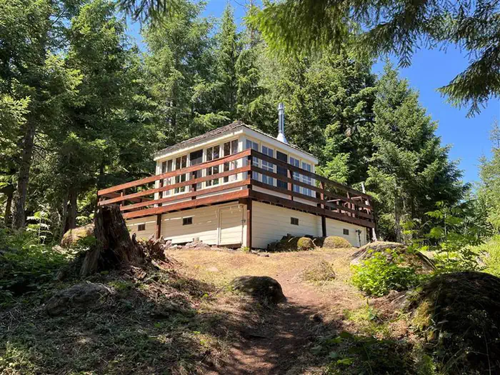
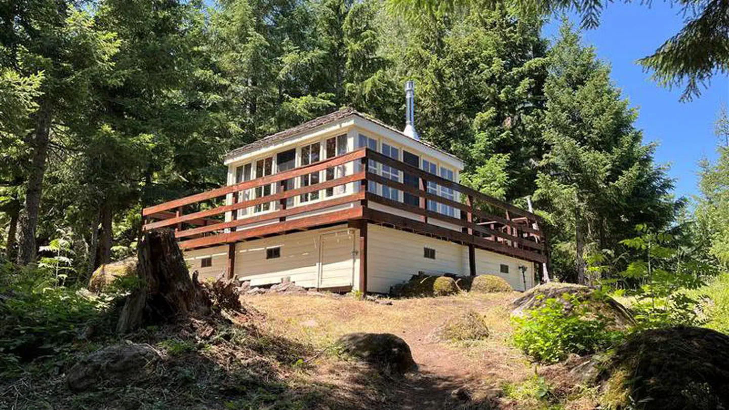
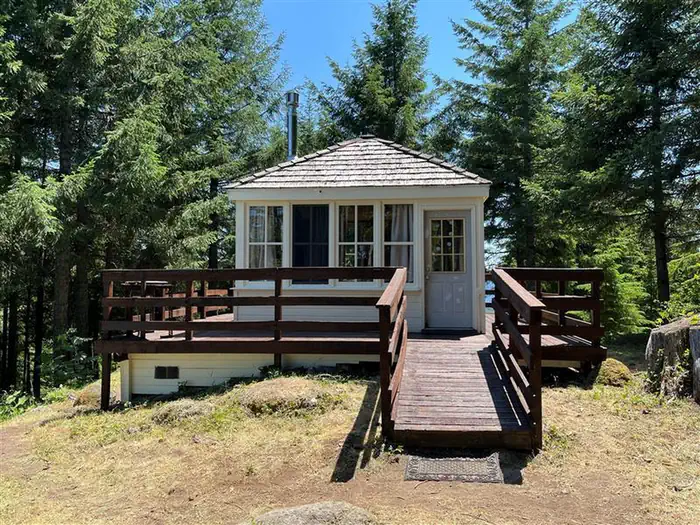
Timber Butte Lookout is located in the Fall Creek area of the Willamette National Forest at an elevation of 3,650 feet 19 miles from Lowell, Oregon. The cabin is open from mid-April through late October, offering the chance to enjoy beautiful scenery and a variety of recreational activities. The lookout was constructed in 2005 as a replica of the L-4 gabled-style lookout with wooden catwalk commonly built in this region in the 1930s. It was built through volunteer efforts with a $10,000 grant from Lane County and other contributions by individuals and organizations. The cabin can be accessed by car, but guests should expect to walk about 300 feet uphill from their parking spot. A high-clearance vehicle is recommended.Facilities
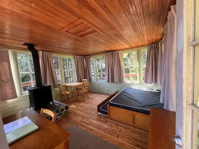
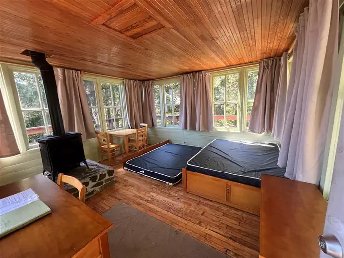
The 14x14-ft. cabin is encircled by a catwalk. It sits slightly off the ground and is accessed by a ramp. The cabin accommodates 4 people and contains a double bed with sleeping pad, a propane heating stove, fire extinguisher, broom and dustpan. A 3-burner propane cook top is located on the deck. Propane is provided. Dishes and cookware are available. A picnic table and fire ring are located in a nearby group of trees, and a vault toilet is located about 300 feet away. No drinking water or electricity is provided. Guests must bring their own supply of drinking water. Items such as bedding, lanterns or flashlights, matches, extra toilet paper, first aid supplies, trash bags, dish soap, towels and an ice chest are not available. Guests are expected to pack out their trash and clean the cabin before leaving.Natural Features
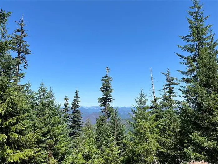
The lookout offers panoramic views of the Cascade Mountains and the surrounding evergreen forest. On clear days, guests may see Mount Jefferson and the peaks of the Three Sisters. Willamette National Forest offers prime habitat for such species as Roosevelt elk, black bear, bald eagles, black tail deer and bobcats, among other wildlife.Recreation
The lookout is located near the Fall Creek Trail Area. Several hiking trails can be accessed from this area, including the Fall Creek National Recreation Trail, which also offers opportunities for fishing and picnicking. Swimming holes can also be found along this trail.Hunting is another popular activity in this area.
Nearby Attractions
Guests can explore up to 20 historic covered bridges in nearby Lane County by car. Within 10 miles there is creek access, fishing, swimming, and hiking.Important Notices
THE HEATING STOVE INSIDE THE CABIN IS A PROPANE GAS STOVE, ATTEMPTING TO BURN FIREWOOD INSIDE THE STOVE WILL RESULT IN SERIOUS INJURY, EXPLOSION OR WORSE, ABSOLUTELY NO BURNING FIREWOOD IN STOVE!
No drinking water is available at the cabin
Entry to the cabin is by combination lock; guests must contact the Middle Fork Ranger District Office (541) 782-2283 at least several days prior to arrival for the combination. Call for the combination weekdays only; the site administrator is not available on weekends. It is very important that you relock the gate behind you after passing through to prohibit others from interrupting your stay.
During periods of severe fire danger, open campfires may be prohibited
There is no tent, trailer or RV camping at the site
Guests must bring their own trash bags and pack out all trash
Guests must clean out the cabin before departure
Pets are not allowed
Smoking is not permitted
Check in at 12PM. Check out at 11AM
Guests should contact the Ranger District prior to arriving to check on any restrictions or conditions, such as fire, road closures or weather, that may affect their visit
Learn more about the Willamette National Forest
Don't Move Firewood: Please protect Pacific Northwest forests by preventing the spread of invasive species. Firewood can carry insects and diseases that can threaten the health of our western forests. You can make a difference by obtaining and burning your firewood near your camping destination. Visit Dontmovefirewood.org for further information.
Available Activities
- Wildlife Viewing - Wildlife Viewing
- Hunting - Hunting
- Camping - Camping
- Birding - Birding
Directions
<p><strong>Do not use the Google map suggested routes</strong> as they will take you through areas with many rock/logging trucks on one lane roads. Total mileage from Lowell to Timber Butte Cabin is 19 miles and will be around a 45 minute drive time. From Interstate 5 (I-5), take Highway 58 East (Exit 188) and travel for 13 miles toward Oakridge. Turn left off of Highway 58 at the Lowell covered bridge and proceed toward the town of Lowell. At the 4-way junction in Lowell, turn left onto Boundary Road. Take the next right (Moss Street) for 2 miles to the crossroads of Unity, where you'll see another covered bridge. Turn right (east) onto Big Fall Creek Road (18) and proceed 1/2 mile and turn right onto FSR 1802 (Winberry Creek Road), continue up approx. 12 miles. Turn left onto FSR 1821 and proceed approx. 1.5 miles. At the T junction turn left and continue 0.5 miles. Then turn left onto FSR 1821-168 for 1 mile, beware of logging trucks for this one mile stretch. Turn right onto FSR 1816-175 and after 100 yards turn left onto FSR 1816-131 (gated entrance road to the cabin). Look for the signs that say TB with arrows that point the way after you reach the 1821.</p><p><strong>The last mile of the road is brushy and road conditions make a high clearance vehicle necessary.</strong></p><p>Cabin parking is located about 1 mile up FSR 1816-131, adjacent to the outhouse.</p>
Contact Information
Phone: 541-782-2283
46375 Highway 58Westfir, OR 97492