Sunshine Guard Station
SUNSHINE GUARD STATION
Part of Malheur National Forest
Overview
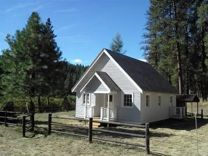
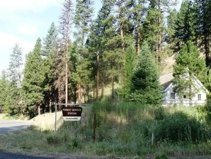
Sunshine Guard Station is situated along John Day River in the Malheur National Forest at an elevation of 3,700 feet, about 43 miles northeast of John Day, Oregon. The former guard station was built in 1936 and until the 1990s was used alternatively as a bunkhouse or a work station for fireguards.The guard station can be accessed by vehicle. Guests are responsible for their own travel arrangements and safety, and must bring several of their own amenities.
Facilities
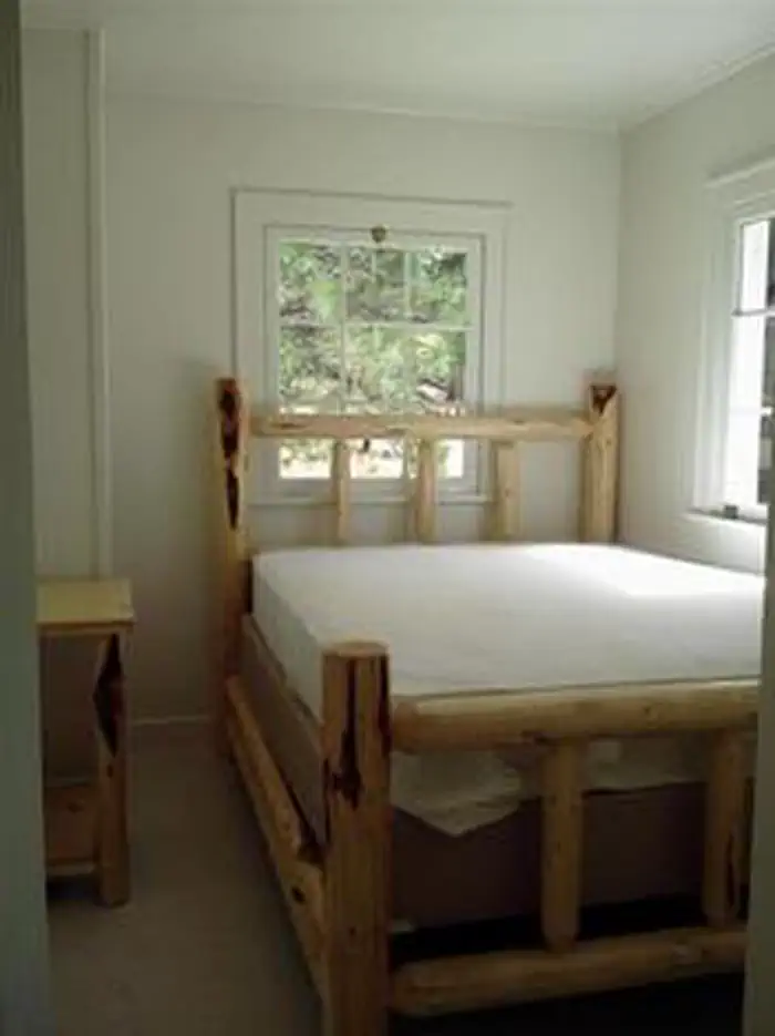
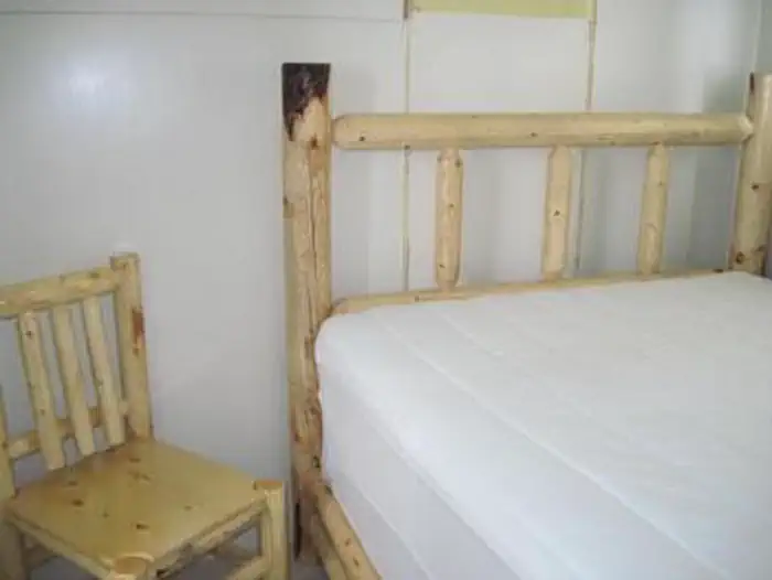
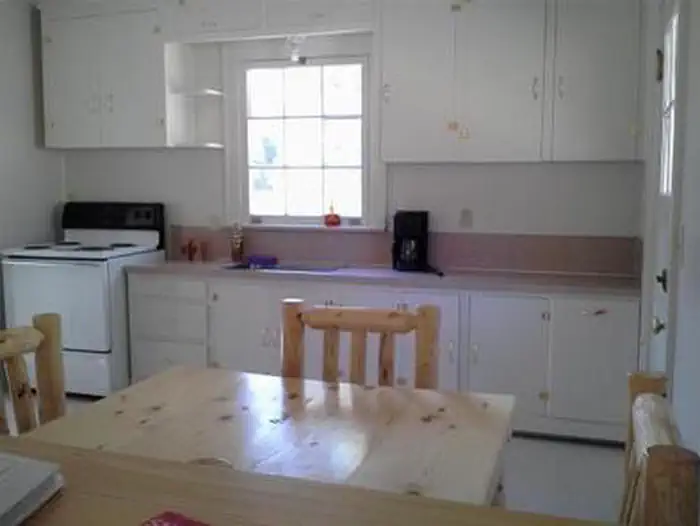
This rustic four-room cabin sleeps up to six and has a kitchen, living room, and two bedrooms. The living room is furnished with a futon, two chairs, a coffee table and an end table. The larger bedroom is furnished with a queen-sized bed and a closet, while the smaller bedroom offers a queen-sized bed and a chair.
The kitchen is furnished with a table and four chairs, electric refrigerator, and stove. Electric heat and lights are provided, and a vault toilet is located next to the cabin.
There is no water in the cabin. Guests must bring their own water for drinking, cooking and washing.
Roads to the guard station are paved and maintained for summer and winter access.
No pets allowed in the Guard Station.
Natural Features
The guard station has a view of the Middle Fork of the John Day River. The Vinegar Hill Forest/Indian Rock Scenic Area is nearby. The 25,000-acre area includes a 10 mile ridgeline that comprises the summit of the Greenhorn Range in the Blue Mountains of eastern Oregon. Outcrops of serpentine, rhyolite, basalt, granite, and shale can be seen. Agates can also be found on some of the rocky slopes.
Wildlife includes elk and deer, songbirds and, in the river, steelhead and trout. Nearly every type of alpine wildflower found west of the Rockies can be blooming at different times in this area.
Magone Lake is about 20 miles west of the guard station.
Recreation
Recreational options include fishing for steelhead and rainbow trout in the John Day River. Restrictions apply; visitors should refer to Oregon State regulations.
There are hiking trails and back roads to the north of the guard station that lead into the nearby Vinegar Hill / Indian Rock Scenic Area.
Wildlife viewing is popular, as is scenic driving.
Contact Info
For facility specific information, please call (541) 575-3000.Important Notices
Please contact the Malheur National Forest Recreation department before arriving at the cabin rental to check on any restrictions or conditions, such as fire or road closures, weather or storms.
County Road 20 along the Middle Fork John Day River, accessing Sunshine Guard Station, receives limited winter maintenance. On occasion the road may be closed or entirely inaccessible. Also, there are no services along the Middle Fork of the John Day River should you need assistance. Please be sure to contact the Blue Mountain Ranger District at 541-575-3000 prior to visiting the Guard Station to check conditions. Be prepared and self-sufficient when traveling on the Malheur National Forest and travel at your own risk.
Sunshine Guard Station is in a remote forest location with no mobile phone coverage.
The cabin does not have water; guests must bring their own water for drinking, cooking, and washing.
Guests must bring bedding, pillows, and/or sleeping bags as well as a flashlight or lantern for emergencies, first aid kit, washcloths and towels and dish soap.
Guests must bring trash bags and pack out their own trash.
Guests must clean the cabin before their departure.
The Middle Fork of the John Day River can be seasonally "buggy", including box-elder bugs and houseflies. Recreation staff (and guests) do their best to keep the facility clean and to prevent insects from entering. We also provide a vacuum cleaner for use by guests. Nonetheless, you may encounter insects within the guard station. We apologize for the inconvenience, and if the situation warrants recreation staff attention, please call 541-820-3800 and we will do our best to address the issue.
Entry to the cabin is by combination lock; the combination to the guard station will be in your confirmation letter.
Most of the area around the cabin is closed to snowmobiles, except on open roads, to protect winter range for elk and deer.
- This is bear country; food should be stored properly; learn more about bear and other safety precautions
Don't Move Firewood: Please protect Pacific Northwest forests by preventing the spread of invasive species. Firewood can carry insects and diseases that can threaten the health of our western forests. You can make a difference by obtaining and burning your firewood near your camping destination. Visit Dontmovefirewood.org for further information.
Learn more about the The Malheur National Forest
Available Activities
- Hunting - Hunting
- Hiking - Hiking
- Camping - Camping
- Biking - Biking
- Fishing - Fishing
Directions
From Prairie City, OR., travel east on US Highway 26 approximately 13 miles to the junction of US Highway 7. Turn left on US Highway 7, travel one mile to the junction with County Road 20/ Middle Fork Road. Turn left and follow County Road 20 approximately 13 miles, the guard station will be on the right.
Contact Information
Phone: 541-820-3800
431 Patterson Bridge RdJohn Day, OR 97845