Spillway Recreation Area
SPILLWAY RECREATION AREA
Part of Wappapello Lake
Overview
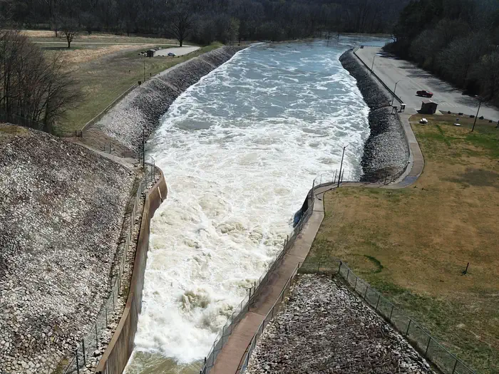
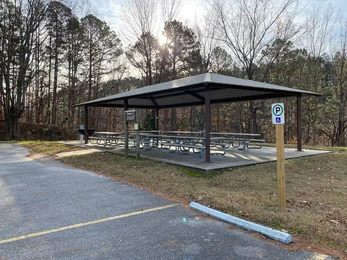
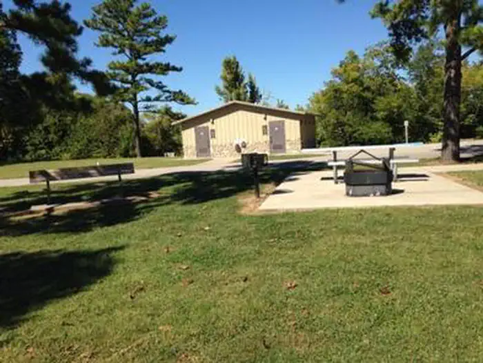
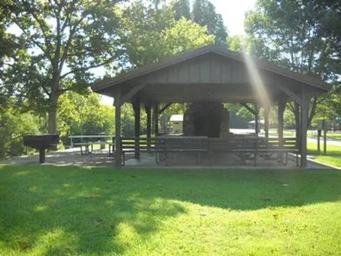
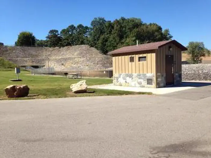
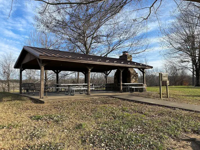
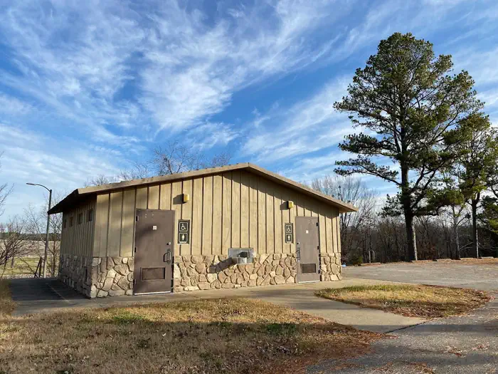
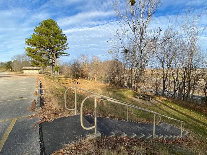
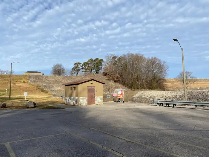
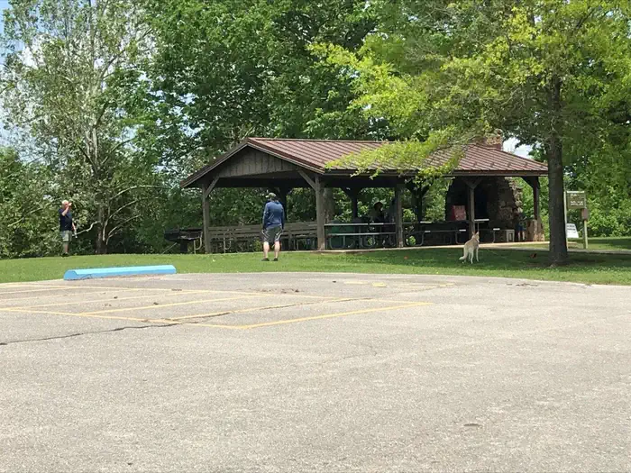
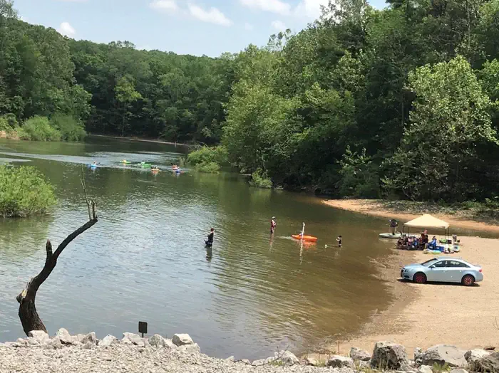
The Spillway Recreation Area's iconic outllet structure has delighted visitors to Wappapello Lake since 1937. Feeding the St. Francis River, the spillway banks are a favorite location for fisherman. A one lane boat ramp provides river access, the lower boat ramp area is also an ideal location for kayakers with easy bank access for launching. 11 picnic areas and 2 accessible picnic shelters are available for use year round. Each shelter has a large capacity grill, electricity, water fountains and water hydrants available, Shelter 4 has a large wood burning fireplace in the covered area. A 6 stall, accessible restroom is centrally located within the recreation area.
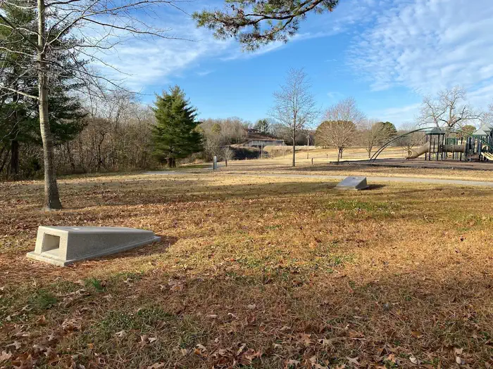
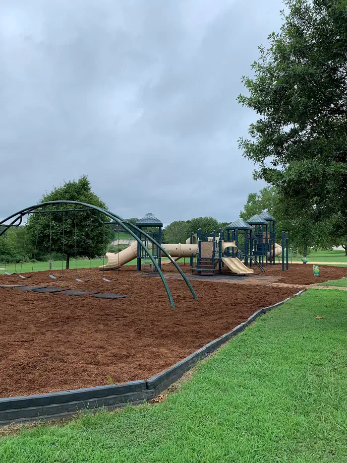
A sand volleyball court, large playground, horseshoe pits, cornhole boards and a Lake View Trailhead offer recreational opportunities for all ages and interests.
Click here to take a virtual tour of the facilities at Wappapello Lake!
Facilities
This day use area includes two large picnic shelters, 8 picnic sites, a volleyball court, playground, horseshoe pits and bank fishing.Natural Features
Wappapello Lake has a seemingly endless string of secluded coves hugged by a winding, wooded shoreline. The public recreation area spans 45,000 acres in the southeastern Ozark foothills.Recreation
Boating and fishing are the most popular activities with largemouth bass, crappie, bluegill, white bass and channel catfish, among other species.Pine Ridge Natural Trail, a 3/4-mile double loop, starts at the Spillway Recreation Area and provides an excellent way to explore the beautiful woodlands.
Nearby Attractions
The extensive 33-mile Ozark Trail, starts just south of Sam A. Baker State Park and winds along the west side of the St. Francis River and Wappapello Lake.Contact Info
This location is unstaffed. To speak with our main office for general information, please call: (573) 222-7500.Important Notices
- No overnight camping allowed
- Don't Move Firewood: Protect your forests from tree-killing pests by buying your firewood locally and burning it on-site. Visit Dontmovefirewood.org for further information.
- Existing day use shelter reservations may be cancelled by the U.S. Army Corps of Engineers if the facility is closed due to flooding, elevated security threats, maintenance problems, etc. Reservations may also be cancelled when the reservation conflicts with large public special events that would negatively impact a private event at the shelter. For these reasons, customers should consider an alternate date or location in the event a closure is necessary. We apologize for any inconvenience this may cause.
The U.S. Army Corps of Engineers provides free, family-oriented programs throughout the calendar year, for more information about scheduled events you can contact the management office at 573-222-7500 or on the Wappapello Lake Facebook page.
Attention All Recreation Users: If you would like to hold an event or wedding at any of the project’s day use shelters, boat ramps, or any recreation area please call or visit the USACE Wappapello Lake project office to obtain the special use or event permit REQUIRED.
These permits are required if you are hosting: a large gathering greater than 50 people, fishing tournaments, 5k’s, weddings, use of a bounce house/water slide of any kind, ETC.
Please note that if events are held that require, but do not possess a special use or special event permit may be subject to a WRITTEN CITATION. Per Title 36 CFR 327.21(a)
If you are planning on hosting an event and it does not fall under these specific criteria, please contacting with the USACE Wappapello Lake Project Office at 1(573) 222-7500 or messaging us on our Facebook page.
Available Activities
- Fishing - Fishing
- Day Use Area - Day Use Area
- Water Access - Water Access
Directions
From St. Louis, Missouri: Take I-55 South to US Highway 67 South to State Highway D (located just South of Greenville, Missouri). Take State Highway D south for 20 miles to State Highway T. Cross Wappapello Dam and take the first left onto a paved road and watch for signs. <br /><br /> From Poplar Bluff, Missouri: Take US Highway 60 East to State Highway T North. Go North on State Highway T for 22 miles and watch for signs.
Contact Information
Phone: 573-222-8562
10992 HIGHWAY TWAPPAPELLO, MO 63966-9603
Rental Options
Available Campsites
- Site S04, Loop SPILLWAY REC, Type Group Shelter Electric
- Site S06, Loop SPILLWAY REC, Type Group Shelter Electric