Table Mountain (Angeles)
TABLE MOUNTAIN (ANGELES)
Part of Angeles National Forest
Overview
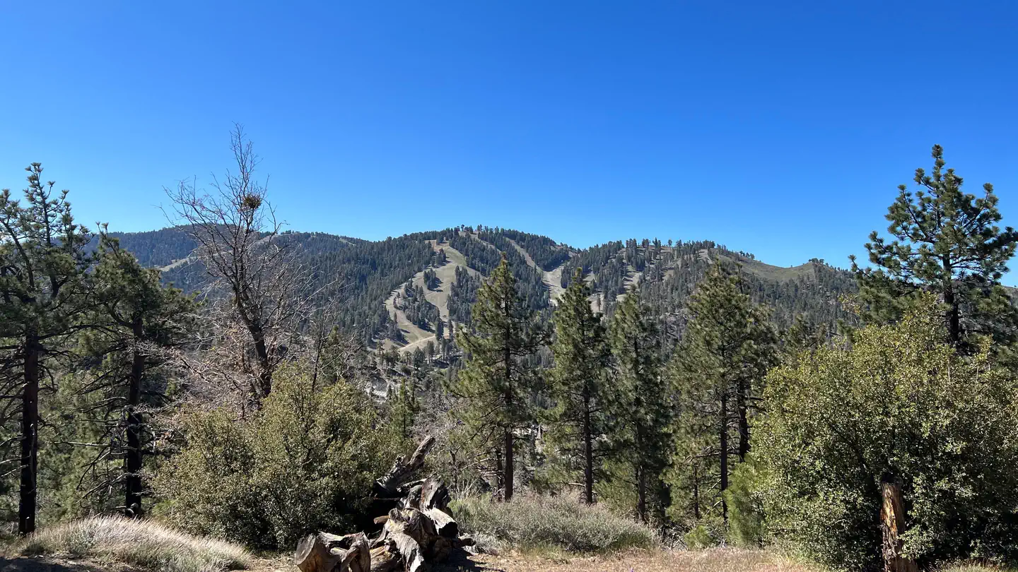
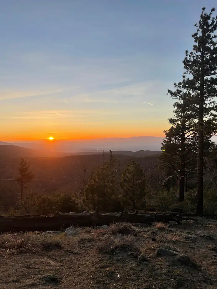
Table Mountain, just a short journey northwest of the Los Angeles metro area, provides a beautiful escape from urban life. Campers will find hiking, mountain biking, birding and countless other recreation opportunities. The surrounding landscape is also ideal for scenic drives.
The campground sits in the Angeles National Forest, spanning 694,187 acres over most of the San Gabriel Mountain range. The forest boasts spectacular scenery and 557 miles of hiking and equestrian trails.
Facilities
- Campsites range from level meadow locations to shaded, hilly sites. All sites are reasonably close to vault toilets and have paved spurs and fire pits. Water spigots are spaced about every six sites.
- The amphitheater site is available for day-use only and accommodates up to 150 guests and 30 vehicles. Prices vary based on time of year. To RESERVE THE AMPHITHEATER contact Tyler Shippy at tyler_shippy@mthigh.com or call (888) 754-7878 ext 7834.
Natural Features
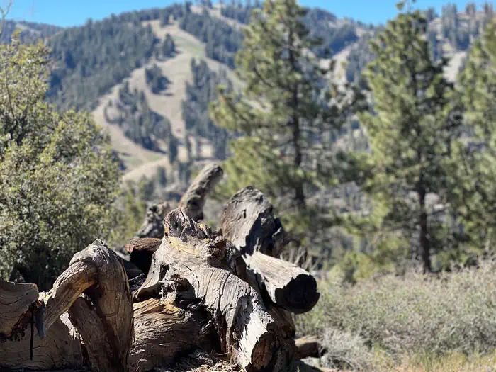
Table Mountain is set in a hilly, oak and pine forest with two large meadows and beautiful views. At an elevation of 7,000 feet, summer temperatures average in the low 80s with cool nights.Recreation
The Table Mountain Nature Trail runs through the campground, and visitors can spot birds, squirrel, deer and the California condor.The Angeles Crest Scenic Byway is a highly recommended drive that extends through oak thickets, chaparral, high desert landscapes and pine tree forests along the highest and most scenic ridges of the San Gabriel mountain range.
Nearby Attractions
The Angeles Crest Highway, part of California State Route 2, is a scenic byway that meanders through oak thickets, chaparral, high desert landscapes and pine tree forests.
The ski resort town of Wrightwood is very close by. Restaurants and a disc golf course can be found at the North Resort.
Take a hike on the Blue Ridge Trail or the Pacific Crest Trail. The Pacific Crest Trail is an impressive path that starts in Mexico and zigzags its way through Angeles and continues north across California, Oregon and Washington.
Contact Info
For facility specific information, please call (760) 316-7828.Important Notices
It is advised that transportation remain on-site with your group in case of emergency evacuations.
Fire restrictions may be enforced due to dry conditions.
Bears frequent the area; all food must be kept in approved containers.
First-come, first-served sites may be available.
A fee will be charged for additional vehicles.
Be aware that some of our campsites don't have the space to back in a Travel Trailer. A trailer is NOT an RV. Check each campsite details before you arrive.
- Don't Move Firewood: Protect California's forests from tree-killing pests by buying your firewood locally and burning it on-site. For more information visit firewood.ca.gov.
Available Activities
- Day Use Area - Day Use Area
- Wildlife Viewing - Wildlife Viewing
- Hiking - Hiking
- Camping - Camping
- Biking - Biking
- Scenic Drive - Scenic Drive
- Mountain Biking - Mountain Biking
Directions
From Wrightwood, California, take State Route 2 west for 2.4 miles to the Table Mountain Campground sign and continue to follow signs into the campground.
Contact Information
Phone: 760-249-3526
At the top of Table Mt. RoadWRIGHTWOOD, CA 92397
Rental Options
Available Campsites
- Site 093, Loop CHER, Type Standard Nonelectric
- Site 090, Loop CHER, Type Standard Nonelectric
- Site 024, Loop BROK, Type Standard Nonelectric
- Site 056, Loop MOHA, Type Standard Nonelectric
- Site 051, Loop MOHA, Type Standard Nonelectric
- Site 100, Loop ZUNI, Type Standard Nonelectric
- Site 102, Loop ZUNI, Type Standard Nonelectric
- Site 008, Loop TABL, Type Standard Nonelectric
- Site 081, Loop APAC, Type Standard Nonelectric
- Site 106, Loop ZUNI, Type Standard Nonelectric
- Site 034, Loop BROK, Type Standard Nonelectric
- Site 107, Loop ZUNI, Type Standard Nonelectric
- Site 097, Loop CHER, Type Standard Nonelectric
- Site 048, Loop OSAG, Type Standard Nonelectric
- Site 084, Loop CHER, Type Standard Nonelectric
- Site 87-88 DBL, Loop CHER, Type Standard Nonelectric
- Site 083, Loop CHER, Type Standard Nonelectric
- Site 066, Loop PIMA, Type Standard Nonelectric
- Site 067, Loop PIMA, Type Standard Nonelectric
- Site 045, Loop OSAG, Type Standard Nonelectric
- Site 022, Loop BROK, Type Standard Nonelectric
- Site 116, Loop ZUNI, Type Standard Nonelectric
- Site 118, Loop ZUNI, Type Standard Nonelectric
- Site 038, Loop BROK, Type Standard Nonelectric
- Site 017, Loop TWIS, Type Standard Nonelectric
- Site 068, Loop PIMA, Type Standard Nonelectric
- Site 013, Loop KNOL, Type Standard Nonelectric
- Site 005, Loop TABL, Type Standard Nonelectric
- Site 14-15 DBL, Loop TWIS, Type Standard Nonelectric
- Site 070, Loop APAC, Type Standard Nonelectric
- Site 054, Loop MOHA, Type Standard Nonelectric
- Site 010, Loop TABL, Type Standard Nonelectric
- Site 061, Loop PIMA, Type Standard Nonelectric
- Site 032, Loop BROK, Type Standard Nonelectric
- Site 114, Loop ZUNI, Type Standard Nonelectric
- Site 117, Loop ZUNI, Type Standard Nonelectric
- Site 63-64 DBL, Loop PIMA, Type Standard Nonelectric
- Site 043, Loop OSAG, Type Standard Nonelectric
- Site 004, Loop TABL, Type Standard Nonelectric
- Site 57-58 DBL, Loop MOHA, Type Standard Nonelectric
- Site 053, Loop MOHA, Type Standard Nonelectric
- Site 108, Loop ZUNI, Type Standard Nonelectric
- Site 020, Loop BROK, Type Standard Nonelectric
- Site 071, Loop APAC, Type Standard Nonelectric
- Site 105, Loop ZUNI, Type Standard Nonelectric
- Site 029, Loop BROK, Type Standard Nonelectric
- Site 031, Loop BROK, Type Standard Nonelectric
- Site 080, Loop APAC, Type Standard Nonelectric
- Site 069, Loop PIMA, Type Standard Nonelectric
- Site 009, Loop TABL, Type Standard Nonelectric
- Site 094, Loop CHER, Type Standard Nonelectric
- Site 110, Loop ZUNI, Type Standard Nonelectric
- Site 021, Loop BROK, Type Standard Nonelectric
- Site 023, Loop BROK, Type Standard Nonelectric
- Site 039, Loop BROK, Type Standard Nonelectric
- Site 006, Loop TABL, Type Standard Nonelectric
- Site 075, Loop APAC, Type Standard Nonelectric
- Site 109, Loop ZUNI, Type Standard Nonelectric
- Site 018, Loop TWIS, Type Standard Nonelectric
- Site 059, Loop MOHA, Type Standard Nonelectric
- Site 044, Loop OSAG, Type Standard Nonelectric
- Site 115, Loop ZUNI, Type Standard Nonelectric
- Site 030, Loop BROK, Type Standard Nonelectric
- Site 042, Loop MOHA, Type Standard Nonelectric
- Site 049, Loop OSAG, Type Standard Nonelectric
- Site AMPHIT, Loop APAC, Type Group Shelter Nonelectric
- Site 096, Loop CHER, Type Standard Nonelectric
- Site 113, Loop ZUNI, Type Standard Nonelectric
- Site 060, Loop PIMA, Type Standard Nonelectric
- Site 007, Loop TABL, Type Standard Nonelectric
- Site 033, Loop BROK, Type Standard Nonelectric
- Site 112, Loop ZUNI, Type Standard Nonelectric
- Site 041, Loop BROK, Type Standard Nonelectric
- Site 065, Loop PIMA, Type Standard Nonelectric
- Site 011, Loop TWIS, Type Standard Nonelectric
- Site 099, Loop ZUNI, Type Standard Nonelectric
- Site 079, Loop APAC, Type Standard Nonelectric
- Site 074, Loop APAC, Type Standard Nonelectric
- Site 072, Loop APAC, Type Standard Nonelectric
- Site 104, Loop ZUNI, Type Standard Nonelectric
- Site 040, Loop BROK, Type Standard Nonelectric
- Site 055, Loop MOHA, Type Standard Nonelectric
- Site 019, Loop TWIS, Type Standard Nonelectric
- Site 086, Loop CHER, Type Standard Nonelectric
- Site 111, Loop ZUNI, Type Standard Nonelectric
- Site 103, Loop ZUNI, Type Standard Nonelectric
- Site 073, Loop APAC, Type Standard Nonelectric
- Site 036, Loop BROK, Type Standard Nonelectric
- Site 092, Loop CHER, Type Standard Nonelectric
- Site 035, Loop BROK, Type Standard Nonelectric
- Site 012, Loop KNOL, Type Standard Nonelectric
- Site 095, Loop CHER, Type Standard Nonelectric
- Site 46-47 DBL, Loop OSAG, Type Standard Nonelectric
- Site 085, Loop CHER, Type Standard Nonelectric
- Site 062, Loop PIMA, Type Standard Nonelectric
- Site 089, Loop CHER, Type Standard Nonelectric
- Site 052, Loop MOHA, Type Standard Nonelectric
- Site 098, Loop ZUNI, Type Standard Nonelectric
- Site 091, Loop CHER, Type Standard Nonelectric
- Site 037, Loop BROK, Type Standard Nonelectric
- Site 016, Loop TWIS, Type Standard Nonelectric
- Site 25-28 QUAD, Loop BROK, Type Group Standard Nonelectric
- Site 050, Loop OSAG, Type Standard Nonelectric
- Site 101, Loop ZUNI, Type Standard Nonelectric