King'S Mountain Point Picnic Pavilion (NC)
KING'S MOUNTAIN POINT PICNIC PAVILION (NC)
Part of National Forests in North Carolina
Overview
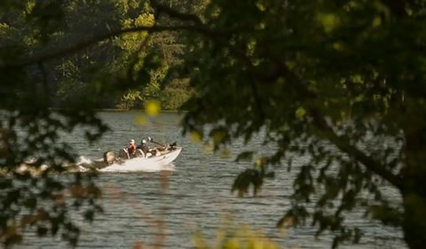
King's Mountain Point Day Use Area is located on the shores of Badin Lake north of Troy, NC in Montgomery County. The biggest fishing hole in the Uwharrie National Forest is Badin Lake. This 5,350-acre impoundment of the Yadkin River was built in 1917 by the Aluminum Company of America (ALCOA) to generate hydroelectric power for the aluminum plant at Badin. The eastern shore borders the National Forest and the lake is well stocked with catfish, bream, largemouth, white and striped bass.Facilities
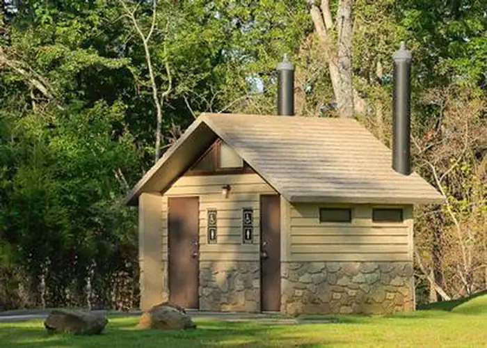
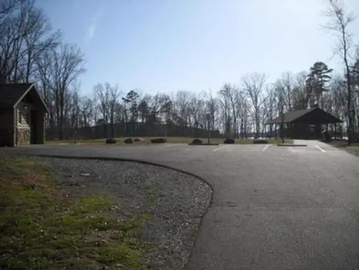
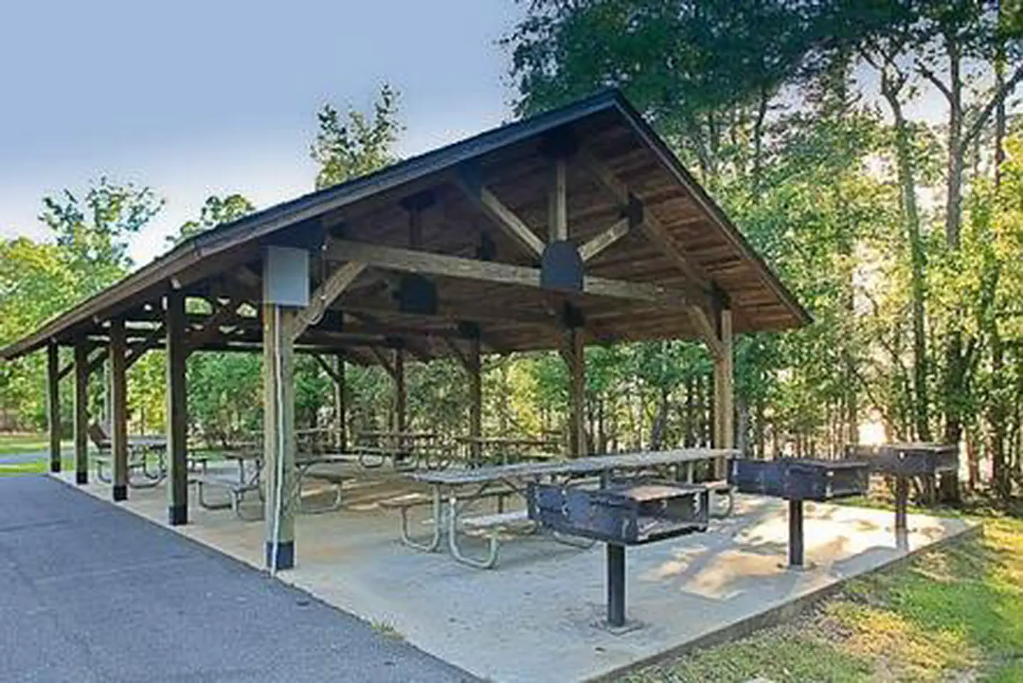
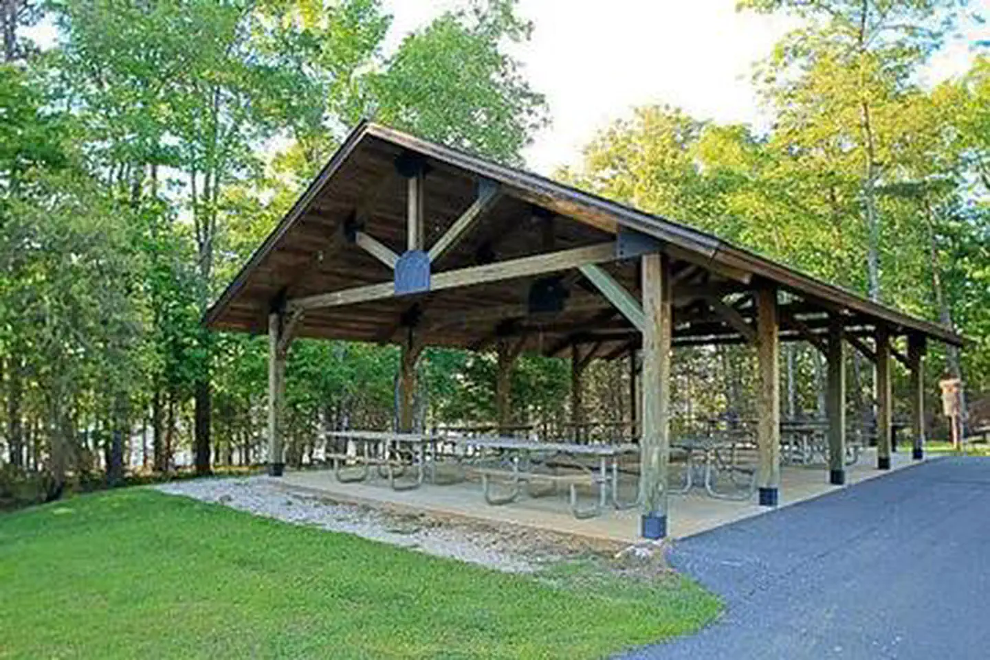
King's Mountain Point Day Use Area offers a picnic shelter with 9 picnic tables and 3 large BBQ grills. There are 6 electrical outlets of 30 amps at the picnic pavilion, but no lights built into the pavilion. The pavilion is accessible and it has flush toilets located near this facility. Additionally, there are 3 vault toilets at the day use area.Natural Features
This picnic shelter is located in a large field bordered by trees and is located on Badin Lake in the Uwharrie National Forest. This point is forested by mixed hardwoods and pines. This area has great fishing for all anglers to enjoy.Recreation
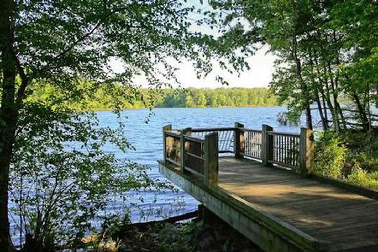
The King's Mountain Point Day Use Area offers access to 4 accessible fishing piers, the Badin Lake Hiking Trail and a 0.5 mile paved, accessible trail around the day use area with splendid views of the lake. Additionally, there is a 9 hole, disc golf course. You can bring your own Frisbees or Discs or sign them out from our Day Use Host that is on site.Important Notices
Throughout the year the Uwharrie National Forest performs prescribed burns. Some of these burns will be next to and around this recreation facility and may cause smokey conditions during the actual burning and for the days following the burns. Sometimes we do not make a decision until the very morning that we will be able to do the burn due to weather and staffing. If you have questions about the prescribed burning possibility please call the Uwharrie National Forest Ranger District office at 910-576-6391 for updated information.
The King's Mountain Point Day Use Area is open from 7 am to 10 pm each day.
Camping is Prohibited.
Horses are Prohibited.
Unlicensed vehicles are Prohibited.
Alcohol is Prohibited.
Fireworks are Prohibited.
There are flush toilets near the pavilion. There are several hydrants for potable water around the facility. The pavilion has electrical outlets. The pavilion is available by reservation only.
There are 34 individual picnic sites with pedestal grills around the day use area that can be used for free without reservations. There are 3 vault toilets around the facility.
You must clean up all of your trash and dispose of it in the trash cans provided at the recreation site.
There are 2 designated handicapped parking spaces near the pavilion. You can drop off your picnic supplies when you arrive, but then move your cars to a proper parking space if you do not have a handicapped parking pass.
There are 3 large grills located at the pavilion. The grills provided on site are for charcoal grilling. You must provide your own charcoal and clean out the grills before you leave. Make sure charcoal is cooled off before putting in trash receptacles. Talk to day use host about proper disposal of ashes and trash.
There are horseshoe pits, a Disc golf course, a 0.5 mile paved, accessible path around the site. You have to provide your own horseshoes and Frisbees / Discs. There is a large field next to the pavilion that can be used for volleyball, tag, etc.
There are 4 accessible fishing piers on site anyone older than 16 years must have a valid fishing license before fishing.
Directly access the Badin Lake Hiking Trail that is a 5.6 mile trail along the shoreline.
- Don't Move Firewood: Help protect our forests! Prevent the spread of tree-killing pests by obtaining firewood at or near your destination and burning it on-site. Moving firewood is illegal in some states. Visit dontmovefirewood.org to learn more.
Notifications and Alerts
Our floating fishing pier is currently being renovated with estimated completion in Spring of 2027. Some of the smaller standing piers may also be under construction during your visit. Fishing from the shoreline is allowed in the meantime, thank you for you patience and understanding.
Available Activities
- CAMPING - Camping
- BOATING - Kayak Rentals
Directions
<b> From the north: </b> get onto NC Hwy 109 South (near Denton) and take it south toward Troy. Cross over NC Hwy 49 and continue south approximately 8 miles into the community of Eldorado and turn right onto Mullinix Road (State Road 1154). There is a big brown sign directing people to the Badin Lake Recreation Area. Take Mullinix Road to the stop sign and turn right onto Forest Road 544 (McLean's Creek Rd); continue to stop sign and turn right onto Forest Road 597 (Badin Lake Road); take the first left onto Forest Road 597A and continue on this road following signs for the picnic area and the picnic pavilion is on the hill opposite the entrance to the day use area. <br /> <br /> <b> From the south: </b> get onto NC Hwy 109 North (near Troy) and take it north toward the community of Uwharrie. Continue north approximately 3 miles and take the 2nd left after you cross over the Uwharrie River onto Mullinix Road (State Road 1154). Then follow the directions described above from Mullinix Road.
Contact Information
Phone: 910-576-6391
Uwharrie National Forest, 789 NC Hwy 24/27 EastTroy, NC 27371
Rental Options
Available Campsites
- Site GS01 (Sun,M,T,W,TH,F,Sat), Loop KING'S MOUNTAIN POINT PICNIC PAVILION (NC), Type Group Shelter Electric
- Site GS01 (Sat.-Sun.), Loop KINGS MOUNTAIN POINT PICNIC PAVILION (NC), Type Group Shelter Electric
- Site GS01 AM (Mon.-Fri.), Loop KING'S MOUNTAIN POINT PICNIC PAVILION (NC), Type Group Shelter Electric
- Site GS01 PM (Mon.-Fri.), Loop KING'S MOUNTAIN POINT PICNIC PAVILION (NC), Type Group Shelter Electric
- Site GS01 PM (Mon.-Fri.), Loop KINGS MOUNTAIN POINT PICNIC PAVILION (NC), Type Group Shelter Electric
- Site GS01 AM (Mon.-Fri.), Loop KINGS MOUNTAIN POINT PICNIC PAVILION (NC), Type Group Shelter Electric