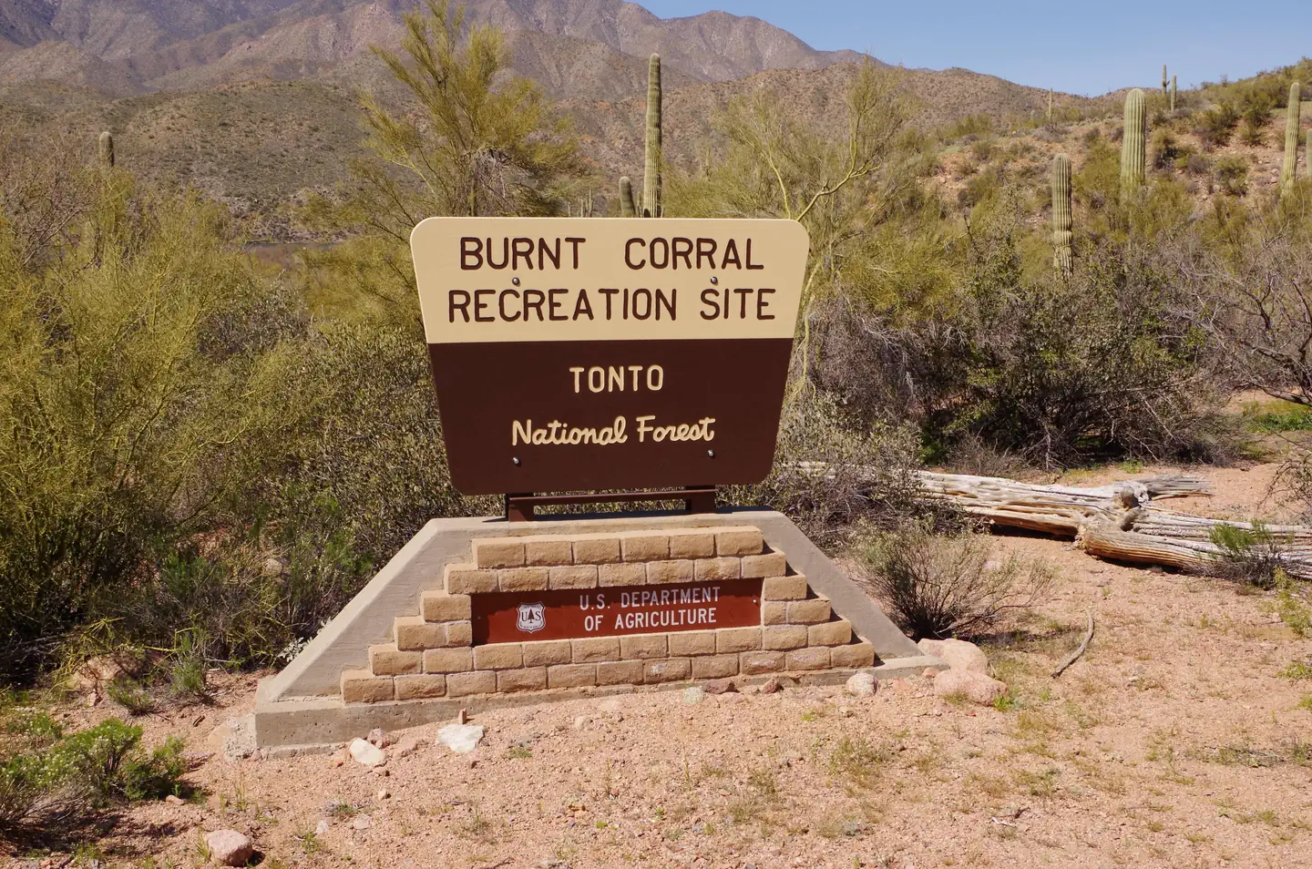
Burnt Corral Campground
Burnt Corral Campground
Part of Tonto National Forest
Overview
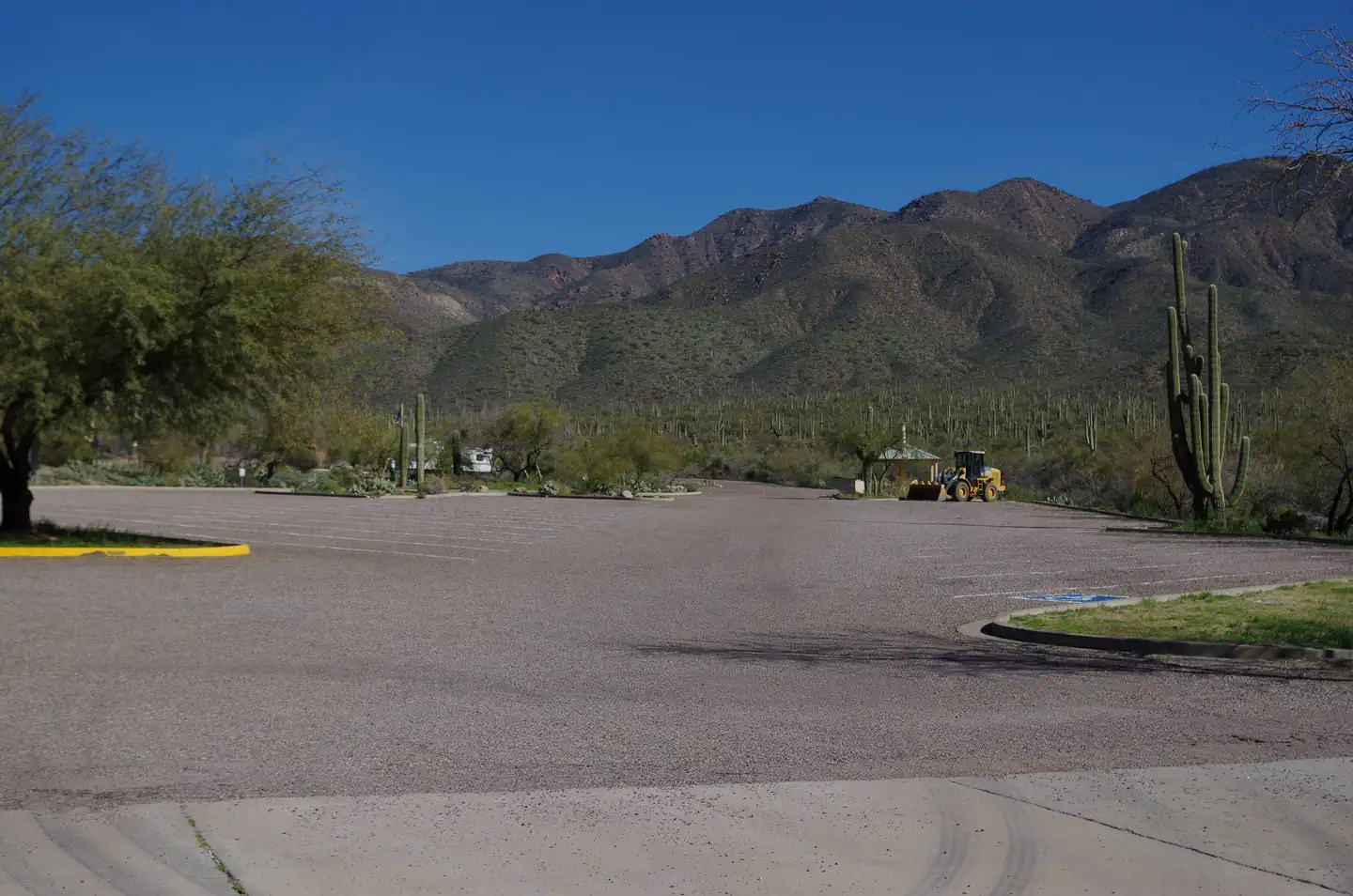
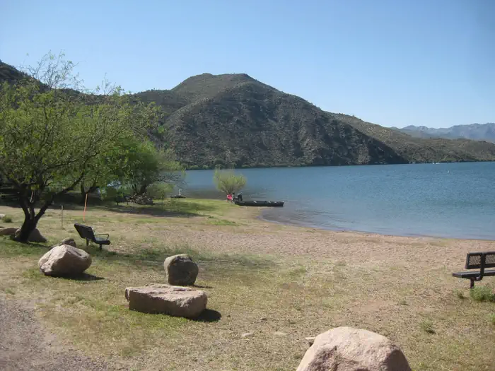
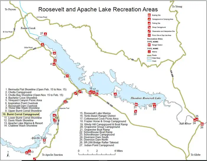
Burnt Corral Campground and Recreation Area (elevation 1914') is about 5.8 miles south of Roosevelt Dam along the Apache Trail (AZ Hwy 88) along the shoreline of Apache Lake. It is nestled amongst the saguaros, mesquites, and palo verdes, and offers opportunities to boat, swim, fish, relax, hike, and sightsee.
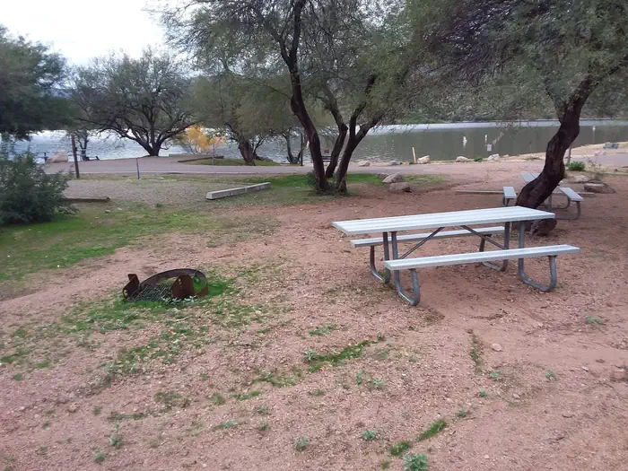
Facilities
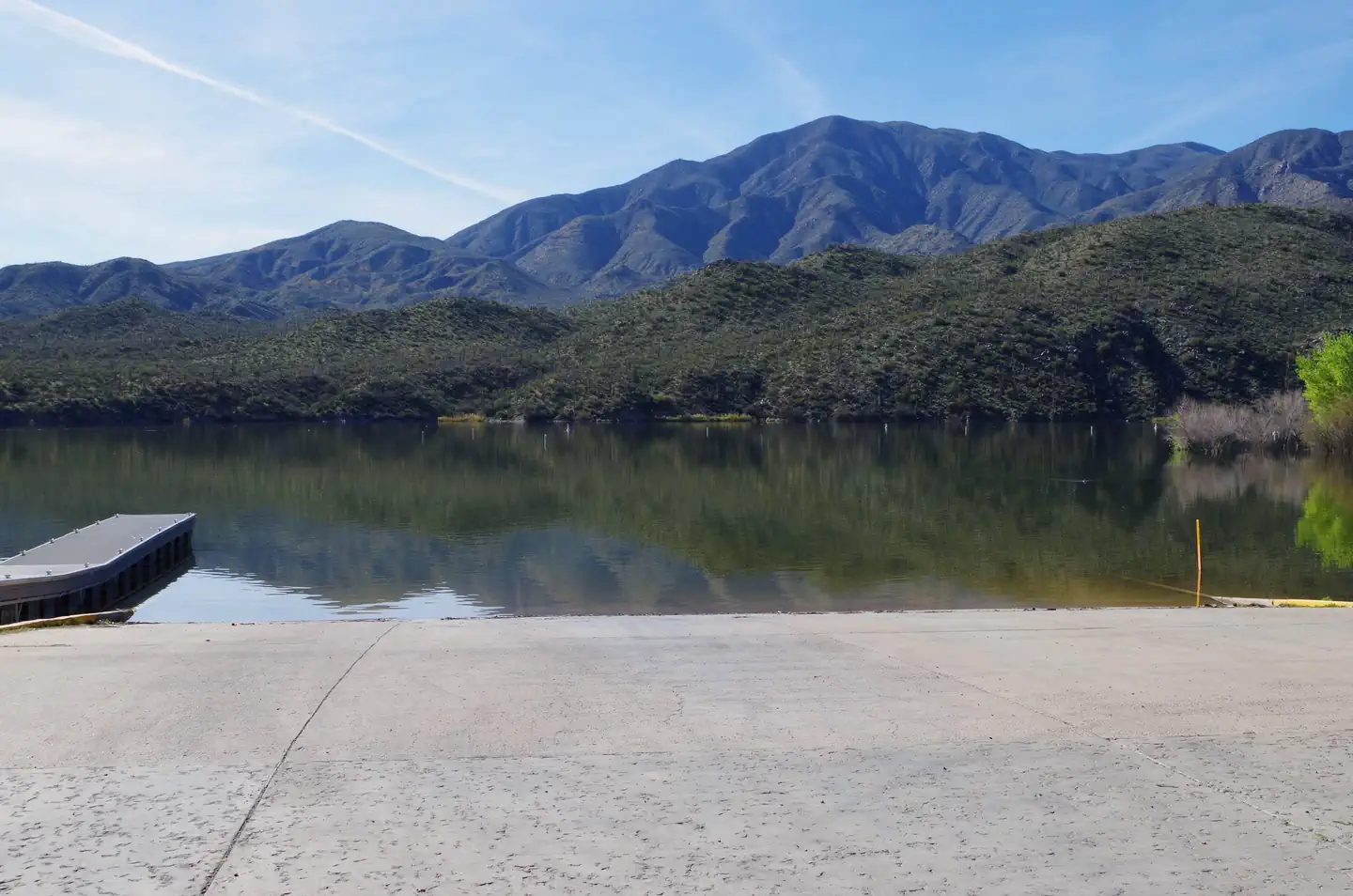
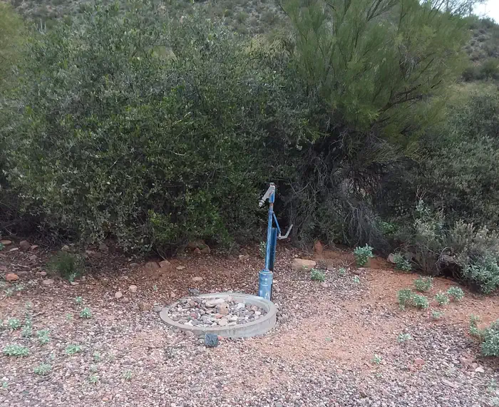
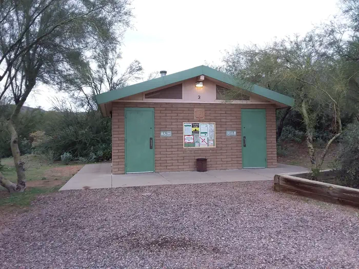
Burnt Corral Campground includes 76 camp units, vault toilets, potable water hydrants, 6 day-use picnic units, paved boat launch, boat boarding dock; Each campsite includes a parking spur, fire ring with grill, a shade ramada, and a picnic table. This campground provides access to visitors who are mobility impaired.
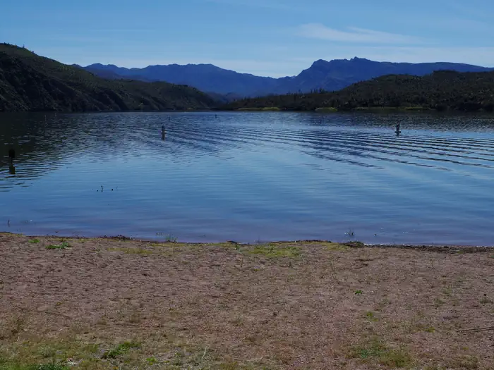
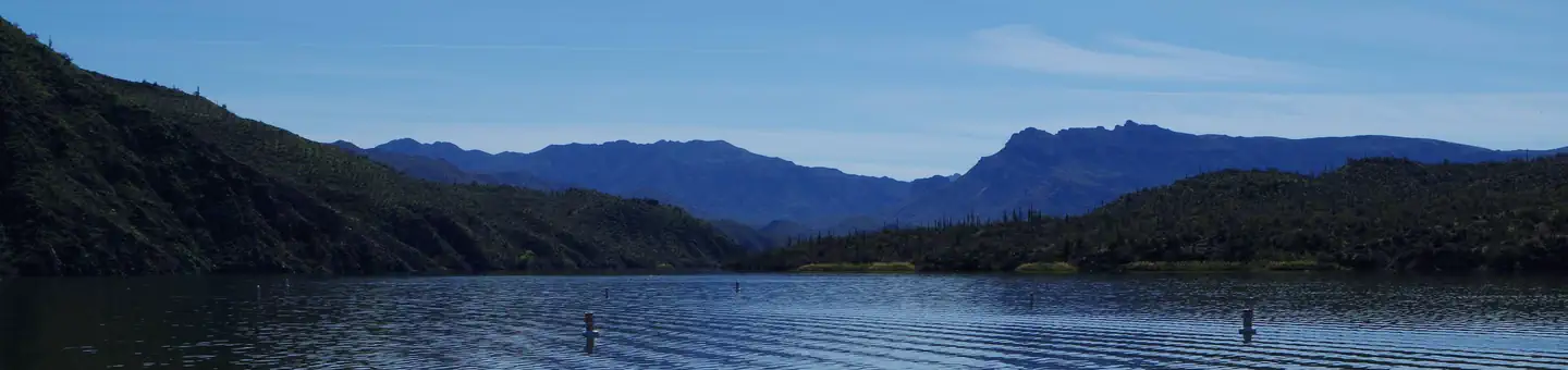
Natural Features
Burnt Corral Campground is situated in what may be the most stunning Sonoran Desert landscape in Arizona. The contrast of sunshine, clear blue water, and saguaro's surrounded by the Four Peaks and Superstition Wilderness' is a magnificant sight to see. While shade is scarce in the desert, campsites are situated amongst mature mesquite and palo verde trees, and desert chaparral. Apache Lake is 17 miles long making it the longest in the chain of reservoirs on the lower Salt River below Roosevelt Dam.
Recreation
Motorboating, fishing, water-skiing, and paddlesports are very popular because of the developed and undeveloped lake access from within the campground. Others may enjoy hiking nearby trails, being challenged by local jeep trails, or practicing their landscape photography, or simply relaxing with a good book.
Nearby Attractions
Roosevelt Dam, Apache Lake Marina, Tortilla Flats, Tonto National Monument (Cliff Dwellings), Roosevelt Lake, Apache Trail Scenic Byway (AZ Hwy 88), Spines to Pines Scenic Byway (AZ Hwy 288). The City of Globe and Town of Payson are only an hour away.
Important Notices
Access to Burnt Coral Campground is via the AZ Hwy 88 which is narrow, steep, and windy in spots. Max vehicle length is 40' and maximum trailer length is 22'.
Check in time is 2:00pm and check out time is 11:00am. Quiet hours are from 10:00pm to 6:00am.
During June, July, and August temperatures reach well over 100° and many RV air conditioners cannot keep up.
Gas is only located at both ends of the lake.
Extra (second) vehicle charge of $8 per night is required. An RV towing a car counts as one vehicle and a vehicle pulling a trailer counts as one vehicle. Fee can be bundled with online reservation or purchased on-site at fee machine. Maximum of 2 vehicles per campsite.
Boat ramps are usable when water elevations are higher then 2,110 feet.
Fireworks are always prohibited on National Forest Land.
Maximum stay limit is 14 days within 30 consecutive days on the Tonto National Forest including dispersed areas.
Notifications and Alerts
Fire restrictions are currently in effect that prohibit charcoal fires, wood-burning camp stoves, and charcoal grills. Only gas or propane stoves are permitted.
Available Activities
- Biking - Biking
- Boating - Boating
- Camping - Camping
- Fishing - Fishing
- Hiking - Hiking
- Paddling - Paddling
- Picnicking - Picnicking
- Photography - Photography
- Water Access - Water Access
- Wildlife Viewing - Wildlife Viewing
Directions
<p>Access to Burnt Corral from Tortilla Flat HWY88E/Apache Trail is currently closed, please use an alternative route.</p> <p>From the Mesa area: Head to AZ-87N for approximately 59 miles. Turns right onto AZ-188S for 31.6 miles. Turn right onto AZ-88W for 6 miles and Burnt Corral Recreation Site will be on your right.</p> <p> From the Globe area: Take AZ-188 west for 30 miles to its junction with AZ-88. Turn left onto AZ-88, and continue past historic Roosevelt Dam (unpaved) for 5 miles to Forest Road FR 183/ Burnt Corral Recreation Site. Turn right and continue to site. </p>
Contact Information
Phone: TONTO BASIN RANGER DISTRICT (602) 225-5395
28079 N. AZ HWY 188ROOSEVELT, AZ 85545
Rental Options
Available Campsites
- Site 71, Loop Main, Type Standard Nonelectric
- Site 55, Loop Main, Type Standard Nonelectric
- Site 47, Loop Main, Type Standard Nonelectric
- Site 18, Loop Main, Type Standard Nonelectric
- Site 19, Loop Main, Type Standard Nonelectric
- Site 28, Loop Main, Type Standard Nonelectric
- Site 51, Loop Main, Type Standard Nonelectric
- Site 27, Loop Main, Type Standard Nonelectric
- Site 6, Loop Main, Type Standard Nonelectric
- Site 70, Loop Main, Type Standard Nonelectric
- Site 67, Loop Main, Type Standard Nonelectric
- Site 63, Loop Main, Type Standard Nonelectric
- Site 29, Loop Main, Type Standard Nonelectric
- Site 73, Loop Main, Type Standard Nonelectric
- Site 59, Loop Main, Type Standard Nonelectric
- Site 38, Loop Main, Type Standard Nonelectric
- Site 65, Loop Main, Type Standard Nonelectric
- Site 69, Loop Main, Type Standard Nonelectric
- Site 21, Loop Main, Type Standard Nonelectric
- Site 31D, Loop Main, Type Standard Nonelectric
- Site 48, Loop Main, Type Standard Nonelectric
- Site 72, Loop Main, Type Standard Nonelectric
- Site 31A, Loop Main, Type Standard Nonelectric
- Site 9, Loop Main, Type Standard Nonelectric
- Site 49, Loop Main, Type Standard Nonelectric
- Site 24, Loop Main, Type Standard Nonelectric
- Site 41, Loop Main, Type Standard Nonelectric
- Site 33, Loop Main, Type Standard Nonelectric
- Site 7, Loop Main, Type Standard Nonelectric
- Site 57, Loop Main, Type Standard Nonelectric
- Site 23, Loop Main, Type Standard Nonelectric
- Site 10, Loop Main, Type Standard Nonelectric
- Site 31C, Loop Main, Type Standard Nonelectric
- Site 60, Loop Main, Type Standard Nonelectric
- Site 66, Loop Main, Type Standard Nonelectric
- Site 17, Loop Main, Type Standard Nonelectric
- Site 54, Loop Main, Type Standard Nonelectric
- Site 44, Loop Main, Type Standard Nonelectric
- Site 22, Loop Main, Type Standard Nonelectric
- Site 45, Loop Main, Type Standard Nonelectric
- Site 77, Loop Main, Type Standard Nonelectric
- Site 35, Loop Main, Type Standard Nonelectric
- Site 64, Loop Main, Type Standard Nonelectric
- Site 62, Loop Main, Type Standard Nonelectric
- Site 2, Loop Main, Type Standard Nonelectric
- Site 11, Loop Main, Type Standard Nonelectric
- Site 14, Loop Main, Type Standard Nonelectric
- Site 37, Loop Main, Type Standard Nonelectric
- Site 5, Loop Main, Type Standard Nonelectric
- Site 26, Loop Main, Type Standard Nonelectric
- Site 43, Loop Main, Type Standard Nonelectric
- Site 50, Loop Main, Type Standard Nonelectric
- Site 36, Loop Main, Type Standard Nonelectric
- Site 56, Loop Main, Type Standard Nonelectric
- Site 12, Loop Main, Type Standard Nonelectric
- Site 20, Loop Main, Type Standard Nonelectric
- Site 39, Loop Main, Type Standard Nonelectric
- Site 30, Loop Main, Type Standard Nonelectric
- Site 32, Loop Main, Type Standard Nonelectric
- Site 75, Loop Main, Type Standard Nonelectric
- Site 53, Loop Main, Type Standard Nonelectric
- Site 58, Loop Main, Type Standard Nonelectric
- Site 31B, Loop Main, Type Standard Nonelectric
- Site 46, Loop Main, Type Standard Nonelectric
- Site 1, Loop Main, Type Standard Nonelectric
- Site 68, Loop Main, Type Standard Nonelectric
- Site 76, Loop Main, Type Standard Nonelectric
- Site 52, Loop Main, Type Standard Nonelectric
- Site 4, Loop Main, Type Standard Nonelectric
- Site 13, Loop Main, Type Standard Nonelectric
- Site 16, Loop Main, Type Standard Nonelectric
- Site 74, Loop Main, Type Standard Nonelectric
- Site 42, Loop Main, Type Standard Nonelectric
- Site 3, Loop Main, Type Standard Nonelectric
- Site 15, Loop Main, Type Standard Nonelectric
- Site 25, Loop Main, Type Standard Nonelectric
- Site 34, Loop Main, Type Standard Nonelectric
- Site 8, Loop Main, Type Standard Nonelectric
- Site 40, Loop Main, Type Standard Nonelectric