Alsea Falls Recreation Site (Campground)
Alsea Falls Recreation Site (Campground)
Part of Mary's Peak Extensive
Overview
Reserve a site at Alsea Falls on recreation.gov or pay when you arrive for non-reserved campsites using the Recreation.gov Mobile App. You must download before you reach the site since there is no cell reception in the drainage.
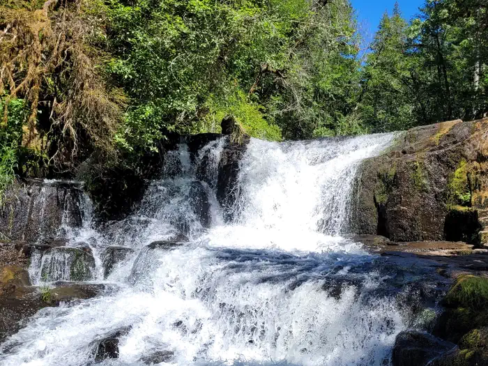
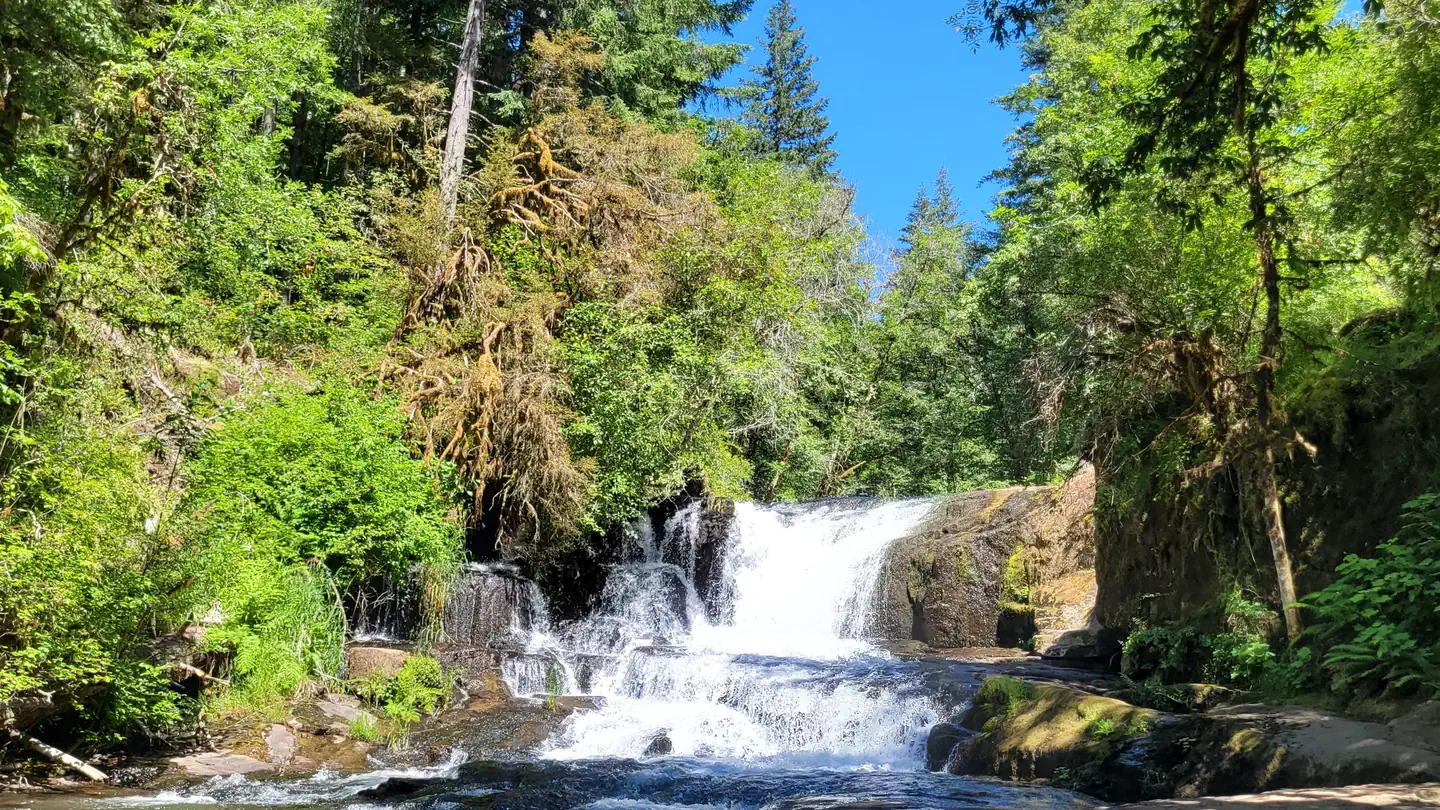
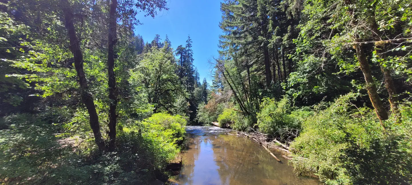
Alsea Falls Recreation Site is located along a Bureau of Land Management National Back Country Byway, located in the Oregon Coast Range, 13 miles west of Monroe, Oregon, in Benton County. Alsea Falls is open for camping the first weekend in May through the end of September of each year. Day use is open year round. The South Fork of the Alsea River flows through the Alsea Falls Recreation Site, cascading down 30 feet to form Alsea Falls in the day use area.
Facilities
This recreation area has 16 individual campsites; all are reservable. No first come-first served availability, however, you can come by on a nightly basis to camp if the site is not reserved until the reservation holder arrives. Amenities within the campground include drinking water and vault toilets. Several campsites can accommodate large RVs or trailers: up to 32 feet long. A site map is available here.
Natural Features
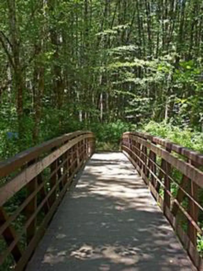
Forests in all stages of growth line South Fork Alsea National Back Country Byway. The nearby South Fork Alsea River offers painters and photographers endless opportunities to capture the natural beauty of Alsea Falls and the surrounding area. Old growth Douglas fir and western red cedar forests can be seen on the nearby ridges, while younger Douglas fir and vine maples provide a pleasant atmosphere at the Alsea Falls Recreation Site.Recreation
- The beautiful surroundings of Alsea Falls can be enjoyed by exploring the trails that wander through the area and lead to the picnic grounds and beyond. On a warm day, Alsea Falls Recreation Site offers cool relief along the river.
- During the winter months, the South Fork of the Alsea River provides excellent salmon and steelhead fishing. Be sure to check with the Oregon Department of Fish and Wildlife for current fishing regulations.
Nearby Attractions
- The Fall Creek Day-Use Trailhead offers over 12 miles of mountain bike specific trails. Hikers can use these trails as well.
- Green Peak Falls with a drop of 45 feet is accessed by road or trail through the private campground of McBee Park. Follow the markers along the trail and road.
- Alsea Trout Hatchery is north of the town of Alsea.
Contact Info
This location has limited staffing. Please call (503) 375-5646 for general information.Important Notices
Campfires? Current fire information for the Northwest Oregon District closures and restrictions can be found at BLM Fire Closures and Restrictions under the district specific section. Normally, campfires are limited to the steel fire rings or BBQ grills provided within the recreation site. At high to extreme fire danger levels, campfires are most likely prohibited, check above link. No building rock campfire rings.
All campsites are available for advanced reservations up to 2 days in advance of your stay. Although the legend shows FF (first come-first served) we call it walk-up camping. You may camp in a site that shows FF as a walk-up user on a nightly basis until the next reservation holder arrives to the site. On the day of the reservation holder's arrival you must vacate the site by 11:00 am.
A fee of $5 for extra vehicles will be collected at the facility through the on site fee station. Cash or check made payable to BLM is accepted. Place fee in the yellow fee envelope. Keep the receipt tab to display on your vehicle dash or campsite post.
All equipment must fit on the site pad. Vehicles park in developed areas only.
There is a limit of 1 RV/camper/trailer and 2 tents per standard nonelectric campsite.
No hookups or phone service.
No ATV's or ORV's allowed in the facility.
Visitors flock to Alsea Falls when the weather is hot in the Willamette Valley.
Available Activities
- Hunting - Hunting
- Hiking - Hiking
- Fishing - Fishing
- Camping - Camping
- Biking - Biking
- Photography - Photography
- Mountain Biking - Mountain Biking
- Day Use Area - Day Use Area
Directions
<p><strong>From Corvallis:</strong> Take Hwy 99W south about 15 miles. Turn right on Alpine Road, follow for approximately 9 miles. Alpine Road turns into South Fork Road. Follow about 4 miles to the Alsea Falls Campground on the right. <br><br><br><strong>From Alsea: </strong>Travel south from the town Alsea on Alsea-Deadwood Hwy for about 1 mile. Turn left on the South Fork Road and follow for approximately 8.5 miles (stay on main paved road). Pass the Alsea Falls Day-Use about 0.5 miles and turn left into the Alsea Falls Campground Entrance.</p>
Cancellation Policy
<p>Standard fees apply and are non-refundable.</p> <p>Visit <a href="https://www.recreation.gov/rules-reservation-policies" rel="nofollow">https://www.recreation.gov/rules-reservation-policies</a> for more information.</p>
Contact Information
Phone: 503-375-5646
Northwest Oregon DistrictAttn: Recreation Operations
1717 Fabry Rd SE
Salem, OR 97306 No physical address
S Fork Rd
Alsea, OR 97324
Rental Options
Available Campsites
- Site 11, Loop Campground, Type Standard Nonelectric
- Site 08, Loop Campground, Type Standard Nonelectric
- Site T4, Loop Tent Loop, Type Walk To
- Site 12, Loop Campground, Type Standard Nonelectric
- Site 03, Loop Campground, Type Standard Nonelectric
- Site 07, Loop Campground, Type Standard Nonelectric
- Site T3, Loop Tent Loop, Type Walk To
- Site 05, Loop Campground, Type Standard Nonelectric
- Site T2, Loop Tent Loop, Type Walk To
- Site 04, Loop Campground, Type Standard Nonelectric
- Site 15, Loop Campground, Type Standard Nonelectric
- Site 14, Loop Campground, Type Standard Nonelectric
- Site 01, Loop Campground, Type Standard Nonelectric
- Site T5, Loop Tent Loop, Type Walk To
- Site 06, Loop Campground, Type Standard Nonelectric
- Site 13, Loop Campground, Type Standard Nonelectric
- Site 09, Loop Campground, Type Standard Nonelectric
- Site 16, Loop Campground, Type Standard Nonelectric
- Site 10, Loop Campground, Type Standard Nonelectric
- Site 02, Loop Campground, Type Standard Nonelectric
- Site T1, Loop Tent Loop, Type Walk To