Sacramento National Wildlife Refuge
Overview
Sacramento National Wildlife Refuge is managed by Fish and Wildlife Service and is located near Willows, California.
Sacramento National Wildlife Refuge was established in 1937 with funds from Emergency Conservation Fund Act of 1933 to provide refuge and breeding habitat for migratory birds and other wildlife, provide habitat and manage for endangered, threatened, or sensitive species, and alleviate crop depredation. Historically, the area of the refuge was known as the Colusa Plains which was a vacant, windswept plain with short grasses, shrubs and forbs. In January 1937, the federal government purchased 10,775-acre Spalding Ranch and christened it the Sacramento Migratory Waterfowl Refuge. From 1937-1942 the Civilian Conservation Corp's (CCC) "Camp Sacramento" housed up to 200 men at the current headquarters area. The men constructed levees, water control structures, and delivery ditches to create and sustain wetlands across the majority of the refuge. Mosquito bitten, sunburned, dust-choked men worked non-stop even on 100-degree days to create the refuge.
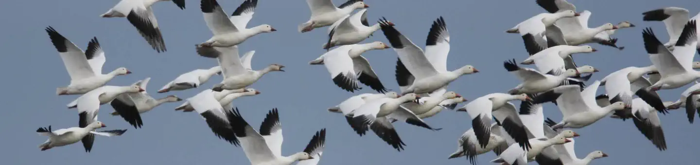
Today, the refuge is known as the Sacramento National Wildlife Refuge and it functions as the headquarters for the entire Sacramento National Wildlife Refuge Complex. The refuge supports over 250 species of birds. Most notable are the huge wintering concentrations (November - January) with regular peaks of over 500,000 ducks and 250,000 geese. Raptor numbers swell as the waterfowl numbers increase, including bald eagles and peregrine falcons. Waterfowl viewing is good between October and March. In addition, shorebird numbers peak in the spring and fall, while some waterfowl and numerous migratory songbird species nest here during the summer. Many birds and mammals provide year-round viewing.
Things to Do at Sacramento National Wildlife Refuge
Recreation Activities
Popular activities at Sacramento National Wildlife Refuge include:
Nearby Activities
- Auto Touring
- Hiking
- Hunting
- Interpretive Programs
- Visitor Center
- Wildlife Viewing
Plan Your Visit
Reservation Tips
Sacramento National Wildlife Refuge is a popular destination. Check individual facility pages for specific booking windows and availability.
Getting There
Traveling north or south on I-5:
- exit at Road 68 (9.1 miles north of Maxwell, or 8.3 miles south of Willows)
- go north on Hwy 99W (1.7 miles)
- turn right into Sacramento NWR
- follow signs to Visitor Parking
- Click here for a map with directions
Check station is approximately 9.5 miles south from Willows, and 10.2 miles north from Maxwell.
From Interstate 5:
- exit at Road 68 (8.3 miles south of Willows, or 9.2 miles north of Maxwell)
- go 1 mile east on Road 68
- turn right at Check Station gate
- Click here for a map with directions
GPS Coordinates: 39.42996572000000, -122.19171271899999
Contact & Resources
Phone: 530-934-2801
Additional Information: