Lava Flow Trail
Overview
Lava Flow Trail is managed by Bureau of Land Management and is located near Ajo, Arizona.
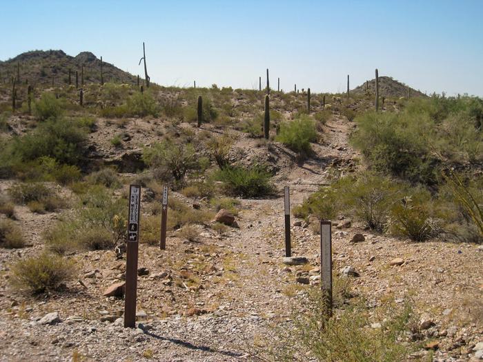
Lava Flow Trail, in the 34,400-acre Table Top Wilderness, offers a hiking opportunity of light to moderate difficulty in a varied and dramatic Sonoran Desert landscape. Three trailheads are linked by a relatively level 7 1/4-mile trail. From south to north, the trail meanders through dense forests of saguaro, paloverde, ironwood, and cholla; skirts the jumbled basaltic slopes of Black Mountain; traverses an extensive creosote-bush flat; and crosses several large washes. Lava Flow Trail provides sweeping views of Vekol Valley and the Sand Tank Mountains to the west, while flat-topped Table Top Mountain -- highest point in the Table Top Wilderness -- looms to the east.
Only hiking and equestrian use is allowed in wilderness under the Wilderness Act of 1964. Motorized vehicles and mountain bikes are prohibited in wilderness.
Know Before You Go
- Motorized equipment and equipment used for mechanical transport are generally prohibited on all federal lands designated as wilderness. This includes the use of motor vehicles (including OHVs), motorboats, bicycles, hang gliders, wagons, carts, portage wheels, and the landing of aircraft including helicopters. Contact the agency for more information about regulations.
- Road conditions to the wilderness vary with high-clearance and four-wheel-drive vehicle requirements. Roads are primitive and not maintained. Have a full tank of gas, full-size spare tires, a vehicle tool kit, and first aid kit. The main access routes and washes are prone to heavy seasonal rains and flash floods. Do not cross flooding streams or washes!
- Motorized and mechanized vehicles, including bicycles must remain on existing routes.
- Drinking water is not available, so you should bring plenty of your own water.
- Cellular phones do not work in many areas of the national monument.
- Drug and human smuggling activities have occurred within the monument south of Interstate 8. If you see any activity that looks illegal, suspicious, or out of place, please do not intervene. Contact BLM Federal Law Enforcement Communications Center, County Sheriff or Border Patrol. Call 911 to report emergencies.
- Summer temperatures may often reach up 115 degrees. Wear a hat, long sleeve shirt, sunglasses, and sunscreen. Drink plenty of water!
- You might encounter rattlesnakes and scorpions. Don't put your hands or feet in brush or under rocks and boulders.
- Many abandoned mine shafts dot the landscape in Arizona and are very dangerous. Many shafts are deep vertical holes with no way out. Do not get close to or enter any mine shaft.
- Fires are not allowed in Table Top Wilderness.
Things to Do at Lava Flow Trail
Recreation Activities
Popular activities at Lava Flow Trail include:
Nearby Activities
- Hiking
- Wilderness
Plan Your Visit
Getting There
A high-clearance vehicle is required to access Lava Flow South Trailhead. Four-wheel drive is required to access Lava Flow North and West trailheads.
Lava Flow Trail is accessed at three points. Exit Interstate 8 at the Vekol Valley Interchange (Exit 144) approximately 26 miles east of Gila Bend and 34 miles west of Casa Grande.
To access Lava Flow West and South trailheads, travel south on Vekol Valley Road (BLM Route 8007) 2.1 miles to the Vekol Ranch turnoff. An information kiosk will be on your right. For the West trailhead, continue south on Route 8007 for 5.7 miles. Turn left on BLM Route 8046 and travel 2 miles to the trailhead. For the South trailhead, continue for 8.7 miles south from the kiosk to BLM Route 8024. Turn left onto Route 8024 and travel 3.7 miles to the trailhead.
To access Lava Flow North Trailhead, travel south on Vekol Valley Road 0.7 miles from Interstate 8 and turn east onto BLM Route 8043. Continue east 2.8 miles to Route 8042. Turn right and drive 2.3 miles, keep left to stay on Route 8042, and continue 3.3 miles to the trailhead.
GPS Coordinates: 32.75297700000000, -112.20604600000000
Contact & Resources
Phone: (623) 580-5500