S.F. Shoshone River
Overview
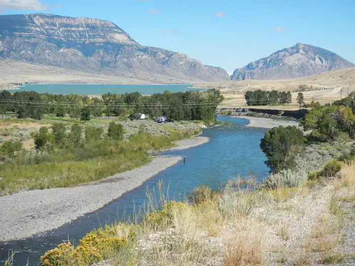
S.F. Shoshone River is managed by Bureau of Land Management and is located near Cody, Wyoming. The South Fork Shoshone River begins its journey from the Fremont County/Park County boundary high in the Absaroka Mountains draining north into Buffalo Bill Reservoir.
The BLM administers a handful of parcels along the South Fork, all of which offers fishing opportunities, and other dispersed recreational opportunities.
Things to Do at S.F. Shoshone River
Recreation Activities
Popular activities at S.F. Shoshone River include:
Nearby Activities
- Fishing
- Hiking
- Horseback Riding
- Hunting
- Photography
- Picnicking
- Wildlife Viewing
Plan Your Visit
Getting There
From Sheridan Ave in Cody, Wyoming, head south on the South Fork Highway (County Road 6WX). The entire length of the road will take you to the public parcels, and will end at Cabin Creek, located within the Shoshone National Forest.
GPS Coordinates: 44.42446900000000, -109.25700800000000
Contact & Resources
Phone: (307) 578-5900
Additional Information: