Bonita Canyon Campground
- Price:
- $25 - $50 per night
- Rating:
- 4.7 stars (1363 reviews)
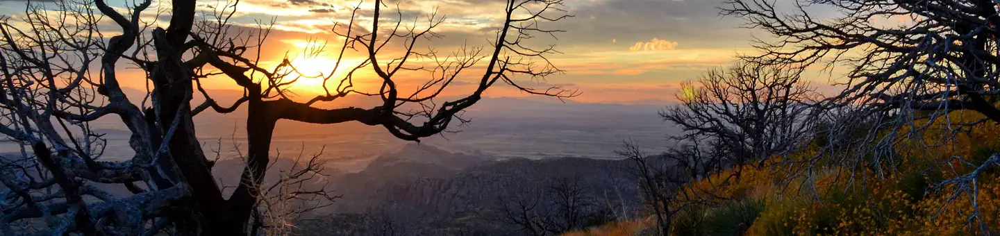
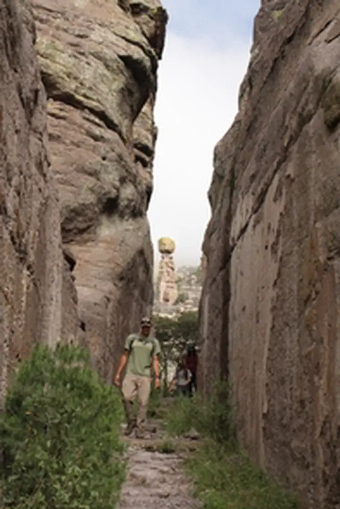
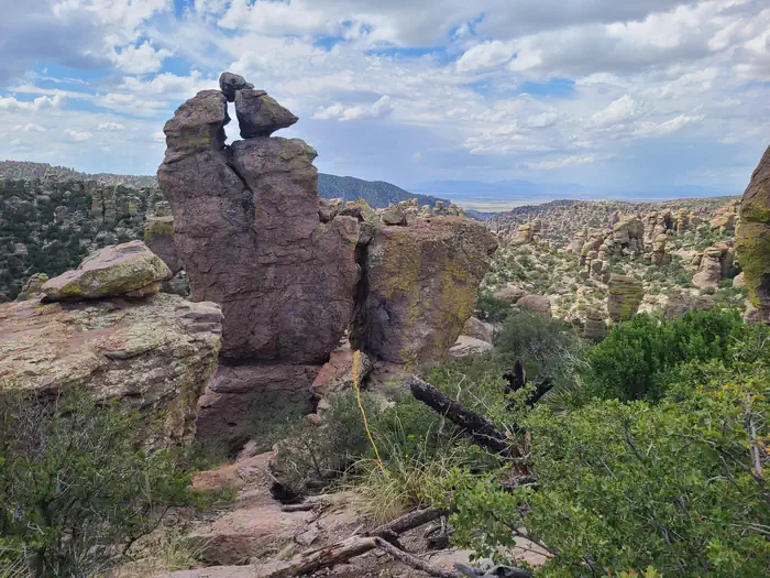
Chiricahua National Monument is managed by National Park Service and is located near Willcox, Arizona. Explore the pinnacles, spires, and balanced rocks that originated 27 million years ago by a massive volcanic eruption. Hike within these formations that help protect the exceptional biodiversity of the sky islands region. Connect with the human history spanning thousands of years, encompassing prehistoric indigenous peoples, Chiricahua Apaches, Buffalo Soldiers, ranchers, CCC, and visitors today.
Chiricahua National Monument offers 1 campground with various amenities and settings. From developed campgrounds with full facilities to primitive backcountry sites, there are options for every camping style.
Popular activities at Chiricahua National Monument include:
Chiricahua National Monument is a popular destination. Campground reservations typically open several months in advance. For peak season visits, book as early as possible. Check individual facility pages for specific booking windows and availability.
Chiricahua National Monument is located 120 miles southeast of Tucson. Take I-10 east from Tucson to the first exit for Willcox. Travel 3 miles into town to the stoplight and turn right. You will follow Arizona State Highway 186 for 32 miles to the junction of Arizona State Highway 181. Turn left and 4 miles later you will be at the Chiricahua entrance station. Maximum vehicle length is 29 feet to drive beyond the visitor center. A hiking shuttle is available daily at 9 am from the visitor center.
GPS Coordinates: 32.01214600000000, -109.34160700000000
Phone: (520) 824-3560
Additional Information: