Paria Canyon-Vermilion Cliffs Wilderness Area
Vermilion Cliffs National Monument, Near Kanab, Utah
Paria Canyon-Vermilion Cliffs Wilderness Area does not offer reservations through Recreation.gov. Please take a look at the area details below for more information about visiting this location. Enjoy your visit!
Overview
Overview
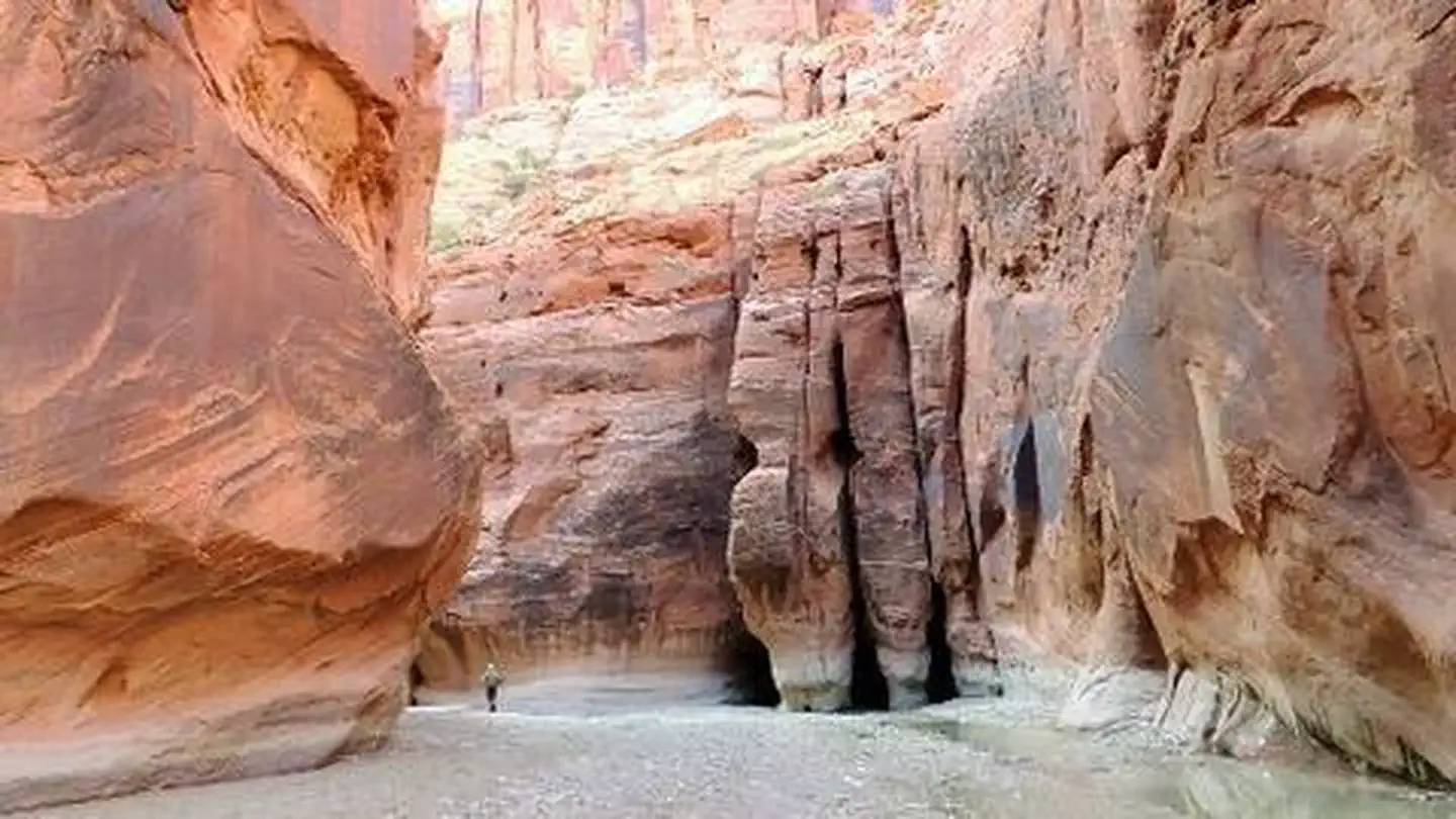
The 112,500-acre Paria Canyon-Vermilion Cliffs Wilderness lies approximately 10 miles west of Page, Arizona in Coconino County, Arizona and Kane County, Utah.
Nationally known for its beauty, the Paria Canyon has towering walls streaked with desert varnish, huge red rock amphitheaters, sandstone arches, wooded terraces, and hanging gardens. The 3,000-foot escarpment known as the Vermilion Cliffs dominates the remainder of the wilderness with its thick Navajo sandstone face, steep, boulder-strewn slopes, rugged arroyos and stark overall appearance. Some of the best slot canyon hiking opportunities on the Colorado Plateau are found here. Deer and desert bighorn sheep inhabit the area.
The wilderness also provides opportunities for backpacking, photography, and solitude. In the northwest portion of the wilderness lies Coyote Buttes, an area of spectacular scenery displaying domes, aprons, fins, corridors, and a variety of small fragile rock sculptures carved in colorful swirling cross bedded sandstone. The variety of colors and textures in the rock formations within the wilderness constantly change with variations in light and weather. This colorful sandstone area creates a feeling of wonder and amazement.
A permit is required for overnight trips within Paria Canyon. Learn more about Paria Canyon permits.
The Paria River is subject to periodic and seasonal flooding. The US Geological Survey collects Paria River streamflow data at their gauging station on the Paria River at Lees Ferry, Arizona.
View Paria River conditions near the Paria Contact Station, UT.
View Paria River conditions at Lees Ferry, AZ.