Crescent Lake National Wildlife Refuge
Fish and Wildlife Service, Nebraska.
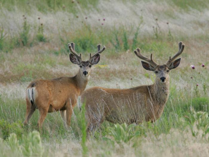
Crescent Lake National Wildlife Refuge was established in 1931, and is located 28 miles north of Oshkosh, Nebraska in Garden County. It is administered by the U.S. Fish & Wildlife Service and is within the Central Flyway. This little known refuge is located in the Nebraska panhandle and is within the largest continuous sand dune area in the United States. The grass covered dunes were created from the wind blown sands of an ancient sea.
The Refuge is governed in part by the National Wildlife Refuge System (NWRS) Improvement Act of 1997. The NWRS Improvement Act defines a unifying mission for all refuges, including a process for determining compatible uses on refuges, and requiring that each refuge be managed according to a Plan. The NWRS Improvement Act expressly states that wildlife conservation is the priority of System lands and that the Secretary shall ensure that the biological integrity, diversity, and environmental health of refuge lands are maintained. Each refuge must be managed to fulfill the specific purposes for which the refuge was established and the System mission. The main priority of each refuge is to conserve, manage, and if needed, restore fish and wildlife populations and habitats according to its purpose.
The Refuge contains 1,076 acres of designated Research Natural Areas (Goose Lake and Hackberry Units), and also a proposed Wilderness Area of 24,502 acres which encompasses the eastern half of the Refuge.
Habitat types on the Refuge are sub-irrigated meadows (4,126 acres); uplands (33,014 acres), and wetlands (8,709 acres) which include 21 lakes and numerous small wetlands. Sub-irrigated meadows occur in-between the dunes where the groundwater is close enough to the surface to allow plant roots to reach it. The constant supply of water allows greater numbers of plants to grow more abundantly. Uplands are "high ground" elevated above wetlands, streams, etc. and are generally dry. Wetlands are areas where water covers the soil, or is present either at or near the surface of the soil all year or for varying periods of time during the year, including during the growing season.
The Sandhills are within a wide transitional zone called the mixed-grass prairie, which lies between tallgrass prairie to the east and short grass prairie to the west. Although precipitation is typical of the semi-arid mixed-grass prairie, the Sandhills are characterized by "climax", tallgrass species. The climax stage is reached when the final community becomes more or less stabilized for a longer period of time and species can maintain themselves within the climate of a given area.
Nearby Activities
- Auto Touring
- Boating
- Environmental Education
- Fishing
- Hiking
- Hunting
- Interpretive Programs
- Paddling
- Photography
- Wildlife Viewing
Directions
To enter from the south, go north from Oshkosh, NE on West Second Street for 28 miles. Follow Refuge signs along this route.
From Alliance, NE, go east on State Highway 2 to about one quarter mile east of Antioch. Go south, following Refuge signs.
From Ellsworth, go west on Highway 2 about 8 miles then go south, following Refuge signs.
Plan to drive about an hour after leaving highways from the north or south.
Please click here for general Refuge location.