Scenic Byway 12
Overview
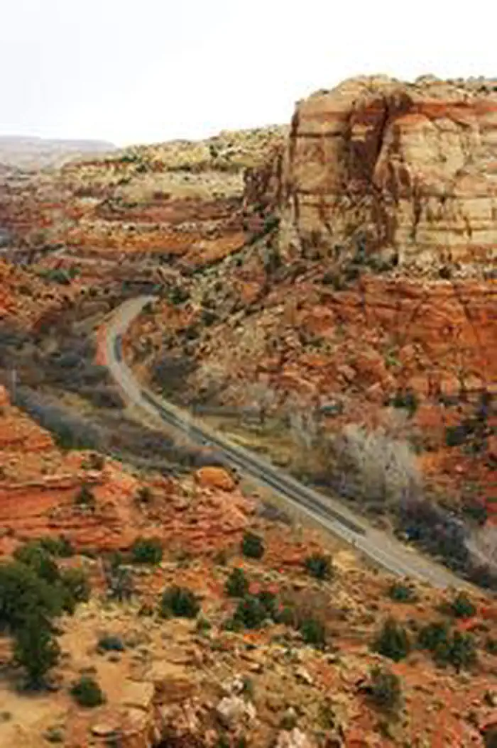
Scenic Byway 12 is managed by Department of Transportation. Scenic Byway 12 takes you to the heart of the American West. This exceptional 124 mile route negotiates an isolated landscape of canyons, plateaus, and valleys ranging from 4,000 to 9,000 feet above sea level. You'll encounter archaeological, cultural, historical, natural, recreational, and scenic qualities while driving this exhilarating byway.
Things to Do at Scenic Byway 12
Plan Your Visit
Getting There
Getting to the Byway:
Denver International Airport (DEN), CO
* Take I-70 west past Green River, UT to UT-24.
* Turn south onto UT-24 and continue to Hanksville.
* Stay on UT-24 and continue west through Capital Reef National Park to just east of Torrey, UT, and the junction with UT-12, where the byway begins.
Salt Lake City, UT
- Take I-15 south to UT-20 exit.
- Follow UT-20 to Bear Valley Junction.
- Take US-89 through Panguitch to UT-12 where the byway begins.
St. George, UT
- Take I-15 north to Cedar City.
- Get on UT-14 going east to Long Valley Junction.
- Take US-89 north to UT-12 where the byway begins.
Navigating the Byway:
From US-89 south of Panguitch, the byway travels through 122 miles of the most varied scenery in Utah. Beginning in Red Canyon, the byway winds through the northern portion of vibrant Bryce Canyon National Park, Dixie National Forest, past Kodachrome Basin State Park, through the Grand Staircase-Escalante National Monument, Escalante Canyons, crosses over aspen-covered Boulder Mountain, and ends up Torrey, just five miles west of Capitol Reef National Park.
The byway is rated one of the top ten Scenic Byways in America by Car and Driver magazine. Spanning a route of more than 120 miles, the byway travels from west to east through Garfield and Wayne Counties.
* The byway begins at the junction of Hwy 89 and SR-12 (Scenic Byway 12), seven miles south of Panguitch and eight miles north of Hatch. When you start, you bisect the beautiful red rock formations of Red Canyon in Dixie National Forest. Continuing east, the byway passes through spectacular views of a variety of rock formations. Stone and mud food-storage structures called granaries can be seen along the route. Visitor centers and businesses along the way have information about the area.
* From Escalante, geographically located near the midpoint of the byway, the road turns north winding through vast expanses of slickrock country. Along the way travelers are rewarded with views of the Escalante River, Calf Creek Canyon, and the Hogsback and Boulder Mountain. At Boulder visitors can get a firsthand look at life in a prehistoric Native American village at the Anasazi Indian Village Park.
* Continuing north from Boulder, still on SR-12, the road crosses the eastern flank of Boulder Mountain with spectacular views of Capitol Reef National Park, the Henry Mountains, Circle Cliffs, and Navajo Mountain on the far side of Lake Powell. On a clear day travelers can see more than 100 miles into Colorado and Arizona.
* The byway ends at the junction of SR-12 and Hwy 24 in Wayne County. The town of Torrey is just west of this junction, or travelers can take the nine-mile drive east to the Capitol Reef National Park Visitor Center.
Contact & Resources
Phone: 800-444-6689
Additional Information: